Property Record
37363 Brownsvillage Rd, Slidell, LA 70460

NEARBY LISTINGS FOR SALE OR LEASE
Property Detail
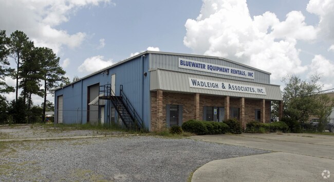
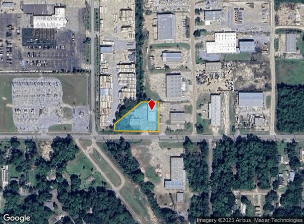
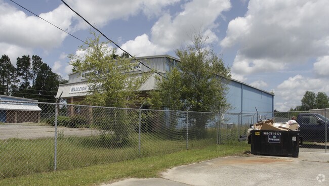
37363 Brownsvillage Rd
New Orleans-Metairie, LA
Commercial Brown's Village Rd
110966
LOT 8 SLIDELL INDUSTRIAL PARK CONT 1.06 ACS INST NO 908655 INST NO 949393 INST NO 1188199 INST NO 1620273 INST NO 1758530 INS
Commercialnec
St Tammany
ARE
Louisiana
2025
8
2024
1.06 AC
040713
Slidell
10,625 SF
New Orleans/Metairie/Kenner
DEMOGRAPHICS near 37363 Brownsvillage Rd
1 Mile
3 Mile
5 Mile
2024 Total Population
3,394
38,150
87,117
2029 Population
3,660
41,024
93,747
Pop Growth 2024-2029
+ 7.84%
+ 7.53%
+ 7.61%
Average Age
39
40
40
2024 Total Households
1,294
14,543
33,214
HH Growth 2024-2029
+ 7.73%
+ 7.54%
+ 7.65%
Median Household Inc
$49,106
$57,391
$58,821
Avg Household Size
2.50
2.60
2.60
2024 Avg HH Vehicles
2.00
2.00
2.00
Median Home Value
$137,657
$171,966
$185,851
Median Year Built
1985
1982
1988
Nearby Places
Map Layers
Map Styles
 Street
 Aerial
- Restaurants
- Banks
- Shops
- Fitness
- Groceries
PUBLIC TRANSPORTATION
COMMUTER RAIL
Slidell Amtrak Station (Crescent - Amtrak)
DRIVE
WALK
Distance
Slidell Amtrak Station (Crescent - Amtrak)
5 min
3.1 mi
Freight Ports
Port of New Orleans
DRIVE
WALK
Distance
Port of New Orleans
51 min
39.4 mi
Nearby Properties
Address
Land Use
TOTAL SIZE
Lot Size
Zoning
Address
Land Use
TOTAL SIZE
Lot Size
Zoning
120,000 SF
6.75 AC
Address
Land Use
TOTAL SIZE
Lot Size
Zoning
104,000 SF
2.89 AC
Address
Land Use
TOTAL SIZE
Lot Size
Zoning
205,496 SF
27.47 AC
Address
Land Use
TOTAL SIZE
Lot Size
Zoning
192,685 SF
Address
Land Use
TOTAL SIZE
Lot Size
Zoning
157,561 SF
10.06 AC
Address
Land Use
TOTAL SIZE
Lot Size
Zoning
137,402 SF
76.02 AC
Address
Land Use
TOTAL SIZE
Lot Size
Zoning
132,961 SF
12.06 AC
Address
Land Use
TOTAL SIZE
Lot Size
Zoning
123,155 SF
15 AC
Address
Land Use
TOTAL SIZE
Lot Size
Zoning
127,681 SF
3 AC
Address
Land Use
TOTAL SIZE
Lot Size
Zoning
63,135 SF
12.49 AC
Address
Land Use
TOTAL SIZE
Lot Size
Zoning
105,633 SF
11 AC
Address
Land Use
TOTAL SIZE
Lot Size
Zoning
104,821 SF
10.09 AC
Address
Land Use
TOTAL SIZE
Lot Size
Zoning
1,940 SF
1.77 AC
Address
Land Use
TOTAL SIZE
Lot Size
Zoning
105,300 SF
8.75 AC
Address
Land Use
TOTAL SIZE
Lot Size
Zoning
54,188 SF
1.50 AC
Address
Land Use
TOTAL SIZE
Lot Size
Zoning
144,674 SF
13.10 AC
Address
Land Use
TOTAL SIZE
Lot Size
Zoning
142,482 SF
1.23 AC
Address
Land Use
TOTAL SIZE
Lot Size
Zoning
84,000 SF
10.84 AC
Address
Land Use
TOTAL SIZE
Lot Size
Zoning
85,000 SF
12.23 AC
Address
Land Use
TOTAL SIZE
Lot Size
Zoning
184,551 SF
20 AC
Address
Land Use
TOTAL SIZE
Lot Size
Zoning
91,149 SF
4.26 AC
Address
Land Use
TOTAL SIZE
Lot Size
Zoning
115,666 SF
9.14 AC
Address
Land Use
TOTAL SIZE
Lot Size
Zoning
104,702 SF
11.69 AC
Address
Land Use
TOTAL SIZE
Lot Size
Zoning
78,250 SF
4.78 AC
Address
Land Use
TOTAL SIZE
Lot Size
Zoning
114,806 SF
10.22 AC
Address
Land Use
TOTAL SIZE
Lot Size
Zoning
66,634 SF
14 AC
Address
Land Use
TOTAL SIZE
Lot Size
Zoning
46,476 SF
5.81 AC
Address
Land Use
TOTAL SIZE
Lot Size
Zoning
42,995 SF
5.20 AC
Address
Land Use
TOTAL SIZE
Lot Size
Zoning
1,378 SF
1.19 AC
Address
Land Use
TOTAL SIZE
Lot Size
Zoning
24,082 SF
8.49 AC
The World's #1 Commercial Real Estate Marketplace
Connect with us
© 2025 CoStar Group
The information above has been obtained from sources believed reliable. While we do not doubt its accuracy we have not verified it and make no guarantee, warranty or representation about it. It is your responsibility to independently confirm its accuracy and completeness. Any projections, opinions, assumptions, or estimates used are for example only and do not represent the current or future performance of the property. The value of this transaction to you depends on tax and other factors which should be evaluated by your tax, financial, and legal advisors. You and your advisors should conduct a careful, independent investigation of the property to determine to your satisfaction the suitability of the property for your needs.