Property Record
3737 Chagrin Rd, Pepper Pike, OH 44022

NEARBY LISTINGS FOR SALE OR LEASE
Property Detail
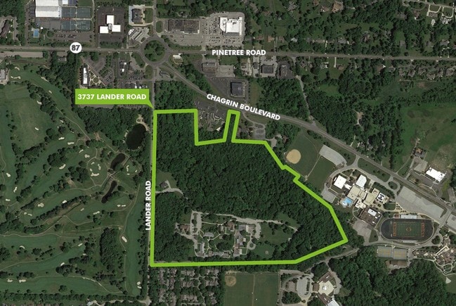
3737 Chagrin Rd
Cleveland
Orange 02
Cleveland-Elyria, OH
PCL B2 VOL 351 PG 22 FF 86.48 86.23AC OL 28 2008 S/R
872-40-001
Cuyahoga
Commercialnec
Ohio
2024
b-2
2024
86.23 AC
196300
Chagrin Corridor
75,275 SF
DEMOGRAPHICS near 3737 Chagrin Rd
1 mile
3 mile
5 mile
2024 Total Population
2,767
24,591
133,266
2029 Population
2,679
24,041
130,159
Pop Growth 2024-2029
(3.18%)
(2.24%)
(2.33%)
Average Age
44
44
43
2024 Total Households
1,060
9,840
57,043
HH Growth 2024-2029
(3.49%)
(2.51%)
(2.47%)
Median Household Inc
$178,968
$117,657
$75,661
Avg Household Size
2.60
2.40
2.20
2024 Avg HH Vehicles
2.00
2.00
2.00
Median Home Value
$445,588
$434,516
$246,284
Median Year Built
1971
1972
1960
Nearby Places
Map Layers
Map Styles
 Street
 Aerial
Transit
 Traffic
 Biking
Places
Listings with unknown addresses are not visible on the map
- Restaurants
- Banks
- Shops
- Fitness
- Groceries
PUBLIC TRANSPORTATION
AIRPORT
Cleveland-Hopkins International
Drive
Walk
Distance
Cleveland-Hopkins International
36 min
23.4 mi
Freight Ports
Port of Toledo
Drive
Walk
Distance
Port of Toledo
150 min
124.3 mi
SALE & LEASE HISTORY
LISTING DATE
SALE/LEASE

Jun 13, 2017
For Sale
Nearby Properties
Address
Land Use
TOTAL SIZE
Lot Size
Zoning
Address
Land Use
TOTAL SIZE
Lot Size
Zoning
975,742 SF
42.03 AC
U-10
Address
Land Use
TOTAL SIZE
Lot Size
Zoning
418,553 SF
40.99 AC
Address
Land Use
TOTAL SIZE
Lot Size
Zoning
737,998 SF
53.07 AC
U-10
Address
Land Use
TOTAL SIZE
Lot Size
Zoning
475,904 SF
8.04 AC
U-7A
Address
Land Use
TOTAL SIZE
Lot Size
Zoning
341,556 SF
17.70 AC
U-4
Address
Land Use
TOTAL SIZE
Lot Size
Zoning
255.11 AC
U-1
Address
Land Use
TOTAL SIZE
Lot Size
Zoning
729,492 SF
17.67 AC
Address
Land Use
TOTAL SIZE
Lot Size
Zoning
323,733 SF
106.35 AC
MRC2
Address
Land Use
TOTAL SIZE
Lot Size
Zoning
257,564 SF
2.70 AC
U-4A
Address
Land Use
TOTAL SIZE
Lot Size
Zoning
262,616 SF
65.48 AC
U-2
Address
Land Use
TOTAL SIZE
Lot Size
Zoning
246,578 SF
28.60 AC
U-5
Address
Land Use
TOTAL SIZE
Lot Size
Zoning
421,649 SF
23.15 AC
U-5
Address
Land Use
TOTAL SIZE
Lot Size
Zoning
360,712 SF
55.30 AC
INS
Address
Land Use
TOTAL SIZE
Lot Size
Zoning
485,482 SF
9.60 AC
U-8A
Address
Land Use
TOTAL SIZE
Lot Size
Zoning
78,838 SF
4.90 AC
U-7A
Address
Land Use
TOTAL SIZE
Lot Size
Zoning
232,078 SF
24.89 AC
U-7
Address
Land Use
TOTAL SIZE
Lot Size
Zoning
274,614 SF
44.25 AC
U-1
Address
Land Use
TOTAL SIZE
Lot Size
Zoning
119,418 SF
42.99 AC
U-5
Address
Land Use
TOTAL SIZE
Lot Size
Zoning
357,252 SF
10.80 AC
U-8A
Address
Land Use
TOTAL SIZE
Lot Size
Zoning
6,754 SF
275.01 AC
U-1
Address
Land Use
TOTAL SIZE
Lot Size
Zoning
92,058 SF
31.37 AC
INS
Address
Land Use
TOTAL SIZE
Lot Size
Zoning
204,701 SF
10.12 AC
Address
Land Use
TOTAL SIZE
Lot Size
Zoning
99,919 SF
17.91 AC
U-1A1
Address
Land Use
TOTAL SIZE
Lot Size
Zoning
108,198 SF
25.45 AC
U-5
Address
Land Use
TOTAL SIZE
Lot Size
Zoning
96,262 SF
10 AC
U-5
Address
Land Use
TOTAL SIZE
Lot Size
Zoning
60,001 SF
8.29 AC
Address
Land Use
TOTAL SIZE
Lot Size
Zoning
82,834 SF
21.10 AC
U-5
Address
Land Use
TOTAL SIZE
Lot Size
Zoning
114,885 SF
1.21 AC
Address
Land Use
TOTAL SIZE
Lot Size
Zoning
196,429 SF
10.31 AC
U-7
Address
Land Use
TOTAL SIZE
Lot Size
Zoning
240,046 SF
28.85 AC
U-1
The World's #1 Commercial Real Estate Marketplace
Connect with us
© 2026 CoStar Group
The information above has been obtained from sources believed reliable. While we do not doubt its accuracy we have not verified it and make no guarantee, warranty or representation about it. It is your responsibility to independently confirm its accuracy and completeness. Any projections, opinions, assumptions, or estimates used are for example only and do not represent the current or future performance of the property. The value of this transaction to you depends on tax and other factors which should be evaluated by your tax, financial, and legal advisors. You and your advisors should conduct a careful, independent investigation of the property to determine to your satisfaction the suitability of the property for your needs.