Property Record
3740 N Pollard Ln, Star, ID 83669
Property Detail
3740 N Pollard Ln
R8525440400
PAR #0022 POR LOT 02 BLK 01 TRELLIS SUB #0021-B
Recreationalentertainmentgeneral
ADA
R-2
Idaho
A Areas with a 1% annual chance of flooding and a 26% chance of flooding over the life of a 30-year mortgage.
02
2023
61.72 AC
2025
North Ada County
010230
Boise City/Nampa
6 SF
Boise City, ID
NEARBY LISTINGS FOR SALE OR LEASE
-
-
-
3251 N Linder Rd & 3622 N Fry Homestead
Eagle, ID 83616
$2,750,000 - $19,250,000
10 - 63.91 AC Lot
Land
-
-
-
-
-
View all Star listings for sale on LoopNet.com
DEMOGRAPHICS near 3740 N Pollard Ln
1 mile
3 mile
5 mile
2024 Total Population
1,295
20,812
38,315
2029 Population
1,463
22,804
41,773
Pop Growth 2024-2029
+ 12.97%
+ 9.57%
+ 9.03%
Average Age
44
43
43
2024 Total Households
434
7,230
13,250
HH Growth 2024-2029
+ 13.36%
+ 9.83%
+ 9.34%
Median Household Inc
$139,830
$110,715
$113,337
Avg Household Size
3.00
2.90
2.90
2024 Avg HH Vehicles
3.00
3.00
2.00
Median Home Value
$757,246
$697,178
$755,074
Median Year Built
2010
2011
2010
Nearby Places
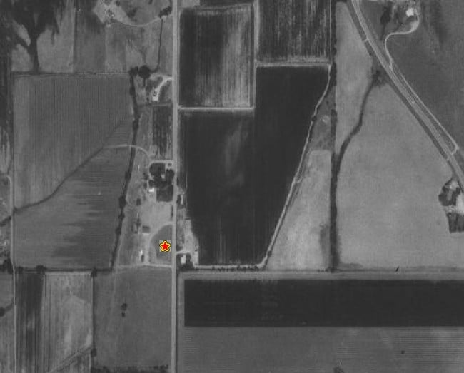
Map Layers
Map Styles
 Street
 Aerial
Transit
 Traffic
 Biking
Places
Listings with unknown addresses are not visible on the map
- Restaurants
- Banks
- Shops
- Fitness
- Groceries
PUBLIC TRANSPORTATION
AIRPORT
Boise Air Trml/Gowen Field
Drive
Walk
Distance
Boise Air Trml/Gowen Field
48 min
26.9 mi
Freight Ports
Port of Portland
Drive
Walk
Distance
Port of Portland
467 min
421.5 mi
Nearby Properties
Address
Land Use
TOTAL SIZE
Lot Size
Zoning
Address
Land Use
TOTAL SIZE
Lot Size
Zoning
15.16 AC
R-14-DA
Address
Land Use
TOTAL SIZE
Lot Size
Zoning
178,710 SF
13.47 AC
R-13
Address
Land Use
TOTAL SIZE
Lot Size
Zoning
265.60 AC
R-2-DA
Address
Land Use
TOTAL SIZE
Lot Size
Zoning
227,392 SF
4.40 AC
L-O
Address
Land Use
TOTAL SIZE
Lot Size
Zoning
96,860 SF
12.62 AC
LI-DA
Address
Land Use
TOTAL SIZE
Lot Size
Zoning
2,496 SF
222.96 AC
R-2-DA
Address
Land Use
TOTAL SIZE
Lot Size
Zoning
174,428 SF
10 AC
MU
Address
Land Use
TOTAL SIZE
Lot Size
Zoning
246,075 SF
11.16 AC
C-2
Address
Land Use
TOTAL SIZE
Lot Size
Zoning
20,595 SF
2.32 AC
MU
Address
Land Use
TOTAL SIZE
Lot Size
Zoning
63,346 SF
6.87 AC
C-2
Address
Land Use
TOTAL SIZE
Lot Size
Zoning
132,187 SF
7.47 AC
MU
Address
Land Use
TOTAL SIZE
Lot Size
Zoning
89.84 AC
R-4-DA
Address
Land Use
TOTAL SIZE
Lot Size
Zoning
58,697 SF
4.86 AC
CBD-DA
Address
Land Use
TOTAL SIZE
Lot Size
Zoning
34,510 SF
3.20 AC
C-2
Address
Land Use
TOTAL SIZE
Lot Size
Zoning
6,683 SF
9.62 AC
C-1-DA
Address
Land Use
TOTAL SIZE
Lot Size
Zoning
52.23 AC
R-3
Address
Land Use
TOTAL SIZE
Lot Size
Zoning
944 SF
26.70 AC
R-2-DA-P
Address
Land Use
TOTAL SIZE
Lot Size
Zoning
4,839 SF
0.77 AC
CBD
Address
Land Use
TOTAL SIZE
Lot Size
Zoning
38,414 SF
4.66 AC
R-8
Address
Land Use
TOTAL SIZE
Lot Size
Zoning
946 SF
19.93 AC
R-4
Address
Land Use
TOTAL SIZE
Lot Size
Zoning
4,041 SF
0.60 AC
C-2
Address
Land Use
TOTAL SIZE
Lot Size
Zoning
12.78 AC
R-4-DA
Address
Land Use
TOTAL SIZE
Lot Size
Zoning
11,873 SF
61.77 AC
MU-DA
Address
Land Use
TOTAL SIZE
Lot Size
Zoning
8,226 SF
1.74 AC
CBD-DA
Address
Land Use
TOTAL SIZE
Lot Size
Zoning
7,129 SF
1.11 AC
C-2
Address
Land Use
TOTAL SIZE
Lot Size
Zoning
9,294 SF
1.07 AC
MU-DA
Address
Land Use
TOTAL SIZE
Lot Size
Zoning
5,215 SF
0.93 AC
C-1-DA
Address
Land Use
TOTAL SIZE
Lot Size
Zoning
4,268 SF
0.93 AC
CBD
Address
Land Use
TOTAL SIZE
Lot Size
Zoning
3,400 SF
1.08 AC
C-2
Address
Land Use
TOTAL SIZE
Lot Size
Zoning
11.06 AC
MU
The World's #1 Commercial Real Estate Marketplace
Connect with us
© 2026 CoStar Group
The information above has been obtained from sources believed reliable. While we do not doubt its accuracy we have not verified it and make no guarantee, warranty or representation about it. It is your responsibility to independently confirm its accuracy and completeness. Any projections, opinions, assumptions, or estimates used are for example only and do not represent the current or future performance of the property. The value of this transaction to you depends on tax and other factors which should be evaluated by your tax, financial, and legal advisors. You and your advisors should conduct a careful, independent investigation of the property to determine to your satisfaction the suitability of the property for your needs.