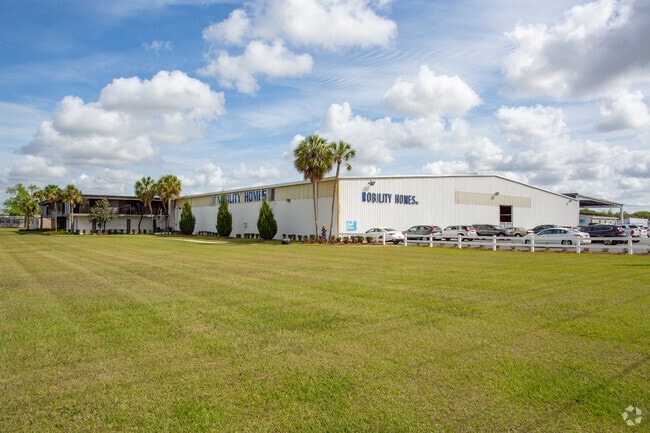
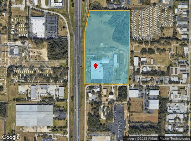
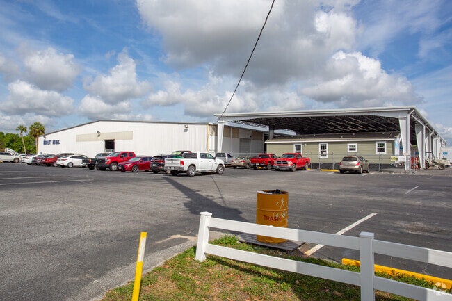
Property Record
3741 Sw 7Th St, Ocala, FL 34474
NEARBY LISTINGS FOR SALE OR LEASE
Property Detail
3741 Sw 7Th St
22774-006-00
SEC 14 TWP 15 RGE 21 S 3/4 OF W 1/2 OF SW 1/4 E OF I-75 EX S 390 FT
Foundry
Marion
A
Florida
12083C0516E
35.49 AC
2024
Greater Ocala
2024
Ocala
001600
Ocala, FL
138,452 SF
DEMOGRAPHICS near 3741 Sw 7Th St
1 Mile
3 Mile
5 Mile
2024 Total Population
3,626
31,377
73,163
2029 Population
4,073
35,529
82,702
Pop Growth 2024-2029
+ 12.33%
+ 13.23%
+ 13.04%
Average Age
38
41
42
2024 Total Households
886
12,573
29,854
HH Growth 2024-2029
+ 14.56%
+ 13.35%
+ 13.08%
Median Household Inc
$48,792
$46,363
$51,270
Avg Household Size
2.30
2.30
2.30
2024 Avg HH Vehicles
1.00
1.00
2.00
Median Home Value
$130,379
$193,421
$208,094
Median Year Built
1986
1988
1986
Nearby Places
Map Layers
Map Styles
 Street
 Aerial
- Restaurants
- Banks
- Shops
- Fitness
- Groceries
Nearby Properties
Address
Land Use
TOTAL SIZE
Lot Size
Zoning
Address
Land Use
TOTAL SIZE
Lot Size
Zoning
207,950 SF
14.08 AC
INST
Address
Land Use
TOTAL SIZE
Lot Size
Zoning
2,015,469 SF
169.30 AC
M1
Address
Land Use
TOTAL SIZE
Lot Size
Zoning
704,765 SF
71.04 AC
GU
Address
Land Use
TOTAL SIZE
Lot Size
Zoning
326,425 SF
11.66 AC
INST
Address
Land Use
TOTAL SIZE
Lot Size
Zoning
493,261 SF
126.01 AC
R3
Address
Land Use
TOTAL SIZE
Lot Size
Zoning
156,201 SF
36.77 AC
INST
Address
Land Use
TOTAL SIZE
Lot Size
Zoning
446,764 SF
138.06 AC
GU
Address
Land Use
TOTAL SIZE
Lot Size
Zoning
1,085,670 SF
89.70 AC
M1
Address
Land Use
TOTAL SIZE
Lot Size
Zoning
164,363 SF
16.51 AC
R3
Address
Land Use
TOTAL SIZE
Lot Size
Zoning
612,196 SF
50.06 AC
M1
Address
Land Use
TOTAL SIZE
Lot Size
Zoning
195,992 SF
5.72 AC
FBC
Address
Land Use
TOTAL SIZE
Lot Size
Zoning
422,264 SF
40.87 AC
SC
Address
Land Use
TOTAL SIZE
Lot Size
Zoning
154,870 SF
23.50 AC
PD
Address
Land Use
TOTAL SIZE
Lot Size
Zoning
178,015 SF
18.28 AC
PD07
Address
Land Use
TOTAL SIZE
Lot Size
Zoning
441,040 SF
150.01 AC
M1
Address
Land Use
TOTAL SIZE
Lot Size
Zoning
324,262 SF
48.94 AC
SC
Address
Land Use
TOTAL SIZE
Lot Size
Zoning
458,983 SF
35.14 AC
M1
Address
Land Use
TOTAL SIZE
Lot Size
Zoning
154,675 SF
23.62 AC
PD09
Address
Land Use
TOTAL SIZE
Lot Size
Zoning
444,381 SF
60 AC
M1
Address
Land Use
TOTAL SIZE
Lot Size
Zoning
152,355 SF
973.50 AC
GU
Address
Land Use
TOTAL SIZE
Lot Size
Zoning
403,023 SF
47.47 AC
M1
Address
Land Use
TOTAL SIZE
Lot Size
Zoning
111,644 SF
19 AC
PD09
Address
Land Use
TOTAL SIZE
Lot Size
Zoning
350,895 SF
27.85 AC
M1
Address
Land Use
TOTAL SIZE
Lot Size
Zoning
222,210 SF
22.14 AC
SC
Address
Land Use
TOTAL SIZE
Lot Size
Zoning
110,226 SF
19.56 AC
PD09
Address
Land Use
TOTAL SIZE
Lot Size
Zoning
421,243 SF
51.48 AC
M2
Address
Land Use
TOTAL SIZE
Lot Size
Zoning
92,049 SF
15.75 AC
R3
Address
Land Use
TOTAL SIZE
Lot Size
Zoning
65,570 SF
18.96 AC
PD
Address
Land Use
TOTAL SIZE
Lot Size
Zoning
60,816 SF
13.67 AC
PD
Address
Land Use
TOTAL SIZE
Lot Size
Zoning
266,503 SF
25.48 AC
SC
The World's #1 Commercial Real Estate Marketplace
Connect with us
© 2025 CoStar Group
The information above has been obtained from sources believed reliable. While we do not doubt its accuracy we have not verified it and make no guarantee, warranty or representation about it. It is your responsibility to independently confirm its accuracy and completeness. Any projections, opinions, assumptions, or estimates used are for example only and do not represent the current or future performance of the property. The value of this transaction to you depends on tax and other factors which should be evaluated by your tax, financial, and legal advisors. You and your advisors should conduct a careful, independent investigation of the property to determine to your satisfaction the suitability of the property for your needs.