Property Record
37415 State Road 19, Umatilla, FL 32784
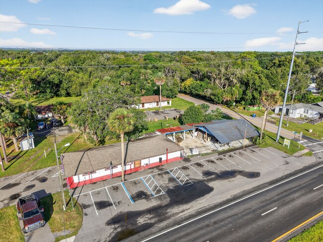
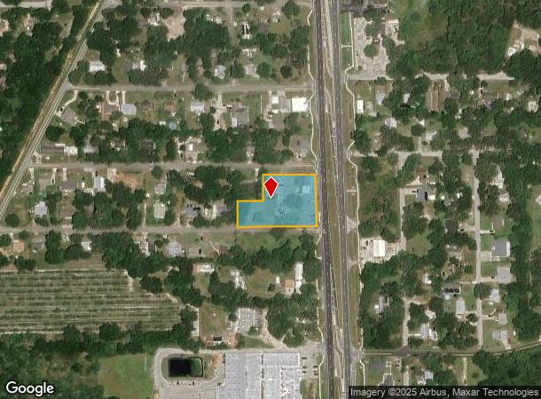
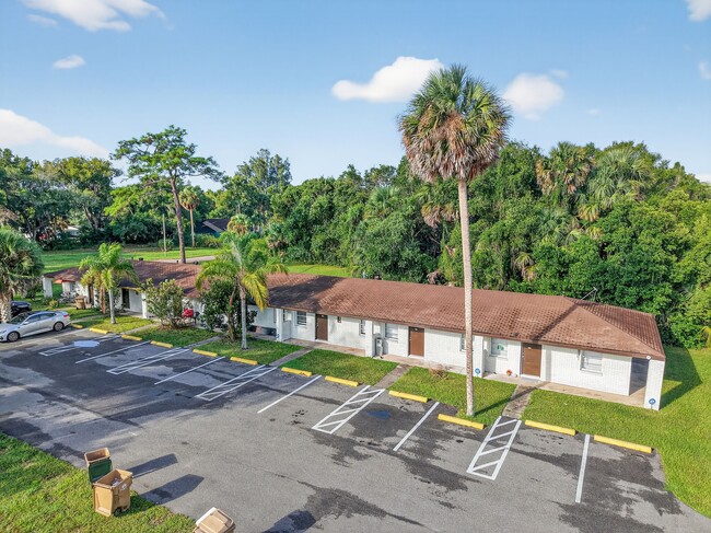
This Property Is For Sale
NEARBY LISTINGS FOR SALE OR LEASE
Property Detail
37415 State Road 19
Orlando-Kissimmee-Sanford, FL
Lynnwood
26-18-26-0500-002-00100
LYNNWOOD LOTS 1 2 8 9 10 BLK 2 PB 12 PG 26 ORB 5510 PG 241
Retailwithmorethanonenonretailuse
Lake
X
Florida
12069C0215E
1
2024
1.17 AC
2026
Lake County
030110
Orlando
4,721 SF
DEMOGRAPHICS near 37415 State Road 19
1 Mile
3 Mile
5 Mile
2024 Total Population
1,398
17,959
50,090
2029 Population
1,594
20,459
57,010
Pop Growth 2024-2029
+ 14.02%
+ 13.92%
+ 13.82%
Average Age
41
43
44
2024 Total Households
547
7,490
20,637
HH Growth 2024-2029
+ 14.08%
+ 14.19%
+ 14.02%
Median Household Inc
$67,169
$65,141
$67,952
Avg Household Size
2.60
2.40
2.40
2024 Avg HH Vehicles
2.00
2.00
2.00
Median Home Value
$272,916
$258,742
$283,260
Median Year Built
1978
1985
1987
Nearby Places
- Restaurants
- Banks
- Shops
- Fitness
- Groceries
PUBLIC TRANSPORTATION
AIRPORT
Orlando Sanford International
DRIVE
WALK
Distance
Orlando Sanford International
59 min
37.9 mi
Freight Ports
Port Canaveral
DRIVE
WALK
Distance
Port Canaveral
119 min
95.9 mi
Nearby Properties
Address
Land Use
TOTAL SIZE
Lot Size
Zoning
Address
Land Use
TOTAL SIZE
Lot Size
Zoning
1,486.45 AC
A
Address
Land Use
TOTAL SIZE
Lot Size
Zoning
174,744 SF
38.45 AC
GI
Address
Land Use
TOTAL SIZE
Lot Size
Zoning
60,476 SF
6.76 AC
MCR
Address
Land Use
TOTAL SIZE
Lot Size
Zoning
12,573 SF
43.71 AC
A
Address
Land Use
TOTAL SIZE
Lot Size
Zoning
494,946 SF
57.60 AC
LM
Address
Land Use
TOTAL SIZE
Lot Size
Zoning
46,374 SF
6.96 AC
GC
Address
Land Use
TOTAL SIZE
Lot Size
Zoning
48,624 SF
12.01 AC
MCR
Address
Land Use
TOTAL SIZE
Lot Size
Zoning
113,572 SF
21.17 AC
LM
Address
Land Use
TOTAL SIZE
Lot Size
Zoning
43,472 SF
3.52 AC
UR
Address
Land Use
TOTAL SIZE
Lot Size
Zoning
71.58 AC
Address
Land Use
TOTAL SIZE
Lot Size
Zoning
90,584 SF
11.14 AC
HM
Address
Land Use
TOTAL SIZE
Lot Size
Zoning
20,680 SF
0.47 AC
Address
Land Use
TOTAL SIZE
Lot Size
Zoning
2,000 SF
21.14 AC
PFD
Address
Land Use
TOTAL SIZE
Lot Size
Zoning
776.54 AC
A
Address
Land Use
TOTAL SIZE
Lot Size
Zoning
34.62 AC
C2
Address
Land Use
TOTAL SIZE
Lot Size
Zoning
31,806 SF
9.46 AC
GI
Address
Land Use
TOTAL SIZE
Lot Size
Zoning
2,000 SF
28.22 AC
PFD
Address
Land Use
TOTAL SIZE
Lot Size
Zoning
41,670 SF
2.93 AC
CP
Address
Land Use
TOTAL SIZE
Lot Size
Zoning
60,524 SF
9.61 AC
RP
Address
Land Use
TOTAL SIZE
Lot Size
Zoning
40,130 SF
4.88 AC
R6
Address
Land Use
TOTAL SIZE
Lot Size
Zoning
24,800 SF
13.08 AC
Address
Land Use
TOTAL SIZE
Lot Size
Zoning
23,424 SF
3.05 AC
Address
Land Use
TOTAL SIZE
Lot Size
Zoning
28,020 SF
4.48 AC
UR
Address
Land Use
TOTAL SIZE
Lot Size
Zoning
15,111 SF
2.14 AC
NC
Address
Land Use
TOTAL SIZE
Lot Size
Zoning
23,855 SF
1.61 AC
RT
Address
Land Use
TOTAL SIZE
Lot Size
Zoning
2,000 SF
30.97 AC
PI
Address
Land Use
TOTAL SIZE
Lot Size
Zoning
24,000 SF
2.67 AC
Address
Land Use
TOTAL SIZE
Lot Size
Zoning
23,506 SF
2.48 AC
R6
Address
Land Use
TOTAL SIZE
Lot Size
Zoning
43,368 SF
5.02 AC
UR
Address
Land Use
TOTAL SIZE
Lot Size
Zoning
20,802 SF
4.16 AC
UR
The World's #1 Commercial Real Estate Marketplace
Connect with us
© 2025 CoStar Group
The information above has been obtained from sources believed reliable. While we do not doubt its accuracy we have not verified it and make no guarantee, warranty or representation about it. It is your responsibility to independently confirm its accuracy and completeness. Any projections, opinions, assumptions, or estimates used are for example only and do not represent the current or future performance of the property. The value of this transaction to you depends on tax and other factors which should be evaluated by your tax, financial, and legal advisors. You and your advisors should conduct a careful, independent investigation of the property to determine to your satisfaction the suitability of the property for your needs.