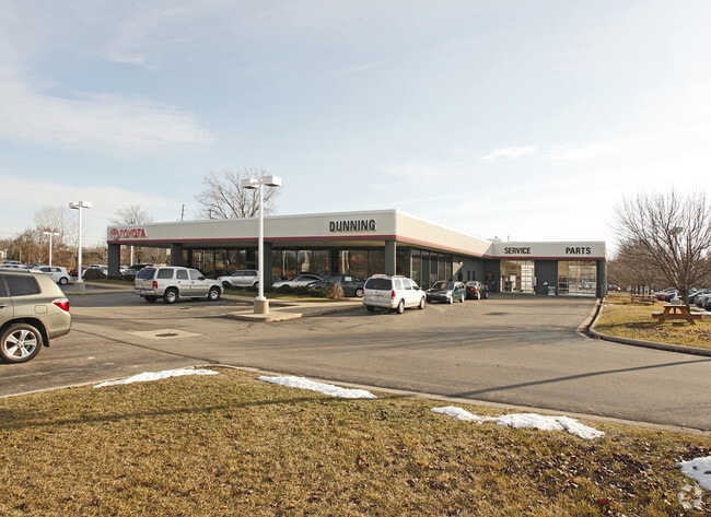
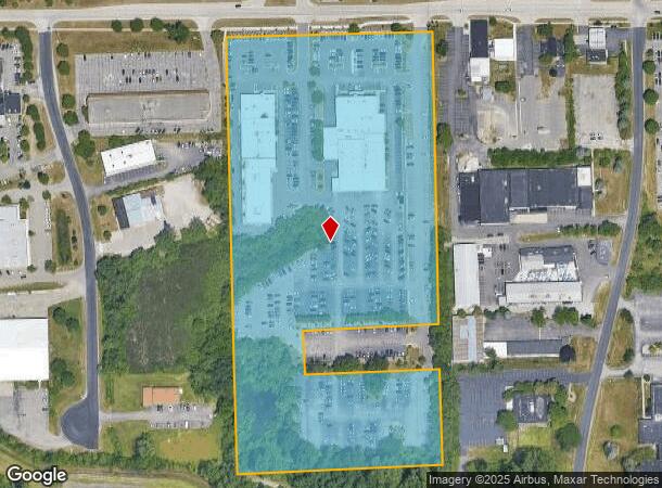
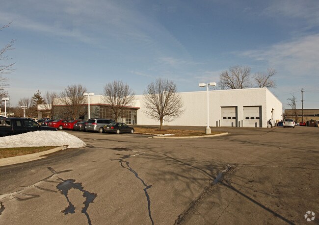
Property Record
3745 Jackson Rd, Ann Arbor, MI 48103

NEARBY LISTINGS FOR SALE OR LEASE
Property Detail
3745 Jackson Rd
08-26-100-029
PT OF NE 1/4 SEC 26, T2S, R5E; TH N 88-53-45 W 1228.79 FT FOR A POB; S 02-06-15 W 835.08 FT; TH N 88-53-45 W 378.56 FT; TH S
Commercialnec
Washtenaw
X
Michigan
26161C0241E
14.36 AC
2025
Washtenaw W of 23
2025
Detroit
456000
Ann Arbor, MI
34,992 SF
DEMOGRAPHICS near 3745 Jackson Rd
1 Mile
3 Mile
5 Mile
2024 Total Population
3,327
46,270
120,414
2029 Population
3,299
45,948
119,246
Pop Growth 2024-2029
(0.84%)
(0.70%)
(0.97%)
Average Age
41
41
36
2024 Total Households
1,413
20,349
48,775
HH Growth 2024-2029
(0.92%)
(0.82%)
(0.93%)
Median Household Inc
$109,281
$108,847
$84,574
Avg Household Size
2.30
2.20
2.20
2024 Avg HH Vehicles
2.00
2.00
2.00
Median Home Value
$405,762
$437,595
$440,702
Median Year Built
1984
1970
1976
Nearby Places
Map Layers
Map Styles
 Street
 Aerial
- Restaurants
- Banks
- Shops
- Fitness
- Groceries
PUBLIC TRANSPORTATION
COMMUTER RAIL
Ann Arbor Amtrak Station (Wolverine - Amtrak)
DRIVE
WALK
Distance
Ann Arbor Amtrak Station (Wolverine - Amtrak)
9 min
3.9 mi
AIRPORT
Detroit Metro Wayne County
DRIVE
WALK
Distance
Detroit Metro Wayne County
35 min
28.8 mi
Freight Ports
Port of Toledo
DRIVE
WALK
Distance
Port of Toledo
79 min
62.0 mi
Nearby Properties
Address
Land Use
TOTAL SIZE
Lot Size
Zoning
Address
Land Use
TOTAL SIZE
Lot Size
Zoning
212,047 SF
1.15 AC
D2
Address
Land Use
TOTAL SIZE
Lot Size
Zoning
186,029 SF
2.06 AC
D2
Address
Land Use
TOTAL SIZE
Lot Size
Zoning
177,763 SF
0.91 AC
D2
Address
Land Use
TOTAL SIZE
Lot Size
Zoning
303,524 SF
19.40 AC
R4B
Address
Land Use
TOTAL SIZE
Lot Size
Zoning
268,002 SF
18.34 AC
Address
Land Use
TOTAL SIZE
Lot Size
Zoning
137,874 SF
0.55 AC
PUD
Address
Land Use
TOTAL SIZE
Lot Size
Zoning
359,701 SF
37.70 AC
R4A
Address
Land Use
TOTAL SIZE
Lot Size
Zoning
231,262 SF
25.82 AC
C3
Address
Land Use
TOTAL SIZE
Lot Size
Zoning
179,981 SF
14.55 AC
R4A
Address
Land Use
TOTAL SIZE
Lot Size
Zoning
3,840 SF
1.55 AC
R4D
Address
Land Use
TOTAL SIZE
Lot Size
Zoning
177,474 SF
58.03 AC
C-2
Address
Land Use
TOTAL SIZE
Lot Size
Zoning
182,625 SF
15.89 AC
C3
Address
Land Use
TOTAL SIZE
Lot Size
Zoning
13.77 AC
MR-3
Address
Land Use
TOTAL SIZE
Lot Size
Zoning
59.07 AC
R-C
Address
Land Use
TOTAL SIZE
Lot Size
Zoning
320 SF
20.95 AC
MR-3
Address
Land Use
TOTAL SIZE
Lot Size
Zoning
80,088 SF
1.44 AC
R4B
Address
Land Use
TOTAL SIZE
Lot Size
Zoning
92,340 SF
0.71 AC
PUD
Address
Land Use
TOTAL SIZE
Lot Size
Zoning
95,831 SF
26.98 AC
I-1
Address
Land Use
TOTAL SIZE
Lot Size
Zoning
112,525 SF
14.40 AC
BI
Address
Land Use
TOTAL SIZE
Lot Size
Zoning
180,899 SF
32.64 AC
C-2
Address
Land Use
TOTAL SIZE
Lot Size
Zoning
38,511 SF
0.23 AC
D2
Address
Land Use
TOTAL SIZE
Lot Size
Zoning
147,400 SF
34.07 AC
SEVERAL
Address
Land Use
TOTAL SIZE
Lot Size
Zoning
86,947 SF
0.25 AC
D1
Address
Land Use
TOTAL SIZE
Lot Size
Zoning
115,158 SF
12.62 AC
R4A
Address
Land Use
TOTAL SIZE
Lot Size
Zoning
180,899 SF
28.14 AC
C-2
Address
Land Use
TOTAL SIZE
Lot Size
Zoning
42,015 SF
0.22 AC
D1
Address
Land Use
TOTAL SIZE
Lot Size
Zoning
11.21 AC
MR-3
Address
Land Use
TOTAL SIZE
Lot Size
Zoning
41,514 SF
0.45 AC
D1
Address
Land Use
TOTAL SIZE
Lot Size
Zoning
64,186 SF
0.41 AC
D1
Address
Land Use
TOTAL SIZE
Lot Size
Zoning
76,454 SF
8.94 AC
PUD
The World's #1 Commercial Real Estate Marketplace
Connect with us
© 2026 CoStar Group
The information above has been obtained from sources believed reliable. While we do not doubt its accuracy we have not verified it and make no guarantee, warranty or representation about it. It is your responsibility to independently confirm its accuracy and completeness. Any projections, opinions, assumptions, or estimates used are for example only and do not represent the current or future performance of the property. The value of this transaction to you depends on tax and other factors which should be evaluated by your tax, financial, and legal advisors. You and your advisors should conduct a careful, independent investigation of the property to determine to your satisfaction the suitability of the property for your needs.