Property Record
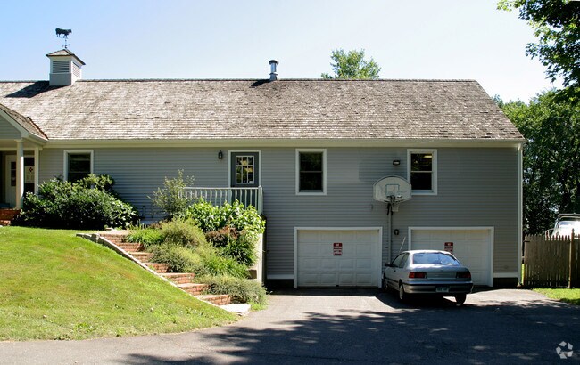
375 Baileyville Rd, Middlefield, CT 06455


Property Detail
375 Baileyville Rd
MFLD-000007-000000-000042-000002
Lower Ct River Vly
Commercialbuilding
Connecticut
AG2
42-2
B and X Area of moderate flood hazard, usually the area between the limits of the 100-year and 500-year floods.
2 AC
2025
NW Middlesex/Middletown
2025
Hartford
580100
Hartford-West Hartford-East Hartford, CT
4,037 SF
NEARBY LISTINGS FOR SALE OR LEASE
DEMOGRAPHICS near 375 Baileyville Rd
1 mile
3 mile
5 mile
2025 Total Population
1,259
22,512
105,065
2030 Population
1,280
22,792
105,741
Pop Growth 2025-2030
+ 1.67%
+ 1.24%
+ 0.64%
Average Age
47
44
41
2025 Total Households
546
9,257
42,586
HH Growth 2025-2030
+ 1.65%
+ 1.23%
+ 0.58%
Median Household Inc
$118,981
$91,209
$73,673
Avg Household Size
2.30
2.40
2.30
2025 Avg HH Vehicles
2.00
2.00
2.00
Median Home Value
$396,874
$280,107
$283,117
Median Year Built
1957
1967
1965
Nearby Places
Map Layers
Map Styles
 Street
 Aerial
Layers
 Traffic
 Biking
Places
Listings with unknown addresses are not visible on the map
- Restaurants
- Banks
- Shops
- Fitness
- Groceries
Nearby Properties
Address
Land Use
TOTAL SIZE
Lot Size
Zoning
Address
Land Use
TOTAL SIZE
Lot Size
Zoning
197,789 SF
31.92 AC
R-15
Address
Land Use
TOTAL SIZE
Lot Size
Zoning
267,249 SF
27.55 AC
R-1
Address
Land Use
TOTAL SIZE
Lot Size
Zoning
108,540 SF
22.99 AC
R-15
Address
Land Use
TOTAL SIZE
Lot Size
Zoning
23.01 AC
M
Address
Land Use
TOTAL SIZE
Lot Size
Zoning
10.38 AC
M-1
Address
Land Use
TOTAL SIZE
Lot Size
Zoning
329,296 SF
35.55 AC
IX
Address
Land Use
TOTAL SIZE
Lot Size
Zoning
339,844 SF
52.43 AC
M-4
Address
Land Use
TOTAL SIZE
Lot Size
Zoning
6.76 AC
M
Address
Land Use
TOTAL SIZE
Lot Size
Zoning
11.02 AC
S-R
Address
Land Use
TOTAL SIZE
Lot Size
Zoning
187,914 SF
16.13 AC
IX
Address
Land Use
TOTAL SIZE
Lot Size
Zoning
203,692 SF
21.22 AC
IX
Address
Land Use
TOTAL SIZE
Lot Size
Zoning
166,724 SF
21.79 AC
M-2
Address
Land Use
TOTAL SIZE
Lot Size
Zoning
598.20 AC
R-R
Address
Land Use
TOTAL SIZE
Lot Size
Zoning
50,533 SF
33 AC
R-30
Address
Land Use
TOTAL SIZE
Lot Size
Zoning
115,951 SF
14.77 AC
M-1
Address
Land Use
TOTAL SIZE
Lot Size
Zoning
171,057 SF
25.06 AC
M-4
Address
Land Use
TOTAL SIZE
Lot Size
Zoning
98,894 SF
44.82 AC
WI
Address
Land Use
TOTAL SIZE
Lot Size
Zoning
18.61 AC
C-2
Address
Land Use
TOTAL SIZE
Lot Size
Zoning
96,874 SF
6.40 AC
IOP
Address
Land Use
TOTAL SIZE
Lot Size
Zoning
3.60 AC
M-1
Address
Land Use
TOTAL SIZE
Lot Size
Zoning
8.68 AC
C-2
Address
Land Use
TOTAL SIZE
Lot Size
Zoning
326,730 SF
25.19 AC
M-1
Address
Land Use
TOTAL SIZE
Lot Size
Zoning
936 SF
18.84 AC
C-2
Address
Land Use
TOTAL SIZE
Lot Size
Zoning
20.60 AC
I-4
Address
Land Use
TOTAL SIZE
Lot Size
Zoning
104,562 SF
B-2
Address
Land Use
TOTAL SIZE
Lot Size
Zoning
187,744 SF
31.68 AC
M-1
Address
Land Use
TOTAL SIZE
Lot Size
Zoning
7.60 AC
B-2
Address
Land Use
TOTAL SIZE
Lot Size
Zoning
150.62 AC
S-R
Address
Land Use
TOTAL SIZE
Lot Size
Zoning
8.39 AC
B-2
Address
Land Use
TOTAL SIZE
Lot Size
Zoning
49,299 SF
19.98 AC
IPD1
The World's #1 Commercial Real Estate Marketplace
Connect with us
© 2026 CoStar Group
The information above has been obtained from sources believed reliable. While we do not doubt its accuracy we have not verified it and make no guarantee, warranty or representation about it. It is your responsibility to independently confirm its accuracy and completeness. Any projections, opinions, assumptions, or estimates used are for example only and do not represent the current or future performance of the property. The value of this transaction to you depends on tax and other factors which should be evaluated by your tax, financial, and legal advisors. You and your advisors should conduct a careful, independent investigation of the property to determine to your satisfaction the suitability of the property for your needs.