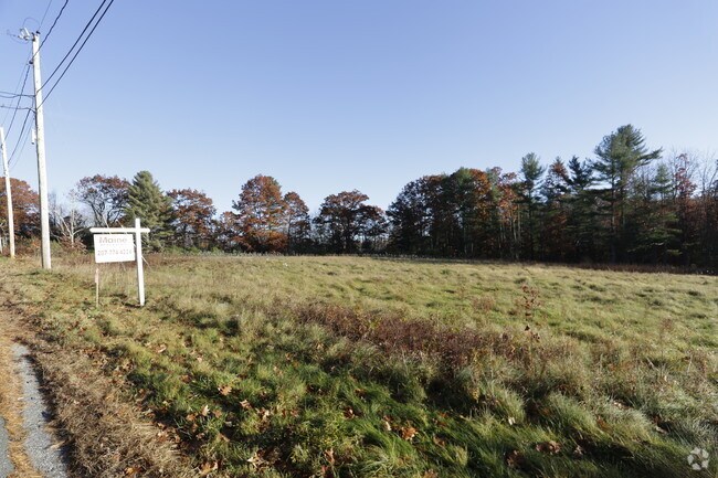
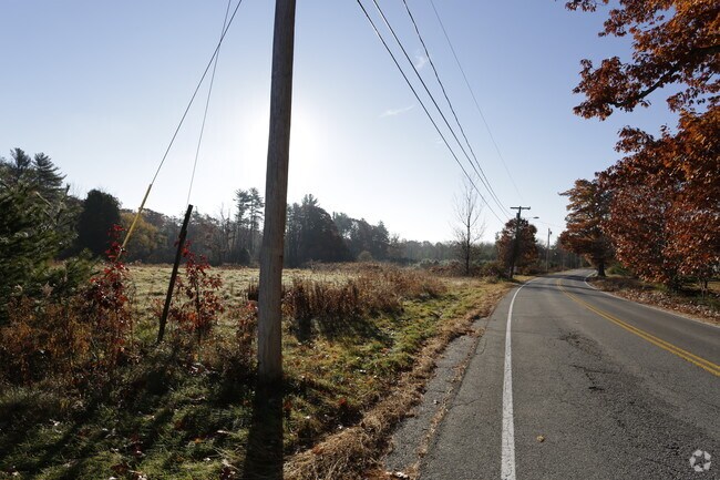
Property Record
375 Duck Pond Rd, Westbrook, ME 04092

Save to a Folder
{{folder.Name}}
{{folder.ListingIds.length}} Properties
{{folder.ListingIds.length}} Property
Create a New Folder
Property Detail
375 Duck Pond Rd
WSBR-000021-000000-000057
CUMBERLAND
Charitableorganization
Maine
13
57
AE The base floodplain where base flood elevations are provided. AE Zones are now used on new format FIRMs instead of A1-A30 Zones.
33.86 AC
2018
NE Cumberland County
2023
Portland/South Portland
002600
Portland-South Portland, ME
NEARBY LISTINGS FOR SALE OR LEASE
DEMOGRAPHICS near 375 Duck Pond Rd
1 mile
3 mile
5 mile
2025 Total Population
1,254
17,603
67,827
2030 Population
1,261
17,697
68,343
Pop Growth 2025-2030
+ 0.56%
+ 0.53%
+ 0.76%
Average Age
44
42
42
2025 Total Households
510
7,054
28,418
HH Growth 2025-2030
+ 0.59%
+ 0.74%
+ 0.85%
Median Household Inc
$142,741
$112,435
$103,389
Avg Household Size
2.40
2.40
2.30
2025 Avg HH Vehicles
2.00
2.00
2.00
Median Home Value
$465,527
$454,608
$460,121
Median Year Built
1988
1978
1970
Nearby Places
Map Layers
Map Styles
 Street
 Aerial
Layers
 Traffic
 Biking
Places
Listings with unknown addresses are not visible on the map
- Restaurants
- Banks
- Shops
- Fitness
- Groceries
PUBLIC TRANSPORTATION
COMMUTER RAIL
Portland (Downeaster - Amtrak)
Drive
Walk
Distance
Portland (Downeaster - Amtrak)
15 min
7.0 mi
AIRPORT
Portland International Jetport
Drive
Walk
Distance
Portland International Jetport
18 min
7.8 mi
Freight Ports
Portland, ME
Drive
Walk
Distance
Portland, ME
16 min
7.9 mi
Nearby Properties
Address
Land Use
TOTAL SIZE
Lot Size
Zoning
Address
Land Use
TOTAL SIZE
Lot Size
Zoning
10.08 AC
Address
Land Use
TOTAL SIZE
Lot Size
Zoning
41 AC
FF
Address
Land Use
TOTAL SIZE
Lot Size
Zoning
55.70 AC
14
Address
Land Use
TOTAL SIZE
Lot Size
Zoning
25.12 AC
Address
Land Use
TOTAL SIZE
Lot Size
Zoning
141,420 SF
11.27 AC
TIF
Address
Land Use
TOTAL SIZE
Lot Size
Zoning
33.07 AC
Address
Land Use
TOTAL SIZE
Lot Size
Zoning
17.72 AC
Address
Land Use
TOTAL SIZE
Lot Size
Zoning
206,165 SF
25.75 AC
Address
Land Use
TOTAL SIZE
Lot Size
Zoning
12.10 AC
Address
Land Use
TOTAL SIZE
Lot Size
Zoning
11.96 AC
Address
Land Use
TOTAL SIZE
Lot Size
Zoning
50,842 SF
Address
Land Use
TOTAL SIZE
Lot Size
Zoning
164 SF
12.48 AC
Address
Land Use
TOTAL SIZE
Lot Size
Zoning
2,362 SF
5.55 AC
Address
Land Use
TOTAL SIZE
Lot Size
Zoning
157,320 SF
15 AC
Address
Land Use
TOTAL SIZE
Lot Size
Zoning
104,580 SF
Address
Land Use
TOTAL SIZE
Lot Size
Zoning
100,000 SF
11.14 AC
Address
Land Use
TOTAL SIZE
Lot Size
Zoning
97,200 SF
12.50 AC
12
Address
Land Use
TOTAL SIZE
Lot Size
Zoning
272.87 AC
Address
Land Use
TOTAL SIZE
Lot Size
Zoning
56,155 SF
6.54 AC
TIF
Address
Land Use
TOTAL SIZE
Lot Size
Zoning
62,208 SF
5.41 AC
Address
Land Use
TOTAL SIZE
Lot Size
Zoning
83,898 SF
19.96 AC
Address
Land Use
TOTAL SIZE
Lot Size
Zoning
4.41 AC
Address
Land Use
TOTAL SIZE
Lot Size
Zoning
4.06 AC
Address
Land Use
TOTAL SIZE
Lot Size
Zoning
75,224 SF
9.62 AC
Address
Land Use
TOTAL SIZE
Lot Size
Zoning
65,400 SF
5.05 AC
Address
Land Use
TOTAL SIZE
Lot Size
Zoning
15.58 AC
Address
Land Use
TOTAL SIZE
Lot Size
Zoning
45,081 SF
12.47 AC
Address
Land Use
TOTAL SIZE
Lot Size
Zoning
37,456 SF
1.67 AC
Address
Land Use
TOTAL SIZE
Lot Size
Zoning
9.37 AC
Address
Land Use
TOTAL SIZE
Lot Size
Zoning
83,943 SF
98.39 AC
21
The World's #1 Commercial Real Estate Marketplace
Connect with us
© 2026 CoStar Group
The information above has been obtained from sources believed reliable. While we do not doubt its accuracy we have not verified it and make no guarantee, warranty or representation about it. It is your responsibility to independently confirm its accuracy and completeness. Any projections, opinions, assumptions, or estimates used are for example only and do not represent the current or future performance of the property. The value of this transaction to you depends on tax and other factors which should be evaluated by your tax, financial, and legal advisors. You and your advisors should conduct a careful, independent investigation of the property to determine to your satisfaction the suitability of the property for your needs.