Property Record
375 E Alessandro Blvd, Riverside, CA 92508


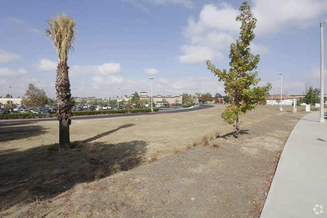
Property Detail
375 E Alessandro Blvd
Riverside-San Bernardino-Ontario, CA
9.97 ACRES M/L IN POR PAR 1 PM 173/046 PM 26320
276-110-018
Riverside
Departmentstore
California
D Areas with possible but undetermined flood hazards.
1
2024
9.97 AC
2025
Moreno Valley/Perris
042012
Inland Empire (California)
104,490 SF
NEARBY LISTINGS FOR SALE OR LEASE
DEMOGRAPHICS near 375 E Alessandro Blvd
1 mile
3 mile
5 mile
2025 Total Population
10,356
62,191
199,056
2030 Population
10,533
63,475
203,350
Pop Growth 2025-2030
+ 1.71%
+ 2.06%
+ 2.16%
Average Age
38
38
36
2025 Total Households
3,244
19,824
58,729
HH Growth 2025-2030
+ 1.17%
+ 1.66%
+ 1.77%
Median Household Inc
$127,308
$123,126
$93,586
Avg Household Size
3.10
3.00
3.10
2025 Avg HH Vehicles
3.00
2.00
2.00
Median Home Value
$734,104
$751,146
$674,350
Median Year Built
1994
1991
1984
Nearby Places
Map Layers
Map Styles
 Street
 Aerial
Layers
 Traffic
 Biking
Places
Listings with unknown addresses are not visible on the map
- Restaurants
- Banks
- Shops
- Fitness
- Groceries
PUBLIC TRANSPORTATION
COMMUTER RAIL
Drive
Walk
Distance
5 min
2.6 mi
Riverside-Downtown (91 Line - Southern California Regional Rail Authority (Metrolink), Inland Empire-Orange County Line - Southern California Regional Rail Authority (Metrolink), Riverside Line - Southern California Regional Rail Authority (Metrolink))
Drive
Walk
Distance
Riverside-Downtown (91 Line - Southern California Regional Rail Authority (Metrolink), Inland Empire-Orange County Line - Southern California Regional Rail Authority (Metrolink), Riverside Line - Southern California Regional Rail Authority (Metrolink))
13 min
6.4 mi
AIRPORT
Ontario International
Drive
Walk
Distance
Ontario International
35 min
24.5 mi
Nearby Properties
Address
Land Use
TOTAL SIZE
Lot Size
Zoning
Address
Land Use
TOTAL SIZE
Lot Size
Zoning
1,101,504 SF
59.45 AC
Address
Land Use
TOTAL SIZE
Lot Size
Zoning
782,209 SF
35.98 AC
Address
Land Use
TOTAL SIZE
Lot Size
Zoning
709,081 SF
33.17 AC
Address
Land Use
TOTAL SIZE
Lot Size
Zoning
1,012,995 SF
47.62 AC
Address
Land Use
TOTAL SIZE
Lot Size
Zoning
929,918 SF
52.44 AC
Address
Land Use
TOTAL SIZE
Lot Size
Zoning
361,346 SF
18.17 AC
Address
Land Use
TOTAL SIZE
Lot Size
Zoning
596,090 SF
29.17 AC
IP
Address
Land Use
TOTAL SIZE
Lot Size
Zoning
95,047 SF
10.25 AC
Address
Land Use
TOTAL SIZE
Lot Size
Zoning
1,007,387 SF
48.02 AC
RR
Address
Land Use
TOTAL SIZE
Lot Size
Zoning
397,994 SF
19.70 AC
H
Address
Land Use
TOTAL SIZE
Lot Size
Zoning
26.96 AC
R3
Address
Land Use
TOTAL SIZE
Lot Size
Zoning
1,001,789 SF
44.53 AC
RR
Address
Land Use
TOTAL SIZE
Lot Size
Zoning
302,116 SF
30.19 AC
RA
Address
Land Use
TOTAL SIZE
Lot Size
Zoning
620,533 SF
32.50 AC
Address
Land Use
TOTAL SIZE
Lot Size
Zoning
449,040 SF
18.86 AC
BMP
Address
Land Use
TOTAL SIZE
Lot Size
Zoning
126,036 SF
30.90 AC
Address
Land Use
TOTAL SIZE
Lot Size
Zoning
38,560 SF
12.04 AC
R3
Address
Land Use
TOTAL SIZE
Lot Size
Zoning
579,807 SF
30.23 AC
MP
Address
Land Use
TOTAL SIZE
Lot Size
Zoning
399,615 SF
24.31 AC
Address
Land Use
TOTAL SIZE
Lot Size
Zoning
486,000 SF
24.62 AC
Address
Land Use
TOTAL SIZE
Lot Size
Zoning
262,260 SF
13.35 AC
RR
Address
Land Use
TOTAL SIZE
Lot Size
Zoning
Address
Land Use
TOTAL SIZE
Lot Size
Zoning
500,174 SF
22.96 AC
Address
Land Use
TOTAL SIZE
Lot Size
Zoning
209,734 SF
10.87 AC
R3
Address
Land Use
TOTAL SIZE
Lot Size
Zoning
663,613 SF
44.28 AC
Address
Land Use
TOTAL SIZE
Lot Size
Zoning
4,439 SF
78.46 AC
Address
Land Use
TOTAL SIZE
Lot Size
Zoning
140,030 SF
9.45 AC
Address
Land Use
TOTAL SIZE
Lot Size
Zoning
16.39 AC
R3
Address
Land Use
TOTAL SIZE
Lot Size
Zoning
600,000 SF
26.89 AC
W-2
Address
Land Use
TOTAL SIZE
Lot Size
Zoning
134,474 SF
7.99 AC
C2
The World's #1 Commercial Real Estate Marketplace
Connect with us
© 2026 CoStar Group
The information above has been obtained from sources believed reliable. While we do not doubt its accuracy we have not verified it and make no guarantee, warranty or representation about it. It is your responsibility to independently confirm its accuracy and completeness. Any projections, opinions, assumptions, or estimates used are for example only and do not represent the current or future performance of the property. The value of this transaction to you depends on tax and other factors which should be evaluated by your tax, financial, and legal advisors. You and your advisors should conduct a careful, independent investigation of the property to determine to your satisfaction the suitability of the property for your needs.