Property Record
3750 Hacks Cross Rd, Memphis, TN 38125


NEARBY LISTINGS FOR SALE OR LEASE
Property Detail
3750 Hacks Cross Rd
08-1083-0-0004
Hacks Cross/ Winchester Pd Phase 2
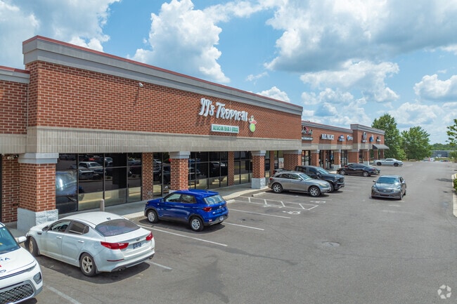
Regionalshoppingcenterormallwithanchorstore
ES HACKS CROSS RD SEE MAP D2-42N, S
X
Shelby
47157C0470F
Tennessee
2024
5.87 AC
2025
Southeast
021548
Memphis
44,724 SF
Memphis, TN-MS-AR
DEMOGRAPHICS near 3750 Hacks Cross Rd
1 Mile
3 Mile
5 Mile
2024 Total Population
7,878
66,607
165,582
2029 Population
7,717
64,862
162,154
Pop Growth 2024-2029
(2.04%)
(2.62%)
(2.07%)
Average Age
37
38
38
2024 Total Households
3,721
26,263
65,002
HH Growth 2024-2029
(2.07%)
(2.58%)
(2.04%)
Median Household Inc
$82,333
$82,243
$75,917
Avg Household Size
2.10
2.50
2.50
2024 Avg HH Vehicles
2.00
2.00
2.00
Median Home Value
$241,006
$256,913
$284,073
Median Year Built
2000
1990
1986
Nearby Places
Map Layers
Map Styles
 Street
 Aerial
- Restaurants
- Banks
- Shops
- Fitness
- Groceries
PUBLIC TRANSPORTATION
AIRPORT
Memphis International
DRIVE
WALK
Distance
Memphis International
21 min
11.7 mi
SALE & LEASE HISTORY
LISTING DATE
SALE/LEASE

Sep 25, 2016
For Lease
Aug 18, 2022
For Lease
Nearby Properties
Address
Land Use
TOTAL SIZE
Lot Size
Zoning
Address
Land Use
TOTAL SIZE
Lot Size
Zoning
73.56 AC
CA
Address
Land Use
TOTAL SIZE
Lot Size
Zoning
184,120 SF
11.11 AC
EMP
Address
Land Use
TOTAL SIZE
Lot Size
Zoning
56,237 SF
20.51 AC
CA
Address
Land Use
TOTAL SIZE
Lot Size
Zoning
55,888 SF
44.01 AC
CA
Address
Land Use
TOTAL SIZE
Lot Size
Zoning
160,832 SF
19.89 AC
CA
Address
Land Use
TOTAL SIZE
Lot Size
Zoning
164,074 SF
14.18 AC
CA
Address
Land Use
TOTAL SIZE
Lot Size
Zoning
52,688 SF
24.38 AC
CA
Address
Land Use
TOTAL SIZE
Lot Size
Zoning
62,013 SF
20 AC
CA
Address
Land Use
TOTAL SIZE
Lot Size
Zoning
251,597 SF
26.90 AC
EMP
Address
Land Use
TOTAL SIZE
Lot Size
Zoning
204,904 SF
6.87 AC
PD
Address
Land Use
TOTAL SIZE
Lot Size
Zoning
117,381 SF
27.16 AC
RU-2
Address
Land Use
TOTAL SIZE
Lot Size
Zoning
67,052 SF
21.65 AC
R-15
Address
Land Use
TOTAL SIZE
Lot Size
Zoning
38,566 SF
27.90 AC
CA
Address
Land Use
TOTAL SIZE
Lot Size
Zoning
64,994 SF
19.07 AC
RU-2
Address
Land Use
TOTAL SIZE
Lot Size
Zoning
70,038 SF
17.95 AC
CA
Address
Land Use
TOTAL SIZE
Lot Size
Zoning
48,768 SF
7.51 AC
R-8
Address
Land Use
TOTAL SIZE
Lot Size
Zoning
95,023 SF
33.86 AC
O-51
Address
Land Use
TOTAL SIZE
Lot Size
Zoning
142,971 SF
29.84 AC
R-15
Address
Land Use
TOTAL SIZE
Lot Size
Zoning
813,591 SF
37.02 AC
EMP
Address
Land Use
TOTAL SIZE
Lot Size
Zoning
10,128 SF
23.35 AC
CA
Address
Land Use
TOTAL SIZE
Lot Size
Zoning
144,416 SF
19.29 AC
SC-1
Address
Land Use
TOTAL SIZE
Lot Size
Zoning
71,363 SF
10 AC
R-T
Address
Land Use
TOTAL SIZE
Lot Size
Zoning
107,938 SF
9.16 AC
CA
Address
Land Use
TOTAL SIZE
Lot Size
Zoning
113,990 SF
9.07 AC
R-15
Address
Land Use
TOTAL SIZE
Lot Size
Zoning
88,484 SF
15.28 AC
RU-3
Address
Land Use
TOTAL SIZE
Lot Size
Zoning
35,001 SF
33.60 AC
R-10
Address
Land Use
TOTAL SIZE
Lot Size
Zoning
87,346 SF
15.02 AC
EMP
Address
Land Use
TOTAL SIZE
Lot Size
Zoning
216,086 SF
26.69 AC
R-15
Address
Land Use
TOTAL SIZE
Lot Size
Zoning
78,770 SF
18.67 AC
CA
Address
Land Use
TOTAL SIZE
Lot Size
Zoning
95,456 SF
21.96 AC
R-15
The World's #1 Commercial Real Estate Marketplace
Connect with us
© 2025 CoStar Group
The information above has been obtained from sources believed reliable. While we do not doubt its accuracy we have not verified it and make no guarantee, warranty or representation about it. It is your responsibility to independently confirm its accuracy and completeness. Any projections, opinions, assumptions, or estimates used are for example only and do not represent the current or future performance of the property. The value of this transaction to you depends on tax and other factors which should be evaluated by your tax, financial, and legal advisors. You and your advisors should conduct a careful, independent investigation of the property to determine to your satisfaction the suitability of the property for your needs.