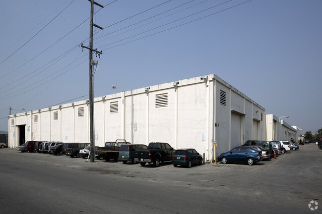
Property Record
3750 Nw 49Th St, Miami, FL 33142


NEARBY LISTINGS FOR SALE OR LEASE
Property Detail
3750 Nw 49Th St
04-3120-000-0041
Acreage & Unrec
Heavyindustrial
20 53 41 2.56 AC M/L BEG 35FT W OF NE COR OF S1/2 OF NE1/4 OF SE1/4 OF NE1/4 TH S 211.43FT W71.77FT S28FT W63.89FT N17.04FT W80.29FT N28.22FT N31 DEGW38.85FT W138.38FT N40DEGW 63.05FT W171.98FT N114.34FT E 586.63FT TO POB LESS SAL R/W LOT SIZE 111514
AH
Miami/Dade
12086C0284L
Florida
2024
2.56 AC
2025
Hialeah
001701
South Florida
70,771 SF
Miami-Miami Beach-Kendall, FL
DEMOGRAPHICS near 3750 Nw 49Th St
1 Mile
3 Mile
5 Mile
2024 Total Population
15,789
190,206
596,880
2029 Population
15,318
184,859
584,248
Pop Growth 2024-2029
(2.98%)
(2.81%)
(2.12%)
Average Age
42
42
42
2024 Total Households
5,184
65,604
224,365
HH Growth 2024-2029
(3.41%)
(3.17%)
(2.17%)
Median Household Inc
$48,702
$36,777
$43,939
Avg Household Size
3.00
2.70
2.50
2024 Avg HH Vehicles
2.00
1.00
1.00
Median Home Value
$317,114
$316,598
$358,881
Median Year Built
1960
1963
1970
Nearby Places
Map Layers
Map Styles
 Street
 Aerial
- Restaurants
- Banks
- Shops
- Fitness
- Groceries
PUBLIC TRANSPORTATION
COMMUTER RAIL
Hialeah Market (Tri-County Commuter - South Florida Regional Transportation Authority (Tri-Rail))
DRIVE
WALK
Distance
Hialeah Market (Tri-County Commuter - South Florida Regional Transportation Authority (Tri-Rail))
3 min
18 min
1.0 mi
Brownsville (Metrorail Green Line - Miami-Dade Transit (Metrorail/Metromover))
DRIVE
WALK
Distance
Brownsville (Metrorail Green Line - Miami-Dade Transit (Metrorail/Metromover))
4 min
1.8 mi
AIRPORT
Miami International
DRIVE
WALK
Distance
Miami International
16 min
6.0 mi
Fort Lauderdale/Hollywood International
DRIVE
WALK
Distance
Fort Lauderdale/Hollywood International
35 min
23.0 mi
Freight Ports
Port of Miami
DRIVE
WALK
Distance
Port of Miami
18 min
8.7 mi
Nearby Properties
Address
Land Use
TOTAL SIZE
Lot Size
Zoning
Address
Land Use
TOTAL SIZE
Lot Size
Zoning
16.13 AC
6100
Address
Land Use
TOTAL SIZE
Lot Size
Zoning
2,789,683 SF
33.23 AC
7300
Address
Land Use
TOTAL SIZE
Lot Size
Zoning
256,089 SF
20.35 AC
7600
Address
Land Use
TOTAL SIZE
Lot Size
Zoning
7.62 AC
7200
Address
Land Use
TOTAL SIZE
Lot Size
Zoning
328,554 SF
668.26 AC
8900
Address
Land Use
TOTAL SIZE
Lot Size
Zoning
1,700 SF
7.24 AC
7100
Address
Land Use
TOTAL SIZE
Lot Size
Zoning
648,350 SF
9.78 AC
6118
Address
Land Use
TOTAL SIZE
Lot Size
Zoning
545,220 SF
15.32 AC
6100
Address
Land Use
TOTAL SIZE
Lot Size
Zoning
474,561 SF
1.69 AC
6100
Address
Land Use
TOTAL SIZE
Lot Size
Zoning
306,775 SF
29.70 AC
7000
Address
Land Use
TOTAL SIZE
Lot Size
Zoning
451,817 SF
6400
Address
Land Use
TOTAL SIZE
Lot Size
Zoning
2 SF
154.10 AC
8900
Address
Land Use
TOTAL SIZE
Lot Size
Zoning
885,374 SF
20.59 AC
7300
Address
Land Use
TOTAL SIZE
Lot Size
Zoning
561,195 SF
2.66 AC
6100
Address
Land Use
TOTAL SIZE
Lot Size
Zoning
393,093 SF
3.61 AC
6400
Address
Land Use
TOTAL SIZE
Lot Size
Zoning
476,118 SF
12.93 AC
7300
Address
Land Use
TOTAL SIZE
Lot Size
Zoning
239,869 SF
5 AC
8000
Address
Land Use
TOTAL SIZE
Lot Size
Zoning
326,616 SF
34 AC
6100
Address
Land Use
TOTAL SIZE
Lot Size
Zoning
510,373 SF
154.10 AC
8900
Address
Land Use
TOTAL SIZE
Lot Size
Zoning
530,479 SF
10.13 AC
6400
Address
Land Use
TOTAL SIZE
Lot Size
Zoning
338,957 SF
14.13 AC
6107
Address
Land Use
TOTAL SIZE
Lot Size
Zoning
328,224 SF
28.95 AC
7300
Address
Land Use
TOTAL SIZE
Lot Size
Zoning
680,945 SF
35.56 AC
6400
Address
Land Use
TOTAL SIZE
Lot Size
Zoning
349,686 SF
22.40 AC
7300
Address
Land Use
TOTAL SIZE
Lot Size
Zoning
214,855 SF
3.91 AC
7300
Address
Land Use
TOTAL SIZE
Lot Size
Zoning
694,828 SF
4.01 AC
6100
Address
Land Use
TOTAL SIZE
Lot Size
Zoning
569,763 SF
31.75 AC
3900
Address
Land Use
TOTAL SIZE
Lot Size
Zoning
281,761 SF
26.88 AC
7100
Address
Land Use
TOTAL SIZE
Lot Size
Zoning
412,149 SF
19.40 AC
7100
Address
Land Use
TOTAL SIZE
Lot Size
Zoning
390,142 SF
1.68 AC
6100
The World's #1 Commercial Real Estate Marketplace
Connect with us
© 2026 CoStar Group
The information above has been obtained from sources believed reliable. While we do not doubt its accuracy we have not verified it and make no guarantee, warranty or representation about it. It is your responsibility to independently confirm its accuracy and completeness. Any projections, opinions, assumptions, or estimates used are for example only and do not represent the current or future performance of the property. The value of this transaction to you depends on tax and other factors which should be evaluated by your tax, financial, and legal advisors. You and your advisors should conduct a careful, independent investigation of the property to determine to your satisfaction the suitability of the property for your needs.