Property Record
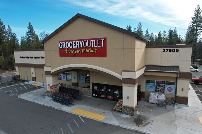
37505 State Highway 299 E, Burney, CA 96013


Property Detail
37505 State Highway 299 E
Supermarket
Shasta
C-2-DR
California
B and X Area of moderate flood hazard, usually the area between the limits of the 100-year and 500-year floods.
2.01 AC
2024
California North Rural Area
2025
Other Market Areas
012701
Redding, CA
18,985 SF
028-370-024-000
NEARBY LISTINGS FOR SALE OR LEASE
DEMOGRAPHICS near 37505 State Highway 299 E
1 mile
3 mile
5 mile
2025 Total Population
1,666
4,616
4,662
2030 Population
1,681
4,757
4,802
Pop Growth 2025-2030
+ 0.90%
+ 3.05%
+ 3.00%
Average Age
44
44
44
2025 Total Households
716
1,957
1,979
HH Growth 2025-2030
+ 0.84%
+ 3.01%
+ 2.98%
Median Household Inc
$61,277
$56,381
$56,483
Avg Household Size
2.20
2.30
2.30
2025 Avg HH Vehicles
2.00
2.00
2.00
Median Home Value
$242,127
$246,271
$246,204
Median Year Built
1974
1973
1973
Nearby Places
Map Layers
Map Styles
 Street
 Aerial
Layers
 Traffic
 Biking
Places
Listings with unknown addresses are not visible on the map
- Restaurants
- Banks
- Shops
- Fitness
- Groceries
SALE & LEASE HISTORY
LISTING DATE
SALE/LEASE

Oct 14, 2020
For Sale
Jan 14, 2025
For Sale
Nearby Properties
Address
Land Use
TOTAL SIZE
Lot Size
Zoning
Address
Land Use
TOTAL SIZE
Lot Size
Zoning
Address
Land Use
TOTAL SIZE
Lot Size
Zoning
6.41 AC
M
Address
Land Use
TOTAL SIZE
Lot Size
Zoning
5.78 AC
R-1
Address
Land Use
TOTAL SIZE
Lot Size
Zoning
1.02 AC
C-2
Address
Land Use
TOTAL SIZE
Lot Size
Zoning
17,450 SF
2.13 AC
C-2
Address
Land Use
TOTAL SIZE
Lot Size
Zoning
9,443 SF
0.67 AC
C-O
Address
Land Use
TOTAL SIZE
Lot Size
Zoning
9,180 SF
1.09 AC
C-2
Address
Land Use
TOTAL SIZE
Lot Size
Zoning
10,600 SF
0.34 AC
C-O
Address
Land Use
TOTAL SIZE
Lot Size
Zoning
17,500 SF
0.98 AC
C-2
Address
Land Use
TOTAL SIZE
Lot Size
Zoning
30,282 SF
2.50 AC
PD
Address
Land Use
TOTAL SIZE
Lot Size
Zoning
6.33 AC
R-1
Address
Land Use
TOTAL SIZE
Lot Size
Zoning
1.55 AC
C-2
Address
Land Use
TOTAL SIZE
Lot Size
Zoning
0.87 AC
C-2
Address
Land Use
TOTAL SIZE
Lot Size
Zoning
0.66 AC
C-2
Address
Land Use
TOTAL SIZE
Lot Size
Zoning
17,280 SF
0.63 AC
R-3
Address
Land Use
TOTAL SIZE
Lot Size
Zoning
50,400 SF
7.48 AC
PD
Address
Land Use
TOTAL SIZE
Lot Size
Zoning
1.54 AC
C-2
Address
Land Use
TOTAL SIZE
Lot Size
Zoning
358 SF
0.37 AC
C-2
Address
Land Use
TOTAL SIZE
Lot Size
Zoning
174.40 AC
EA-AP
Address
Land Use
TOTAL SIZE
Lot Size
Zoning
0.27 AC
C-2
Address
Land Use
TOTAL SIZE
Lot Size
Zoning
0.16 AC
PF
Address
Land Use
TOTAL SIZE
Lot Size
Zoning
2,725 SF
2.06 AC
R-1
Address
Land Use
TOTAL SIZE
Lot Size
Zoning
4,860 SF
1.03 AC
C-2
Address
Land Use
TOTAL SIZE
Lot Size
Zoning
1.38 AC
C-2
Address
Land Use
TOTAL SIZE
Lot Size
Zoning
2,315 SF
6.45 AC
R-L
Address
Land Use
TOTAL SIZE
Lot Size
Zoning
1,440 SF
50.57 AC
Address
Land Use
TOTAL SIZE
Lot Size
Zoning
4,745 SF
0.55 AC
C-2
The World's #1 Commercial Real Estate Marketplace
Connect with us
© 2026 CoStar Group
The information above has been obtained from sources believed reliable. While we do not doubt its accuracy we have not verified it and make no guarantee, warranty or representation about it. It is your responsibility to independently confirm its accuracy and completeness. Any projections, opinions, assumptions, or estimates used are for example only and do not represent the current or future performance of the property. The value of this transaction to you depends on tax and other factors which should be evaluated by your tax, financial, and legal advisors. You and your advisors should conduct a careful, independent investigation of the property to determine to your satisfaction the suitability of the property for your needs.