Property Record
3755 E 25Th St, Lawrence, KS 66046
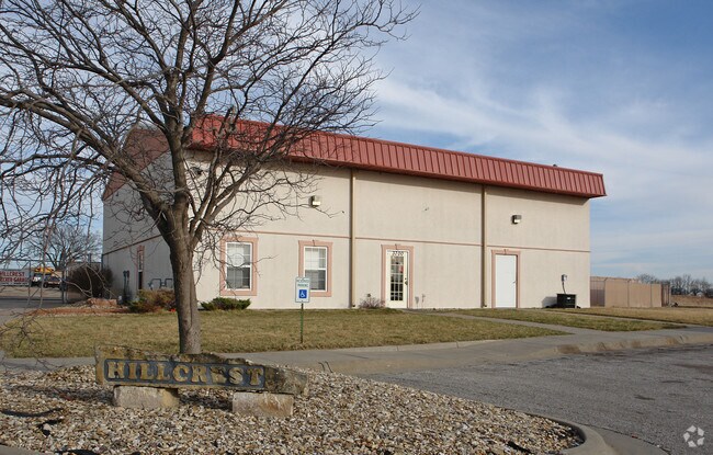

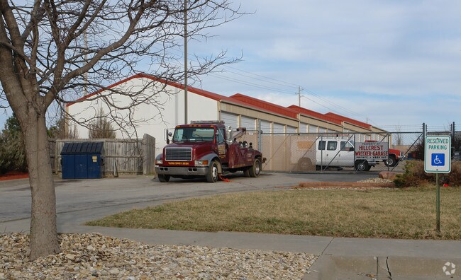
Property Detail
3755 E 25Th St
023-102-09-0-00-00-001.07-0
DOUGLAS COUNTY PUBLIC WORKS ADD NO 2 MINOR SUB LT 1 (REPLAT 2014)
Officebuilding
Douglas
PID2
Kansas
B and X Area of moderate flood hazard, usually the area between the limits of the 100-year and 500-year floods.
1
2025
44.11 AC
2025
Lawrence
001002
Kansas City
24,432 SF
Lawrence, KS
NEARBY LISTINGS FOR SALE OR LEASE
DEMOGRAPHICS near 3755 E 25Th St
1 mile
3 mile
5 mile
2025 Total Population
2,262
20,265
68,112
2030 Population
2,377
20,934
70,074
Pop Growth 2025-2030
+ 5.08%
+ 3.30%
+ 2.88%
Average Age
38
37
35
2025 Total Households
767
8,477
27,518
HH Growth 2025-2030
+ 5.08%
+ 3.39%
+ 3.17%
Median Household Inc
$93,999
$65,557
$57,905
Avg Household Size
2.60
2.20
2.20
2025 Avg HH Vehicles
2.00
2.00
2.00
Median Home Value
$250,950
$219,802
$248,616
Median Year Built
1998
1972
1977
Nearby Places
Map Layers
Map Styles
 Street
 Aerial
Transit
 Traffic
 Biking
Places
Listings with unknown addresses are not visible on the map
- Restaurants
- Banks
- Shops
- Fitness
- Groceries
PUBLIC TRANSPORTATION
COMMUTER RAIL
Lawrence Amtrak Station (Southwest Chief - Amtrak)
Drive
Walk
Distance
Lawrence Amtrak Station (Southwest Chief - Amtrak)
11 min
4.7 mi
Freight Ports
Tulsa Port Of Catoosa
Drive
Walk
Distance
Tulsa Port Of Catoosa
260 min
216.5 mi
Nearby Properties
Address
Land Use
TOTAL SIZE
Lot Size
Zoning
Address
Land Use
TOTAL SIZE
Lot Size
Zoning
632,738 SF
292.10 AC
RS2
Address
Land Use
TOTAL SIZE
Lot Size
Zoning
160,881 SF
20.50 AC
PID2
Address
Land Use
TOTAL SIZE
Lot Size
Zoning
143,467 SF
2.80 AC
RM1
Address
Land Use
TOTAL SIZE
Lot Size
Zoning
125,214 SF
20 AC
RS1
Address
Land Use
TOTAL SIZE
Lot Size
Zoning
78,051 SF
37.20 AC
RS2
Address
Land Use
TOTAL SIZE
Lot Size
Zoning
5,984 SF
142.30 AC
M2
Address
Land Use
TOTAL SIZE
Lot Size
Zoning
52,028 SF
11.07 AC
Address
Land Use
TOTAL SIZE
Lot Size
Zoning
79,784 SF
3.46 AC
RM2
Address
Land Use
TOTAL SIZE
Lot Size
Zoning
56,388 SF
15.40 AC
RS1
Address
Land Use
TOTAL SIZE
Lot Size
Zoning
11,712 SF
1.67 AC
RS2
Address
Land Use
TOTAL SIZE
Lot Size
Zoning
72,479 SF
6.70 AC
RS2
Address
Land Use
TOTAL SIZE
Lot Size
Zoning
2,200 SF
7.36 AC
M2
Address
Land Use
TOTAL SIZE
Lot Size
Zoning
20,882 SF
3.64 AC
PID2
Address
Land Use
TOTAL SIZE
Lot Size
Zoning
383,666 SF
23.60 AC
Address
Land Use
TOTAL SIZE
Lot Size
Zoning
50,000 SF
12.19 AC
Address
Land Use
TOTAL SIZE
Lot Size
Zoning
29,980 SF
9.30 AC
RS2
Address
Land Use
TOTAL SIZE
Lot Size
Zoning
128,000 SF
167.93 AC
497
Address
Land Use
TOTAL SIZE
Lot Size
Zoning
67,346 SF
6.20 AC
M2
Address
Land Use
TOTAL SIZE
Lot Size
Zoning
532.50 AC
497
Address
Land Use
TOTAL SIZE
Lot Size
Zoning
25,694 SF
4.10 AC
PID2
Address
Land Use
TOTAL SIZE
Lot Size
Zoning
5,238 SF
14.80 AC
RM1
Address
Land Use
TOTAL SIZE
Lot Size
Zoning
90,126 SF
1.51 AC
RM2
Address
Land Use
TOTAL SIZE
Lot Size
Zoning
138,251 SF
10.80 AC
M2
Address
Land Use
TOTAL SIZE
Lot Size
Zoning
89,646 SF
14.20 AC
M2
Address
Land Use
TOTAL SIZE
Lot Size
Zoning
7,938 SF
4.81 AC
Address
Land Use
TOTAL SIZE
Lot Size
Zoning
18,044 SF
6.60 AC
RS2
Address
Land Use
TOTAL SIZE
Lot Size
Zoning
257,270 SF
19.30 AC
M2
Address
Land Use
TOTAL SIZE
Lot Size
Zoning
4.63 AC
RS2
Address
Land Use
TOTAL SIZE
Lot Size
Zoning
4.41 AC
RM1
Address
Land Use
TOTAL SIZE
Lot Size
Zoning
2,468 SF
16.50 AC
RS1
The World's #1 Commercial Real Estate Marketplace
Connect with us
© 2026 CoStar Group
The information above has been obtained from sources believed reliable. While we do not doubt its accuracy we have not verified it and make no guarantee, warranty or representation about it. It is your responsibility to independently confirm its accuracy and completeness. Any projections, opinions, assumptions, or estimates used are for example only and do not represent the current or future performance of the property. The value of this transaction to you depends on tax and other factors which should be evaluated by your tax, financial, and legal advisors. You and your advisors should conduct a careful, independent investigation of the property to determine to your satisfaction the suitability of the property for your needs.