Property Record
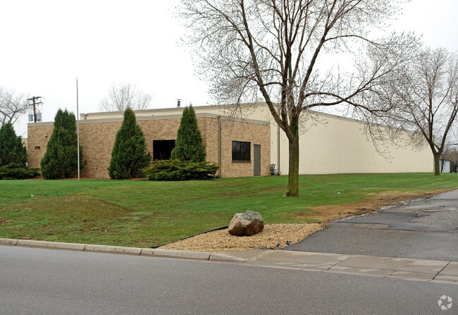
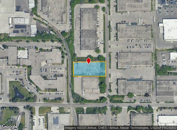
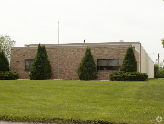
3755 Dunlap St N, Saint Paul, MN 55112
Current Lease Availabilities
NEARBY LISTINGS FOR SALE OR LEASE
Property Detail
3755 Dunlap St N
27-30-23-41-0008
Section 27 Town 30 Range 23
Heavyindustrial
SECTION 27 TOWN 30 RANGE 23 S 135 FT OF N 1038 FT OF W 300 4/10 FT ...OF SE 1/4 OF SEC 27 TN 30 RN 23
X
Ramsey
27053C0250F
Minnesota
2024
0.93 AC
2025
North Central
040804
Minneapolis/St Paul
11,720 SF
Minneapolis-St. Paul-Bloomington, MN-WI
DEMOGRAPHICS near 3755 Dunlap St N
1 Mile
3 Mile
5 Mile
2024 Total Population
4,263
55,878
186,147
2029 Population
4,205
54,717
182,851
Pop Growth 2024-2029
(1.36%)
(2.08%)
(1.77%)
Average Age
43
42
41
2024 Total Households
1,829
23,091
76,592
HH Growth 2024-2029
(1.26%)
(2.21%)
(1.94%)
Median Household Inc
$97,444
$83,495
$84,422
Avg Household Size
2.30
2.30
2.30
2024 Avg HH Vehicles
2.00
2.00
2.00
Median Home Value
$345,595
$343,967
$317,690
Median Year Built
1978
1975
1973
Nearby Places
Map Layers
Map Styles
 Street
 Aerial
- Restaurants
- Banks
- Shops
- Fitness
- Groceries
PUBLIC TRANSPORTATION
COMMUTER RAIL
Fridley Station (Northstar Corridor - Northstar Commuter Rail)
DRIVE
WALK
Distance
Fridley Station (Northstar Corridor - Northstar Commuter Rail)
12 min
7.9 mi
AIRPORT
Minneapolis-St Paul International/Wold-Chamberlain
DRIVE
WALK
Distance
Minneapolis-St Paul International/Wold-Chamberlain
29 min
19.5 mi
Nearby Properties
Address
Land Use
TOTAL SIZE
Lot Size
Zoning
Address
Land Use
TOTAL SIZE
Lot Size
Zoning
70,115 SF
191.32 AC
Address
Land Use
TOTAL SIZE
Lot Size
Zoning
141,716 SF
567.20 AC
Address
Land Use
TOTAL SIZE
Lot Size
Zoning
Address
Land Use
TOTAL SIZE
Lot Size
Zoning
48.52 AC
Address
Land Use
TOTAL SIZE
Lot Size
Zoning
294,047 SF
7.99 AC
Address
Land Use
TOTAL SIZE
Lot Size
Zoning
Address
Land Use
TOTAL SIZE
Lot Size
Zoning
9,320 SF
77.38 AC
Address
Land Use
TOTAL SIZE
Lot Size
Zoning
476,695 SF
21.51 AC
Address
Land Use
TOTAL SIZE
Lot Size
Zoning
4.18 AC
Address
Land Use
TOTAL SIZE
Lot Size
Zoning
2.39 AC
Address
Land Use
TOTAL SIZE
Lot Size
Zoning
Address
Land Use
TOTAL SIZE
Lot Size
Zoning
220 SF
19.66 AC
Address
Land Use
TOTAL SIZE
Lot Size
Zoning
792 SF
42.69 AC
Address
Land Use
TOTAL SIZE
Lot Size
Zoning
419,070 SF
45.50 AC
Address
Land Use
TOTAL SIZE
Lot Size
Zoning
167,511 SF
14.49 AC
Address
Land Use
TOTAL SIZE
Lot Size
Zoning
3.83 AC
Address
Land Use
TOTAL SIZE
Lot Size
Zoning
335,252 SF
19.06 AC
Address
Land Use
TOTAL SIZE
Lot Size
Zoning
21.94 AC
Address
Land Use
TOTAL SIZE
Lot Size
Zoning
212,663 SF
3.50 AC
Address
Land Use
TOTAL SIZE
Lot Size
Zoning
294,500 SF
5.95 AC
Address
Land Use
TOTAL SIZE
Lot Size
Zoning
159.37 AC
Address
Land Use
TOTAL SIZE
Lot Size
Zoning
201,030 SF
7.59 AC
Address
Land Use
TOTAL SIZE
Lot Size
Zoning
150,034 SF
48.48 AC
Address
Land Use
TOTAL SIZE
Lot Size
Zoning
115.62 AC
Address
Land Use
TOTAL SIZE
Lot Size
Zoning
170,875 SF
2.76 AC
Address
Land Use
TOTAL SIZE
Lot Size
Zoning
309,863 SF
56.34 AC
Address
Land Use
TOTAL SIZE
Lot Size
Zoning
91,679 SF
35.89 AC
Address
Land Use
TOTAL SIZE
Lot Size
Zoning
Address
Land Use
TOTAL SIZE
Lot Size
Zoning
Address
Land Use
TOTAL SIZE
Lot Size
Zoning
1.77 AC
The World's #1 Commercial Real Estate Marketplace
Connect with us
© 2026 CoStar Group
The information above has been obtained from sources believed reliable. While we do not doubt its accuracy we have not verified it and make no guarantee, warranty or representation about it. It is your responsibility to independently confirm its accuracy and completeness. Any projections, opinions, assumptions, or estimates used are for example only and do not represent the current or future performance of the property. The value of this transaction to you depends on tax and other factors which should be evaluated by your tax, financial, and legal advisors. You and your advisors should conduct a careful, independent investigation of the property to determine to your satisfaction the suitability of the property for your needs.