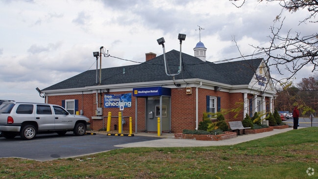
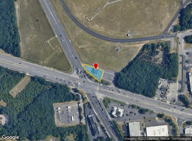
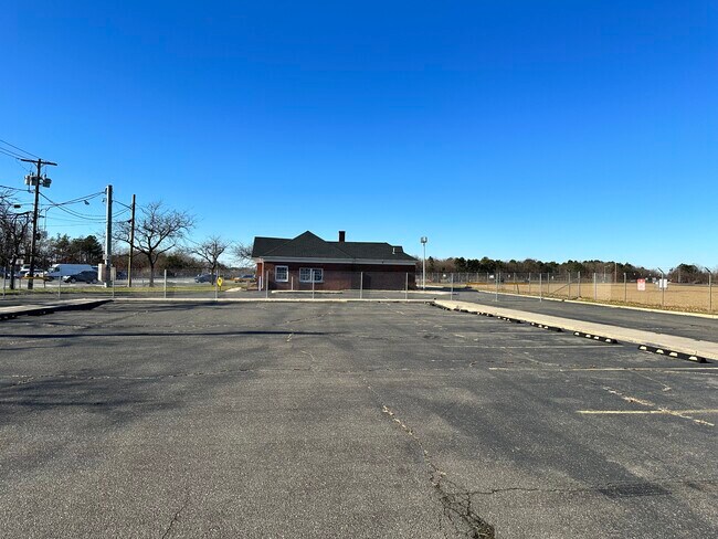
Property Record
3755 Veterans Mem Hwy, Ronkonkoma, NY 11779
NEARBY LISTINGS FOR SALE OR LEASE
Property Detail
3755 Veterans Mem Hwy
0500-148-00-01-00-033-000
X2245278Y205395 N027N00000000
Financialbuilding
Suffolk
X
New York
36103C0690H
100
0
0.33 AC
2024
Central Suffolk
158608
Long Island (New York)
294 SF
Nassau County-Suffolk County, NY
DEMOGRAPHICS near 3755 Veterans Mem Hwy
1 Mile
3 Mile
5 Mile
2024 Total Population
2,626
65,234
216,040
2029 Population
2,568
64,483
212,995
Pop Growth 2024-2029
(2.21%)
(1.15%)
(1.41%)
Average Age
41
42
42
2024 Total Households
891
22,845
74,742
HH Growth 2024-2029
(2.36%)
(1.22%)
(1.48%)
Median Household Inc
$125,123
$116,424
$116,829
Avg Household Size
2.90
2.80
2.80
2024 Avg HH Vehicles
2.00
2.00
2.00
Median Home Value
$458,717
$449,182
$464,239
Median Year Built
1966
1971
1970
Nearby Places
- Restaurants
- Banks
- Shops
- Fitness
- Groceries
PUBLIC TRANSPORTATION
COMMUTER RAIL
Ronkonkoma Station (Greenport Branch - Long Island Rail Road, Ronkonkoma Branch - Long Island Rail Road)
DRIVE
WALK
Distance
Ronkonkoma Station (Greenport Branch - Long Island Rail Road, Ronkonkoma Branch - Long Island Rail Road)
4 min
2.0 mi
Oakdale Station (Montauk Branch - Long Island Rail Road)
DRIVE
WALK
Distance
Oakdale Station (Montauk Branch - Long Island Rail Road)
8 min
4.3 mi
AIRPORT
Long Island MacArthur
DRIVE
WALK
Distance
Long Island MacArthur
4 min
1.4 mi
Freight Ports
Port of New Haven
DRIVE
WALK
Distance
Port of New Haven
133 min
52.3 mi
SALE & LEASE HISTORY
LISTING DATE
SALE/LEASE

Sep 23, 2016
For Sale
Jun 20, 2017
For Sale
Jul 26, 2017
For Sale
Jul 21, 2017
For Sale
Dec 22, 2023
For Sale
Nearby Properties
Address
Land Use
TOTAL SIZE
Lot Size
Zoning
Address
Land Use
TOTAL SIZE
Lot Size
Zoning
1,207.60 AC
Address
Land Use
TOTAL SIZE
Lot Size
Zoning
69.90 AC
AA
Address
Land Use
TOTAL SIZE
Lot Size
Zoning
49.54 AC
CA
Address
Land Use
TOTAL SIZE
Lot Size
Zoning
27.90 AC
AA
Address
Land Use
TOTAL SIZE
Lot Size
Zoning
465.70 AC
AAA
Address
Land Use
TOTAL SIZE
Lot Size
Zoning
29.86 AC
CA
Address
Land Use
TOTAL SIZE
Lot Size
Zoning
26.28 AC
CA
Address
Land Use
TOTAL SIZE
Lot Size
Zoning
27.63 AC
C
Address
Land Use
TOTAL SIZE
Lot Size
Zoning
51.59 AC
AA
Address
Land Use
TOTAL SIZE
Lot Size
Zoning
360.60 AC
AAA
Address
Land Use
TOTAL SIZE
Lot Size
Zoning
23.50 AC
AA
Address
Land Use
TOTAL SIZE
Lot Size
Zoning
26,811 SF
43.20 AC
CA
Address
Land Use
TOTAL SIZE
Lot Size
Zoning
31.30 AC
IND1
Address
Land Use
TOTAL SIZE
Lot Size
Zoning
18.68 AC
IND1
Address
Land Use
TOTAL SIZE
Lot Size
Zoning
23.80 AC
AAA
Address
Land Use
TOTAL SIZE
Lot Size
Zoning
8.65 AC
GSC
Address
Land Use
TOTAL SIZE
Lot Size
Zoning
3.16 AC
A
Address
Land Use
TOTAL SIZE
Lot Size
Zoning
97.24 AC
AAA
Address
Land Use
TOTAL SIZE
Lot Size
Zoning
20.29 AC
CA
Address
Land Use
TOTAL SIZE
Lot Size
Zoning
96 SF
18.29 AC
BUS3
Address
Land Use
TOTAL SIZE
Lot Size
Zoning
16 AC
AA
Address
Land Use
TOTAL SIZE
Lot Size
Zoning
3,025 SF
5.60 AC
AA
Address
Land Use
TOTAL SIZE
Lot Size
Zoning
722 SF
24.39 AC
BUS3
Address
Land Use
TOTAL SIZE
Lot Size
Zoning
25 AC
AA
Address
Land Use
TOTAL SIZE
Lot Size
Zoning
23.08 AC
AA
Address
Land Use
TOTAL SIZE
Lot Size
Zoning
12.70 AC
IND1
Address
Land Use
TOTAL SIZE
Lot Size
Zoning
5.01 AC
AA278
Address
Land Use
TOTAL SIZE
Lot Size
Zoning
200.70 AC
AAA
Address
Land Use
TOTAL SIZE
Lot Size
Zoning
5.53 AC
ICD
Address
Land Use
TOTAL SIZE
Lot Size
Zoning
12.14 AC
BUS3
The World's #1 Commercial Real Estate Marketplace
Connect with us
© 2025 CoStar Group
The information above has been obtained from sources believed reliable. While we do not doubt its accuracy we have not verified it and make no guarantee, warranty or representation about it. It is your responsibility to independently confirm its accuracy and completeness. Any projections, opinions, assumptions, or estimates used are for example only and do not represent the current or future performance of the property. The value of this transaction to you depends on tax and other factors which should be evaluated by your tax, financial, and legal advisors. You and your advisors should conduct a careful, independent investigation of the property to determine to your satisfaction the suitability of the property for your needs.