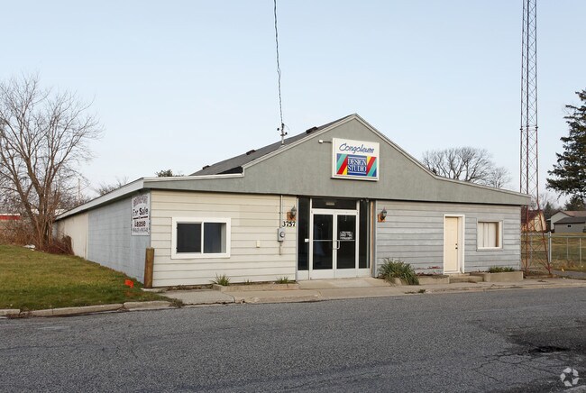
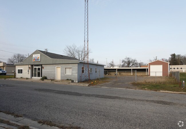
Property Record
3757 Sherman St, Bridgeport, MI 48722
NEARBY LISTINGS FOR SALE OR LEASE
Property Detail
3757 Sherman St
09115160154000
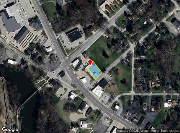
Bridgeport (Map Of Village)
Commercialnec
NELY 94 FT MEASURED ALONG SHERMAN ST OF THAT PART OF LOTS 23 & 24 LYING NWLY OF SD SHERMAN ST BLK 3 VILLAGE OF BRIDGEPORT ALSO S 47 FT OF ELY 100 FT OF LOT 18 BLK 3 VILLAGE OF BRIDGEPORT SEC 16 T11N R5E
AE
Saginaw
26145C0332E
Michigan
2024
18
2025
0.34 AC
011600
Other Market Areas
6,400 SF
Saginaw, MI
DEMOGRAPHICS near 3757 Sherman St
1 Mile
3 Mile
5 Mile
2024 Total Population
1,327
11,027
33,633
2029 Population
1,304
10,891
33,824
Pop Growth 2024-2029
(1.73%)
(1.23%)
+ 0.57%
Average Age
43
43
40
2024 Total Households
550
4,631
14,042
HH Growth 2024-2029
(1.82%)
(1.40%)
+ 0.44%
Median Household Inc
$40,179
$40,634
$31,801
Avg Household Size
2.30
2.30
2.30
2024 Avg HH Vehicles
2.00
2.00
1.00
Median Home Value
$93,103
$79,891
$71,026
Median Year Built
1965
1965
1962
Nearby Places
Map Layers
Map Styles
 Street
 Aerial
- Restaurants
- Banks
- Shops
- Fitness
- Groceries
PUBLIC TRANSPORTATION
AIRPORT
MBS International
DRIVE
WALK
Distance
MBS International
37 min
21.5 mi
Bishop International
DRIVE
WALK
Distance
Bishop International
47 min
32.9 mi
Freight Ports
Port of Toledo
DRIVE
WALK
Distance
Port of Toledo
160 min
138.9 mi
Nearby Properties
Address
Land Use
TOTAL SIZE
Lot Size
Zoning
Address
Land Use
TOTAL SIZE
Lot Size
Zoning
600,385 SF
33.54 AC
Address
Land Use
TOTAL SIZE
Lot Size
Zoning
34,056 SF
3.46 AC
Address
Land Use
TOTAL SIZE
Lot Size
Zoning
25,163 SF
28.65 AC
B3
Address
Land Use
TOTAL SIZE
Lot Size
Zoning
82,868 SF
17.56 AC
M1
Address
Land Use
TOTAL SIZE
Lot Size
Zoning
85,028 SF
9.11 AC
Address
Land Use
TOTAL SIZE
Lot Size
Zoning
65,930 SF
9.91 AC
Address
Land Use
TOTAL SIZE
Lot Size
Zoning
212,454 SF
8.80 AC
M2
Address
Land Use
TOTAL SIZE
Lot Size
Zoning
24,960 SF
22.36 AC
B3
Address
Land Use
TOTAL SIZE
Lot Size
Zoning
119,392 SF
77.98 AC
M2
Address
Land Use
TOTAL SIZE
Lot Size
Zoning
70,966 SF
5.38 AC
M2
Address
Land Use
TOTAL SIZE
Lot Size
Zoning
3,752 SF
11.42 AC
Address
Land Use
TOTAL SIZE
Lot Size
Zoning
45,526 SF
3.58 AC
Address
Land Use
TOTAL SIZE
Lot Size
Zoning
55,944 SF
0.64 AC
Address
Land Use
TOTAL SIZE
Lot Size
Zoning
43,212 SF
3.59 AC
B3
Address
Land Use
TOTAL SIZE
Lot Size
Zoning
Address
Land Use
TOTAL SIZE
Lot Size
Zoning
41,742 SF
6.37 AC
M2
Address
Land Use
TOTAL SIZE
Lot Size
Zoning
53,974 SF
2.41 AC
Address
Land Use
TOTAL SIZE
Lot Size
Zoning
53,450 SF
5.11 AC
Address
Land Use
TOTAL SIZE
Lot Size
Zoning
47,840 SF
10.61 AC
M2
Address
Land Use
TOTAL SIZE
Lot Size
Zoning
42,728 SF
8.51 AC
Address
Land Use
TOTAL SIZE
Lot Size
Zoning
3,228 SF
55.52 AC
R-3 RES
Address
Land Use
TOTAL SIZE
Lot Size
Zoning
15,183 SF
11.46 AC
Address
Land Use
TOTAL SIZE
Lot Size
Zoning
55,720 SF
7.24 AC
M1
Address
Land Use
TOTAL SIZE
Lot Size
Zoning
58,072 SF
5.45 AC
Address
Land Use
TOTAL SIZE
Lot Size
Zoning
58,577 SF
2.75 AC
Address
Land Use
TOTAL SIZE
Lot Size
Zoning
10,371 SF
4.79 AC
B3
Address
Land Use
TOTAL SIZE
Lot Size
Zoning
13,350 SF
1 AC
B2- COM
Address
Land Use
TOTAL SIZE
Lot Size
Zoning
35,328 SF
4.38 AC
Address
Land Use
TOTAL SIZE
Lot Size
Zoning
7,100 SF
1.32 AC
Address
Land Use
TOTAL SIZE
Lot Size
Zoning
11,301 SF
1.21 AC
The World's #1 Commercial Real Estate Marketplace
Connect with us
© 2025 CoStar Group
The information above has been obtained from sources believed reliable. While we do not doubt its accuracy we have not verified it and make no guarantee, warranty or representation about it. It is your responsibility to independently confirm its accuracy and completeness. Any projections, opinions, assumptions, or estimates used are for example only and do not represent the current or future performance of the property. The value of this transaction to you depends on tax and other factors which should be evaluated by your tax, financial, and legal advisors. You and your advisors should conduct a careful, independent investigation of the property to determine to your satisfaction the suitability of the property for your needs.