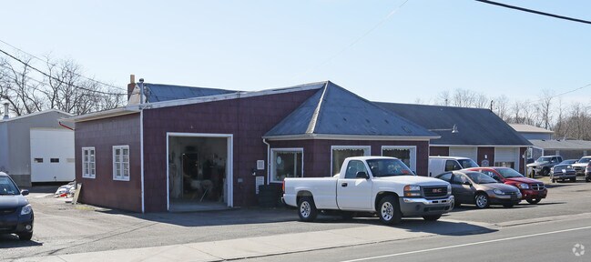
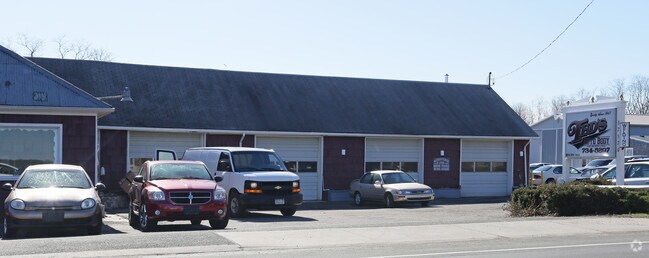
Property Record
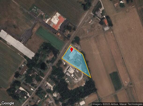
37570 Route 25 Rd, Peconic, NY 11958
NEARBY LISTINGS FOR SALE OR LEASE
-
-
View all Peconic listings for sale on LoopNet.com
Property Detail
37570 Route 25 Rd
1000-085-00-03-00-006-007
Suffolk
Autorepair
New York
X
6
36103C0164H
1.31 AC
2024
Eastern Suffolk
2024
Long Island (New York)
170006
Nassau County-Suffolk County, NY
DEMOGRAPHICS near 37570 Route 25 Rd
1 Mile
3 Mile
5 Mile
2024 Total Population
1,096
9,604
16,991
2029 Population
1,132
9,937
17,483
Pop Growth 2024-2029
+ 3.28%
+ 3.47%
+ 2.90%
Average Age
48
48
48
2024 Total Households
455
4,017
7,118
HH Growth 2024-2029
+ 3.08%
+ 3.41%
+ 2.84%
Median Household Inc
$100,744
$102,612
$100,354
Avg Household Size
2.30
2.30
2.30
2024 Avg HH Vehicles
2.00
2.00
2.00
Median Home Value
$743,750
$759,183
$736,541
Median Year Built
1977
1973
1974
Nearby Places
- Restaurants
- Banks
- Shops
- Fitness
- Groceries
PUBLIC TRANSPORTATION
COMMUTER RAIL
Southold Station (Greenport Branch - Long Island Rail Road)
DRIVE
WALK
Distance
Southold Station (Greenport Branch - Long Island Rail Road)
6 min
3.4 mi
Mattituck Station (Greenport Branch - Long Island Rail Road)
DRIVE
WALK
Distance
Mattituck Station (Greenport Branch - Long Island Rail Road)
10 min
5.6 mi
Freight Ports
Port of New Haven
DRIVE
WALK
Distance
Port of New Haven
168 min
72.1 mi
Nearby Properties
Address
Land Use
TOTAL SIZE
Lot Size
Zoning
Address
Land Use
TOTAL SIZE
Lot Size
Zoning
38.11 AC
R-40 RO
Address
Land Use
TOTAL SIZE
Lot Size
Zoning
26.14 AC
R-80
Address
Land Use
TOTAL SIZE
Lot Size
Zoning
0.02 AC
Address
Land Use
TOTAL SIZE
Lot Size
Zoning
0.02 AC
Address
Land Use
TOTAL SIZE
Lot Size
Zoning
Address
Land Use
TOTAL SIZE
Lot Size
Zoning
12.10 AC
R-80 B
Address
Land Use
TOTAL SIZE
Lot Size
Zoning
3.20 AC
R-80
Address
Land Use
TOTAL SIZE
Lot Size
Zoning
17.40 AC
RR
Address
Land Use
TOTAL SIZE
Lot Size
Zoning
Address
Land Use
TOTAL SIZE
Lot Size
Zoning
10.50 AC
R-40
Address
Land Use
TOTAL SIZE
Lot Size
Zoning
4.91 AC
B
Address
Land Use
TOTAL SIZE
Lot Size
Zoning
0.47 AC
BUS1
Address
Land Use
TOTAL SIZE
Lot Size
Zoning
78.34 AC
AC
Address
Land Use
TOTAL SIZE
Lot Size
Zoning
4.33 AC
R-40 RO
Address
Land Use
TOTAL SIZE
Lot Size
Zoning
Address
Land Use
TOTAL SIZE
Lot Size
Zoning
4.33 AC
R-80
Address
Land Use
TOTAL SIZE
Lot Size
Zoning
36.62 AC
R-80
Address
Land Use
TOTAL SIZE
Lot Size
Zoning
7.20 AC
AC
Address
Land Use
TOTAL SIZE
Lot Size
Zoning
72.30 AC
AC R-80
Address
Land Use
TOTAL SIZE
Lot Size
Zoning
59.94 AC
LI
Address
Land Use
TOTAL SIZE
Lot Size
Zoning
6 AC
R-40
Address
Land Use
TOTAL SIZE
Lot Size
Zoning
10.70 AC
R-40
Address
Land Use
TOTAL SIZE
Lot Size
Zoning
6.84 AC
AC
Address
Land Use
TOTAL SIZE
Lot Size
Zoning
Address
Land Use
TOTAL SIZE
Lot Size
Zoning
Address
Land Use
TOTAL SIZE
Lot Size
Zoning
7.02 AC
LI
Address
Land Use
TOTAL SIZE
Lot Size
Zoning
5.65 AC
LI
Address
Land Use
TOTAL SIZE
Lot Size
Zoning
99.76 AC
AC R-40
Address
Land Use
TOTAL SIZE
Lot Size
Zoning
6.52 AC
LI
Address
Land Use
TOTAL SIZE
Lot Size
Zoning
2.46 AC
HB
The World's #1 Commercial Real Estate Marketplace
Connect with us
© 2025 CoStar Group
The information above has been obtained from sources believed reliable. While we do not doubt its accuracy we have not verified it and make no guarantee, warranty or representation about it. It is your responsibility to independently confirm its accuracy and completeness. Any projections, opinions, assumptions, or estimates used are for example only and do not represent the current or future performance of the property. The value of this transaction to you depends on tax and other factors which should be evaluated by your tax, financial, and legal advisors. You and your advisors should conduct a careful, independent investigation of the property to determine to your satisfaction the suitability of the property for your needs.