Property Record
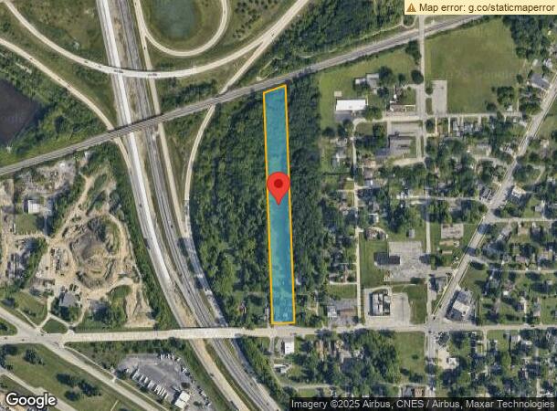
37590 W Huron River Dr, Romulus, MI 48174


NEARBY LISTINGS FOR SALE OR LEASE
Property Detail
37590 W Huron River Dr
Detroit-Warren-Dearborn, MI
Supervisors Romulus Plat No 9
80-073-01-0170-003
19A170A2 W 70FT OF N 180FT OF S 207FT LOT 170 (FROM ORIGINAL PLAT AS RECORDED IN 1941) SUPERVISORS ROMULUS PLAT NO 9 T3S R9E
Restaurantdrivein
Wayne
X
Michigan
26163C0358E
170
2025
0.29 AC
2025
Airport District
585900
Detroit
1,500 SF
DEMOGRAPHICS near 37590 W Huron River Dr
1 Mile
3 Mile
5 Mile
2024 Total Population
2,550
19,957
62,952
2029 Population
2,452
19,144
60,419
Pop Growth 2024-2029
(3.84%)
(4.07%)
(4.02%)
Average Age
44
40
40
2024 Total Households
1,082
8,256
25,693
HH Growth 2024-2029
(3.79%)
(4.13%)
(4.05%)
Median Household Inc
$66,282
$66,850
$65,165
Avg Household Size
2.30
2.40
2.40
2024 Avg HH Vehicles
2.00
2.00
2.00
Median Home Value
$172,602
$187,313
$184,526
Median Year Built
1961
1973
1974
Nearby Places
Map Layers
Map Styles
 Street
 Aerial
- Restaurants
- Banks
- Shops
- Fitness
- Groceries
PUBLIC TRANSPORTATION
AIRPORT
Detroit Metro Wayne County
DRIVE
WALK
Distance
Detroit Metro Wayne County
9 min
5.3 mi
Windsor International
DRIVE
WALK
Distance
Windsor International
52 min
33.1 mi
Freight Ports
Port of Toledo
DRIVE
WALK
Distance
Port of Toledo
61 min
47.2 mi
SALE & LEASE HISTORY
LISTING DATE
SALE/LEASE

Sep 23, 2016
For Sale
Sep 13, 2017
For Lease
Sep 03, 2019
For Lease
Sep 03, 2019
For Sale
Nearby Properties
Address
Land Use
TOTAL SIZE
Lot Size
Zoning
Address
Land Use
TOTAL SIZE
Lot Size
Zoning
739,289 SF
238.69 AC
AG
Address
Land Use
TOTAL SIZE
Lot Size
Zoning
500,240 SF
M1-LIG
Address
Land Use
TOTAL SIZE
Lot Size
Zoning
108,809 SF
AP-AIRPORT
Address
Land Use
TOTAL SIZE
Lot Size
Zoning
461,566 SF
50.13 AC
RM MULT
Address
Land Use
TOTAL SIZE
Lot Size
Zoning
146,562 SF
M2-GEN
Address
Land Use
TOTAL SIZE
Lot Size
Zoning
495,062 SF
52.40 AC
M1 LIG
Address
Land Use
TOTAL SIZE
Lot Size
Zoning
500,240 SF
55.95 AC
M2-GEN
Address
Land Use
TOTAL SIZE
Lot Size
Zoning
1,141,765 SF
154.21 AC
M2-GEN
Address
Land Use
TOTAL SIZE
Lot Size
Zoning
600,000 SF
M1-LIG
Address
Land Use
TOTAL SIZE
Lot Size
Zoning
393,948 SF
43.43 AC
M2-GEN
Address
Land Use
TOTAL SIZE
Lot Size
Zoning
354,968 SF
25.72 AC
RC/M-1
Address
Land Use
TOTAL SIZE
Lot Size
Zoning
435,648 SF
27.84 AC
M2-GEN
Address
Land Use
TOTAL SIZE
Lot Size
Zoning
366,820 SF
20.83 AC
RC/M-1
Address
Land Use
TOTAL SIZE
Lot Size
Zoning
366,820 SF
20.72 AC
RC/M-1
Address
Land Use
TOTAL SIZE
Lot Size
Zoning
268,272 SF
22.70 AC
M-1/COND
Address
Land Use
TOTAL SIZE
Lot Size
Zoning
1,071,200 SF
85.27 AC
M1 LIG
Address
Land Use
TOTAL SIZE
Lot Size
Zoning
199,922 SF
30.86 AC
M2-GEN
Address
Land Use
TOTAL SIZE
Lot Size
Zoning
920,139 SF
56.56 AC
M2-GEN
Address
Land Use
TOTAL SIZE
Lot Size
Zoning
250,263 SF
18.81 AC
RM-MLTI
Address
Land Use
TOTAL SIZE
Lot Size
Zoning
285,080 SF
21.89 AC
M2-GEN
Address
Land Use
TOTAL SIZE
Lot Size
Zoning
244,760 SF
22.63 AC
M-1/COND
Address
Land Use
TOTAL SIZE
Lot Size
Zoning
240,355 SF
26.05 AC
M2-GEN
Address
Land Use
TOTAL SIZE
Lot Size
Zoning
462,840 SF
45.66 AC
PDA
Address
Land Use
TOTAL SIZE
Lot Size
Zoning
5,382 SF
109.33 AC
RMH-MOB
Address
Land Use
TOTAL SIZE
Lot Size
Zoning
1,619,168 SF
150.49 AC
M2-GEN
Address
Land Use
TOTAL SIZE
Lot Size
Zoning
437,836 SF
28.75 AC
M1 LIG
Address
Land Use
TOTAL SIZE
Lot Size
Zoning
249,090 SF
27.15 AC
M1-LIG
Address
Land Use
TOTAL SIZE
Lot Size
Zoning
161,794 SF
17.73 AC
RM MULT
Address
Land Use
TOTAL SIZE
Lot Size
Zoning
87,000 SF
18.02 AC
Address
Land Use
TOTAL SIZE
Lot Size
Zoning
25,002 SF
7.91 AC
C1 GEN
The World's #1 Commercial Real Estate Marketplace
Connect with us
© 2026 CoStar Group
The information above has been obtained from sources believed reliable. While we do not doubt its accuracy we have not verified it and make no guarantee, warranty or representation about it. It is your responsibility to independently confirm its accuracy and completeness. Any projections, opinions, assumptions, or estimates used are for example only and do not represent the current or future performance of the property. The value of this transaction to you depends on tax and other factors which should be evaluated by your tax, financial, and legal advisors. You and your advisors should conduct a careful, independent investigation of the property to determine to your satisfaction the suitability of the property for your needs.