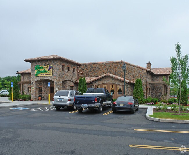
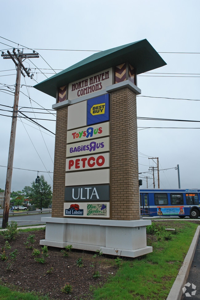
Property Record
300 Universal Dr N, North Haven, CT 06473
NEARBY LISTINGS FOR SALE OR LEASE
Property Detail
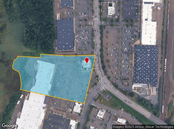
300 Universal Dr N
NRHV-000021-000000-000009
New Haven
Commercialnec
Connecticut
AE
9
09009C0451K
27.36 AC
2024
North Haven
2025
Westchester/So Connecticut
167201
New Haven, CT
DEMOGRAPHICS near 300 Universal Dr N
1 Mile
3 Mile
5 Mile
2024 Total Population
1,998
64,178
203,304
2029 Population
1,994
64,171
202,265
Pop Growth 2024-2029
(0.20%)
(0.01%)
(0.51%)
Average Age
44
43
38
2024 Total Households
752
27,763
80,203
HH Growth 2024-2029
(0.13%)
+ 0.12%
(0.45%)
Median Household Inc
$97,205
$74,836
$66,162
Avg Household Size
2.50
2.30
2.30
2024 Avg HH Vehicles
2.00
2.00
1.00
Median Home Value
$278,217
$275,804
$270,014
Median Year Built
1956
1965
1961
Nearby Places
Map Layers
Map Styles
 Street
 Aerial
- Restaurants
- Banks
- Shops
- Fitness
- Groceries
PUBLIC TRANSPORTATION
COMMUTER RAIL
New Haven-State Street Station (New Haven Line - Metro-North Commuter Railroad Company (Metro-North))
DRIVE
WALK
Distance
New Haven-State Street Station (New Haven Line - Metro-North Commuter Railroad Company (Metro-North))
9 min
5.1 mi
DRIVE
WALK
Distance
10 min
5.7 mi
AIRPORT
Tweed/New Haven
DRIVE
WALK
Distance
Tweed/New Haven
17 min
8.2 mi
Freight Ports
Port of New Haven
DRIVE
WALK
Distance
Port of New Haven
12 min
5.9 mi
Nearby Properties
Address
Land Use
TOTAL SIZE
Lot Size
Zoning
Address
Land Use
TOTAL SIZE
Lot Size
Zoning
268,989 SF
22.59 AC
R20
Address
Land Use
TOTAL SIZE
Lot Size
Zoning
5.14 AC
H/C
Address
Land Use
TOTAL SIZE
Lot Size
Zoning
258,313 SF
23.50 AC
PDU 34
Address
Land Use
TOTAL SIZE
Lot Size
Zoning
0.01 AC
T5
Address
Land Use
TOTAL SIZE
Lot Size
Zoning
54 AC
R-3
Address
Land Use
TOTAL SIZE
Lot Size
Zoning
296,444 SF
23.30 AC
T145
Address
Land Use
TOTAL SIZE
Lot Size
Zoning
72,007 SF
1.79 AC
RS2
Address
Land Use
TOTAL SIZE
Lot Size
Zoning
66.68 AC
IG80
Address
Land Use
TOTAL SIZE
Lot Size
Zoning
14.84 AC
T4
Address
Land Use
TOTAL SIZE
Lot Size
Zoning
30.46 AC
T5
Address
Land Use
TOTAL SIZE
Lot Size
Zoning
60,374 SF
10.85 AC
T2
Address
Land Use
TOTAL SIZE
Lot Size
Zoning
143,428 SF
13.08 AC
T4
Address
Land Use
TOTAL SIZE
Lot Size
Zoning
126,430 SF
10.63 AC
RM1
Address
Land Use
TOTAL SIZE
Lot Size
Zoning
31.34 AC
IL30
Address
Land Use
TOTAL SIZE
Lot Size
Zoning
17.71 AC
IL80
Address
Land Use
TOTAL SIZE
Lot Size
Zoning
25,015 SF
28.30 AC
RS2
Address
Land Use
TOTAL SIZE
Lot Size
Zoning
57,467 SF
3.72 AC
T4
Address
Land Use
TOTAL SIZE
Lot Size
Zoning
134,029 SF
27.54 AC
R20
Address
Land Use
TOTAL SIZE
Lot Size
Zoning
97,057 SF
2.78 AC
RM2
Address
Land Use
TOTAL SIZE
Lot Size
Zoning
23.48 AC
T5
Address
Land Use
TOTAL SIZE
Lot Size
Zoning
97,898 SF
11.40 AC
R20
Address
Land Use
TOTAL SIZE
Lot Size
Zoning
10.77 AC
R5
Address
Land Use
TOTAL SIZE
Lot Size
Zoning
85,000 SF
14 AC
R4
Address
Land Use
TOTAL SIZE
Lot Size
Zoning
23.40 AC
IG80
Address
Land Use
TOTAL SIZE
Lot Size
Zoning
30,272 SF
19.60 AC
R5
Address
Land Use
TOTAL SIZE
Lot Size
Zoning
14,133 SF
2.58 AC
RH1/RS
Address
Land Use
TOTAL SIZE
Lot Size
Zoning
132,592 SF
4.61 AC
PDD 23
Address
Land Use
TOTAL SIZE
Lot Size
Zoning
8.61 AC
R5
Address
Land Use
TOTAL SIZE
Lot Size
Zoning
5,946 SF
0.09 AC
RM1
The World's #1 Commercial Real Estate Marketplace
Connect with us
© 2026 CoStar Group
The information above has been obtained from sources believed reliable. While we do not doubt its accuracy we have not verified it and make no guarantee, warranty or representation about it. It is your responsibility to independently confirm its accuracy and completeness. Any projections, opinions, assumptions, or estimates used are for example only and do not represent the current or future performance of the property. The value of this transaction to you depends on tax and other factors which should be evaluated by your tax, financial, and legal advisors. You and your advisors should conduct a careful, independent investigation of the property to determine to your satisfaction the suitability of the property for your needs.