Property Record
3761 Mcnutt Rd, Sunland Park, NM 88063
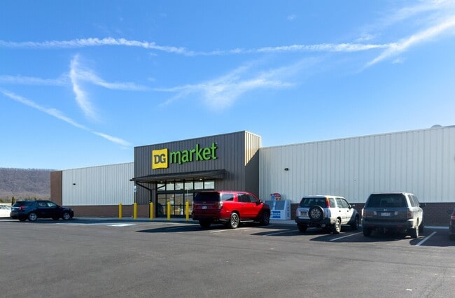


This Property Is For Sale
NEARBY LISTINGS FOR SALE OR LEASE
Property Detail
3761 Mcnutt Rd
Las Cruces, NM
Rio Vista Center Unit 2 Subdivision
16-02654
SUBD: RIO VISTA CENTER UNIT 2 SUBDIVISION (BK 18 PG 256-259 - 9510864) LOT: 8 BLOCK: 3 S: 1 T: 29S R: 3E
Commercialacreage
Dona Ana
X
New Mexico
35013C1925G
8
2024
1.65 AC
2025
Las Cruces/Alamogordo
001707
Other Market Areas
DEMOGRAPHICS near 3761 Mcnutt Rd
1 Mile
3 Mile
5 Mile
2024 Total Population
6,693
33,400
109,100
2029 Population
6,912
34,026
110,351
Pop Growth 2024-2029
+ 3.27%
+ 1.87%
+ 1.15%
Average Age
37
39
39
2024 Total Households
1,936
11,832
40,324
HH Growth 2024-2029
+ 3.20%
+ 1.85%
+ 1.12%
Median Household Inc
$49,923
$60,776
$68,503
Avg Household Size
3.30
2.80
2.70
2024 Avg HH Vehicles
2.00
2.00
2.00
Median Home Value
$148,392
$244,601
$256,935
Median Year Built
1994
1985
1987
Nearby Places
Map Layers
Map Styles
 Street
 Aerial
- Restaurants
- Banks
- Shops
- Fitness
- Groceries
PUBLIC TRANSPORTATION
AIRPORT
El Paso International
DRIVE
WALK
Distance
El Paso International
39 min
23.3 mi
Freight Ports
Port of Corpus Christi
DRIVE
WALK
Distance
Port of Corpus Christi
695 min
704.3 mi
Nearby Properties
Address
Land Use
TOTAL SIZE
Lot Size
Zoning
Address
Land Use
TOTAL SIZE
Lot Size
Zoning
248,997 SF
14.85 AC
C3S
Address
Land Use
TOTAL SIZE
Lot Size
Zoning
588,864 SF
27.37 AC
AO
Address
Land Use
TOTAL SIZE
Lot Size
Zoning
246,802 SF
11.08 AC
C3
Address
Land Use
TOTAL SIZE
Lot Size
Zoning
160,509 SF
8.85 AC
A2
Address
Land Use
TOTAL SIZE
Lot Size
Zoning
119,020 SF
8.56 AC
C3S
Address
Land Use
TOTAL SIZE
Lot Size
Zoning
142,567 SF
5.74 AC
A2S
Address
Land Use
TOTAL SIZE
Lot Size
Zoning
65,601 SF
15.64 AC
R2A
Address
Land Use
TOTAL SIZE
Lot Size
Zoning
119,191 SF
9.05 AC
C3
Address
Land Use
TOTAL SIZE
Lot Size
Zoning
143,731 SF
13.54 AC
C3
Address
Land Use
TOTAL SIZE
Lot Size
Zoning
102,088 SF
10.09 AC
C3
Address
Land Use
TOTAL SIZE
Lot Size
Zoning
68,759 SF
2.35 AC
C3S
Address
Land Use
TOTAL SIZE
Lot Size
Zoning
66,535 SF
12.14 AC
C3S
Address
Land Use
TOTAL SIZE
Lot Size
Zoning
158,188 SF
36.93 AC
R2
Address
Land Use
TOTAL SIZE
Lot Size
Zoning
179,196 SF
9.15 AC
AO
Address
Land Use
TOTAL SIZE
Lot Size
Zoning
80,011 SF
6.56 AC
C3
Address
Land Use
TOTAL SIZE
Lot Size
Zoning
207,123 SF
9.96 AC
A2S
Address
Land Use
TOTAL SIZE
Lot Size
Zoning
177,228 SF
145.21 AC
H_1
Address
Land Use
TOTAL SIZE
Lot Size
Zoning
62,806 SF
6.75 AC
C4S
Address
Land Use
TOTAL SIZE
Lot Size
Zoning
52,204 SF
3.35 AC
C3S
Address
Land Use
TOTAL SIZE
Lot Size
Zoning
101,376 SF
4.81 AC
A2S
Address
Land Use
TOTAL SIZE
Lot Size
Zoning
123,462 SF
11.39 AC
C4S
Address
Land Use
TOTAL SIZE
Lot Size
Zoning
115,491 SF
4.70 AC
A2
Address
Land Use
TOTAL SIZE
Lot Size
Zoning
143,774 SF
10.24 AC
A2
Address
Land Use
TOTAL SIZE
Lot Size
Zoning
51,281 SF
3.91 AC
A2S
Address
Land Use
TOTAL SIZE
Lot Size
Zoning
42,207 SF
4.59 AC
C3C
Address
Land Use
TOTAL SIZE
Lot Size
Zoning
29,255 SF
4.96 AC
A2C
Address
Land Use
TOTAL SIZE
Lot Size
Zoning
137,816 SF
10.12 AC
A2
Address
Land Use
TOTAL SIZE
Lot Size
Zoning
62,797 SF
111.33 AC
R1
Address
Land Use
TOTAL SIZE
Lot Size
Zoning
51,042 SF
4.59 AC
C3
Address
Land Use
TOTAL SIZE
Lot Size
Zoning
40,296 SF
4.37 AC
C3
The World's #1 Commercial Real Estate Marketplace
Connect with us
© 2026 CoStar Group
The information above has been obtained from sources believed reliable. While we do not doubt its accuracy we have not verified it and make no guarantee, warranty or representation about it. It is your responsibility to independently confirm its accuracy and completeness. Any projections, opinions, assumptions, or estimates used are for example only and do not represent the current or future performance of the property. The value of this transaction to you depends on tax and other factors which should be evaluated by your tax, financial, and legal advisors. You and your advisors should conduct a careful, independent investigation of the property to determine to your satisfaction the suitability of the property for your needs.