Property Record
3763 Old Us Highway 52, Lexington, NC 27295

NEARBY LISTINGS FOR SALE OR LEASE
Property Detail
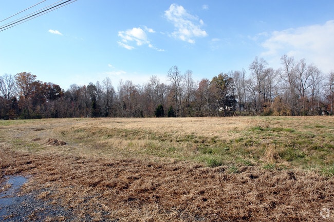
3763 Old Us Highway 52
11-317-0-000-0002-A-0-0
PB40-100 L2A BK2515-656 US 52
Vacantlandnec
Davidson
X
North Carolina
3710673700J
4.19 AC
2025
South Davidson County
2025
Greensboro/Winston-Salem
060400
Winston-Salem, NC
DEMOGRAPHICS near 3763 Old Us Highway 52
1 Mile
3 Mile
5 Mile
2024 Total Population
1,122
12,701
35,230
2029 Population
1,178
13,405
37,285
Pop Growth 2024-2029
+ 4.99%
+ 5.54%
+ 5.83%
Average Age
41
41
41
2024 Total Households
454
5,131
14,118
HH Growth 2024-2029
+ 4.85%
+ 5.44%
+ 5.75%
Median Household Inc
$62,419
$42,435
$41,900
Avg Household Size
2.40
2.40
2.40
2024 Avg HH Vehicles
2.00
2.00
2.00
Median Home Value
$148,104
$156,007
$158,314
Median Year Built
1974
1981
1978
Nearby Places
Map Layers
Map Styles
 Street
 Aerial
- Restaurants
- Banks
- Shops
- Fitness
- Groceries
PUBLIC TRANSPORTATION
AIRPORT
Piedmont Triad International
DRIVE
WALK
Distance
Piedmont Triad International
46 min
34.2 mi
Freight Ports
Port of Wilmington
DRIVE
WALK
Distance
Port of Wilmington
262 min
216.3 mi
Nearby Properties
Address
Land Use
TOTAL SIZE
Lot Size
Zoning
Address
Land Use
TOTAL SIZE
Lot Size
Zoning
32,834 SF
30 AC
RA3
Address
Land Use
TOTAL SIZE
Lot Size
Zoning
33,761 SF
9.48 AC
HC
Address
Land Use
TOTAL SIZE
Lot Size
Zoning
115,748 SF
8.14 AC
B
Address
Land Use
TOTAL SIZE
Lot Size
Zoning
10,248 SF
9 AC
OI
Address
Land Use
TOTAL SIZE
Lot Size
Zoning
8,586 SF
5.15 AC
LI
Address
Land Use
TOTAL SIZE
Lot Size
Zoning
48,362 SF
5.26 AC
HC
Address
Land Use
TOTAL SIZE
Lot Size
Zoning
90,496 SF
10.99 AC
LI
Address
Land Use
TOTAL SIZE
Lot Size
Zoning
9,054 SF
24.77 AC
TN
Address
Land Use
TOTAL SIZE
Lot Size
Zoning
147,689 SF
29.23 AC
OI
Address
Land Use
TOTAL SIZE
Lot Size
Zoning
35,396 SF
10.31 AC
I
Address
Land Use
TOTAL SIZE
Lot Size
Zoning
9,248 SF
14.71 AC
RM2
Address
Land Use
TOTAL SIZE
Lot Size
Zoning
22,415 SF
5 AC
B
Address
Land Use
TOTAL SIZE
Lot Size
Zoning
219.34 AC
HI
Address
Land Use
TOTAL SIZE
Lot Size
Zoning
29,406 SF
5.70 AC
RS
Address
Land Use
TOTAL SIZE
Lot Size
Zoning
6,000 SF
1.17 AC
LI
Address
Land Use
TOTAL SIZE
Lot Size
Zoning
27,736 SF
2.84 AC
OI
Address
Land Use
TOTAL SIZE
Lot Size
Zoning
9,949 SF
7.37 AC
B
Address
Land Use
TOTAL SIZE
Lot Size
Zoning
51,836 SF
3.96 AC
LI
Address
Land Use
TOTAL SIZE
Lot Size
Zoning
26,908 SF
11.79 AC
RA3
Address
Land Use
TOTAL SIZE
Lot Size
Zoning
64,333 SF
10 AC
LI
Address
Land Use
TOTAL SIZE
Lot Size
Zoning
23,093 SF
9.68 AC
RA3
Address
Land Use
TOTAL SIZE
Lot Size
Zoning
12,959 SF
RC
Address
Land Use
TOTAL SIZE
Lot Size
Zoning
34,038 SF
7.81 AC
LI
Address
Land Use
TOTAL SIZE
Lot Size
Zoning
67,170 SF
6.22 AC
B
Address
Land Use
TOTAL SIZE
Lot Size
Zoning
44,050 SF
3.53 AC
LI
Address
Land Use
TOTAL SIZE
Lot Size
Zoning
37,293 SF
8.91 AC
RS
Address
Land Use
TOTAL SIZE
Lot Size
Zoning
7,824 SF
1.29 AC
HC
Address
Land Use
TOTAL SIZE
Lot Size
Zoning
53,143 SF
11.50 AC
TN
Address
Land Use
TOTAL SIZE
Lot Size
Zoning
21,082 SF
7.65 AC
OI
Address
Land Use
TOTAL SIZE
Lot Size
Zoning
20,800 SF
28.54 AC
HI
The World's #1 Commercial Real Estate Marketplace
Connect with us
© 2025 CoStar Group
The information above has been obtained from sources believed reliable. While we do not doubt its accuracy we have not verified it and make no guarantee, warranty or representation about it. It is your responsibility to independently confirm its accuracy and completeness. Any projections, opinions, assumptions, or estimates used are for example only and do not represent the current or future performance of the property. The value of this transaction to you depends on tax and other factors which should be evaluated by your tax, financial, and legal advisors. You and your advisors should conduct a careful, independent investigation of the property to determine to your satisfaction the suitability of the property for your needs.