Property Record
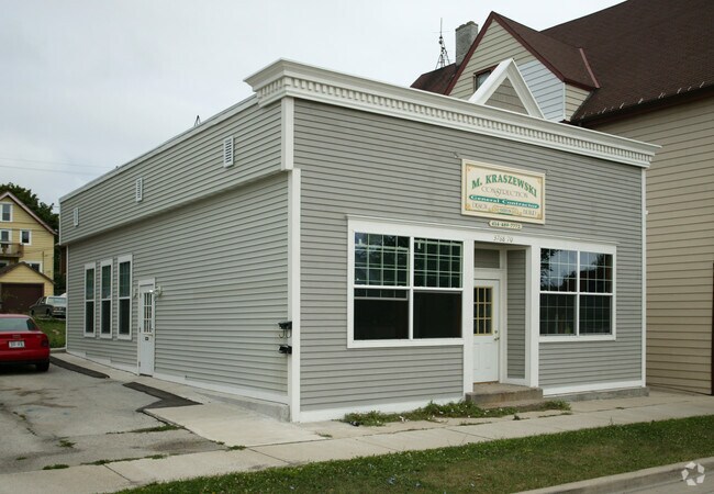
3768 E Layton Ave, Cudahy, WI 53110


Save to a Folder
{{folder.Name}}
{{folder.ListingIds.length}} Properties
{{folder.ListingIds.length}} Property
Create a New Folder
Property Detail
3768 E Layton Ave
589-0605-001
TOWNSIT OF CUDAHY LOTS 35, 36 & 37 BLK 25
Commercialnec
Milwaukee
B-1
Wisconsin
B and X Area of moderate flood hazard, usually the area between the limits of the 100-year and 500-year floods.
35-37
2024
0.25 AC
2025
Milwaukee SE
180200
Milwaukee/Madison
2,372 SF
Milwaukee-Waukesha, WI
NEARBY LISTINGS FOR SALE OR LEASE
DEMOGRAPHICS near 3768 E Layton Ave
1 mile
3 mile
5 mile
2025 Total Population
11,245
48,700
137,204
2030 Population
11,010
47,921
134,390
Pop Growth 2025-2030
(2.09%)
(1.60%)
(2.05%)
Average Age
42
42
39
2025 Total Households
5,305
22,774
57,537
HH Growth 2025-2030
(1.94%)
(1.63%)
(2.00%)
Median Household Inc
$65,165
$74,442
$70,526
Avg Household Size
2.10
2.10
2.30
2025 Avg HH Vehicles
2.00
2.00
2.00
Median Home Value
$229,238
$236,651
$226,620
Median Year Built
1955
1954
1954
Nearby Places
Map Layers
Map Styles
 Street
 Aerial
Layers
 Traffic
 Biking
Places
Listings with unknown addresses are not visible on the map
- Restaurants
- Banks
- Shops
- Fitness
- Groceries
PUBLIC TRANSPORTATION
COMMUTER RAIL
General Mitchell Intl. Airport Amtrak Station (Hiawatha Service - Amtrak)
Drive
Walk
Distance
General Mitchell Intl. Airport Amtrak Station (Hiawatha Service - Amtrak)
12 min
4.5 mi
Milwaukee (Empire Builder - Amtrak)
Drive
Walk
Distance
Milwaukee (Empire Builder - Amtrak)
14 min
7.3 mi
AIRPORT
General Mitchell International
Drive
Walk
Distance
General Mitchell International
10 min
3.9 mi
Freight Ports
Port Milwaukee
Drive
Walk
Distance
Port Milwaukee
11 min
4.4 mi
Nearby Properties
Address
Land Use
TOTAL SIZE
Lot Size
Zoning
Address
Land Use
TOTAL SIZE
Lot Size
Zoning
Address
Land Use
TOTAL SIZE
Lot Size
Zoning
11.09 AC
Address
Land Use
TOTAL SIZE
Lot Size
Zoning
0.43 AC
RT3
Address
Land Use
TOTAL SIZE
Lot Size
Zoning
Address
Land Use
TOTAL SIZE
Lot Size
Zoning
378,000 SF
19.24 AC
M-1PUD
Address
Land Use
TOTAL SIZE
Lot Size
Zoning
94.05 AC
PK
Address
Land Use
TOTAL SIZE
Lot Size
Zoning
216,281 SF
5.99 AC
RESIDENTIA
Address
Land Use
TOTAL SIZE
Lot Size
Zoning
Address
Land Use
TOTAL SIZE
Lot Size
Zoning
Address
Land Use
TOTAL SIZE
Lot Size
Zoning
Address
Land Use
TOTAL SIZE
Lot Size
Zoning
153,300 SF
7.39 AC
M-1PUD
Address
Land Use
TOTAL SIZE
Lot Size
Zoning
Address
Land Use
TOTAL SIZE
Lot Size
Zoning
Address
Land Use
TOTAL SIZE
Lot Size
Zoning
Address
Land Use
TOTAL SIZE
Lot Size
Zoning
149,489 SF
7.43 AC
M-1PUD
Address
Land Use
TOTAL SIZE
Lot Size
Zoning
142,210 SF
14.70 AC
M-1PUD
Address
Land Use
TOTAL SIZE
Lot Size
Zoning
153,000 SF
8.22 AC
M-1PUD
Address
Land Use
TOTAL SIZE
Lot Size
Zoning
87,963 SF
3.10 AC
RM2
Address
Land Use
TOTAL SIZE
Lot Size
Zoning
36.60 AC
Address
Land Use
TOTAL SIZE
Lot Size
Zoning
169,128 SF
8.92 AC
M-1PUD
Address
Land Use
TOTAL SIZE
Lot Size
Zoning
405,764 SF
12.70 AC
M-2
Address
Land Use
TOTAL SIZE
Lot Size
Zoning
Address
Land Use
TOTAL SIZE
Lot Size
Zoning
126,791 SF
8.81 AC
RESIDENTIA
Address
Land Use
TOTAL SIZE
Lot Size
Zoning
118,320 SF
6.29 AC
M-1PUD
Address
Land Use
TOTAL SIZE
Lot Size
Zoning
Address
Land Use
TOTAL SIZE
Lot Size
Zoning
96,096 SF
5.34 AC
RESIDENTIA
Address
Land Use
TOTAL SIZE
Lot Size
Zoning
131,902 SF
5.69 AC
LB1
Address
Land Use
TOTAL SIZE
Lot Size
Zoning
84,345 SF
2.30 AC
RM4
Address
Land Use
TOTAL SIZE
Lot Size
Zoning
126,359 SF
4.93 AC
LB1
Address
Land Use
TOTAL SIZE
Lot Size
Zoning
The World's #1 Commercial Real Estate Marketplace
Connect with us
© 2026 CoStar Group
The information above has been obtained from sources believed reliable. While we do not doubt its accuracy we have not verified it and make no guarantee, warranty or representation about it. It is your responsibility to independently confirm its accuracy and completeness. Any projections, opinions, assumptions, or estimates used are for example only and do not represent the current or future performance of the property. The value of this transaction to you depends on tax and other factors which should be evaluated by your tax, financial, and legal advisors. You and your advisors should conduct a careful, independent investigation of the property to determine to your satisfaction the suitability of the property for your needs.