Property Record
377 Big Station Camp Blvd, Gallatin, TN 37066


NEARBY LISTINGS FOR SALE OR LEASE
Property Detail
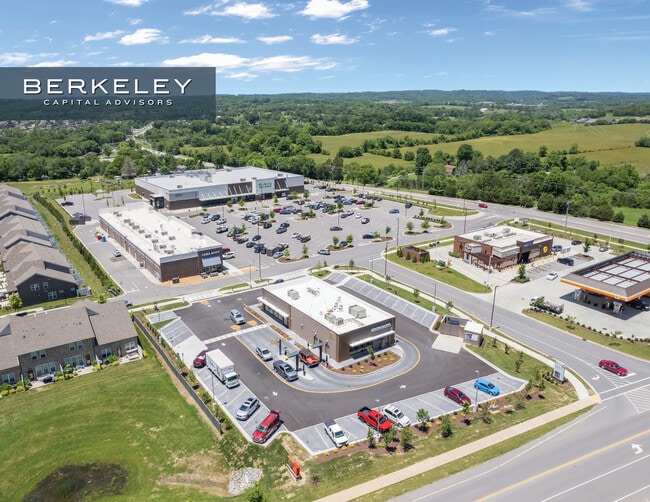
377 Big Station Camp Blvd
Nashville-Davidson--Murfreesboro--Franklin, TN
Newmans Crossing
083124 12100
PB32 PG317 LT3
Restaurantdrivein
Sumner
X
Tennessee
47165C0314G
3
2024
1.16 AC
2025
Hendersonville-Gallatin
020905
Nashville
4,780 SF
DEMOGRAPHICS near 377 Big Station Camp Blvd
1 Mile
3 Mile
5 Mile
2024 Total Population
3,662
22,994
63,197
2029 Population
4,101
26,447
71,657
Pop Growth 2024-2029
+ 11.99%
+ 15.02%
+ 13.39%
Average Age
37
38
41
2024 Total Households
1,263
8,542
23,924
HH Growth 2024-2029
+ 12.91%
+ 15.54%
+ 13.63%
Median Household Inc
$112,697
$101,021
$90,044
Avg Household Size
2.90
2.70
2.60
2024 Avg HH Vehicles
2.00
2.00
2.00
Median Home Value
$389,663
$418,771
$411,764
Median Year Built
2009
2010
2005
Nearby Places
Map Layers
Map Styles
 Street
 Aerial
- Restaurants
- Banks
- Shops
- Fitness
- Groceries
PUBLIC TRANSPORTATION
AIRPORT
Nashville International
DRIVE
WALK
Distance
Nashville International
41 min
33.4 mi
SALE & LEASE HISTORY
LISTING DATE
SALE/LEASE

Jun 18, 2024
For Sale
Nearby Properties
Address
Land Use
TOTAL SIZE
Lot Size
Zoning
Address
Land Use
TOTAL SIZE
Lot Size
Zoning
47,729 SF
28.52 AC
Address
Land Use
TOTAL SIZE
Lot Size
Zoning
58,184 SF
26.27 AC
Address
Land Use
TOTAL SIZE
Lot Size
Zoning
10,208 SF
29.53 AC
ESTATEA
Address
Land Use
TOTAL SIZE
Lot Size
Zoning
27,317 SF
22.74 AC
Address
Land Use
TOTAL SIZE
Lot Size
Zoning
30,149 SF
21.02 AC
Address
Land Use
TOTAL SIZE
Lot Size
Zoning
29,438 SF
6.53 AC
Address
Land Use
TOTAL SIZE
Lot Size
Zoning
29,160 SF
20.02 AC
Address
Land Use
TOTAL SIZE
Lot Size
Zoning
18,734 SF
12.33 AC
MU
Address
Land Use
TOTAL SIZE
Lot Size
Zoning
81,584 SF
5.99 AC
Address
Land Use
TOTAL SIZE
Lot Size
Zoning
15,189 SF
7.84 AC
Address
Land Use
TOTAL SIZE
Lot Size
Zoning
21,126 SF
7.67 AC
Address
Land Use
TOTAL SIZE
Lot Size
Zoning
Address
Land Use
TOTAL SIZE
Lot Size
Zoning
131,339 SF
18.22 AC
Address
Land Use
TOTAL SIZE
Lot Size
Zoning
99,333 SF
1.73 AC
ESTATEA
Address
Land Use
TOTAL SIZE
Lot Size
Zoning
50,964 SF
8.05 AC
Address
Land Use
TOTAL SIZE
Lot Size
Zoning
38,274 SF
9.27 AC
CPUD
Address
Land Use
TOTAL SIZE
Lot Size
Zoning
34,548 SF
5.11 AC
MU
Address
Land Use
TOTAL SIZE
Lot Size
Zoning
12,040 SF
4.02 AC
CPUD
Address
Land Use
TOTAL SIZE
Lot Size
Zoning
62,855 SF
3.46 AC
PGC
Address
Land Use
TOTAL SIZE
Lot Size
Zoning
5,138 SF
2.08 AC
Address
Land Use
TOTAL SIZE
Lot Size
Zoning
27,520 SF
1.31 AC
CPUD
Address
Land Use
TOTAL SIZE
Lot Size
Zoning
51,400 SF
2.80 AC
Address
Land Use
TOTAL SIZE
Lot Size
Zoning
8.94 AC
CPUD
Address
Land Use
TOTAL SIZE
Lot Size
Zoning
9,920 SF
4 AC
Address
Land Use
TOTAL SIZE
Lot Size
Zoning
9,569 SF
1.80 AC
Address
Land Use
TOTAL SIZE
Lot Size
Zoning
6,000 SF
10.11 AC
Address
Land Use
TOTAL SIZE
Lot Size
Zoning
12,538 SF
1.50 AC
PGC
Address
Land Use
TOTAL SIZE
Lot Size
Zoning
15,777 SF
89.10 AC
Address
Land Use
TOTAL SIZE
Lot Size
Zoning
13,249 SF
1.88 AC
PGC
Address
Land Use
TOTAL SIZE
Lot Size
Zoning
14.14 AC
PGC
The World's #1 Commercial Real Estate Marketplace
Connect with us
© 2026 CoStar Group
The information above has been obtained from sources believed reliable. While we do not doubt its accuracy we have not verified it and make no guarantee, warranty or representation about it. It is your responsibility to independently confirm its accuracy and completeness. Any projections, opinions, assumptions, or estimates used are for example only and do not represent the current or future performance of the property. The value of this transaction to you depends on tax and other factors which should be evaluated by your tax, financial, and legal advisors. You and your advisors should conduct a careful, independent investigation of the property to determine to your satisfaction the suitability of the property for your needs.