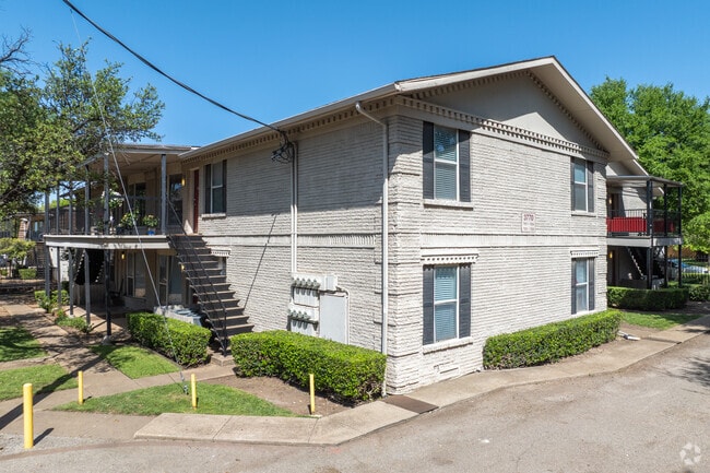
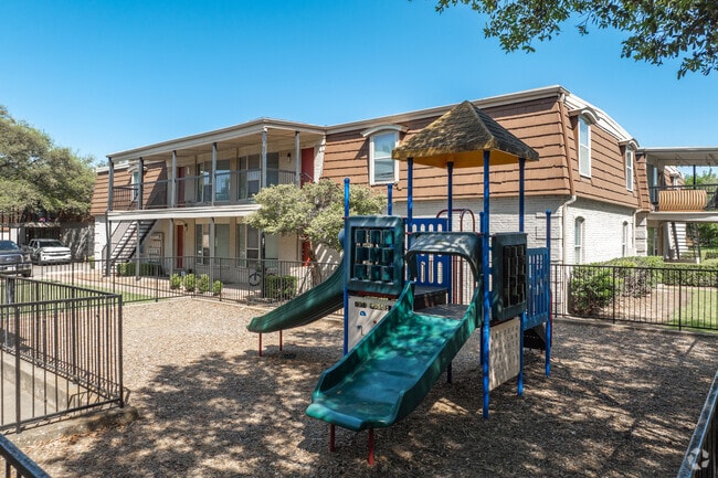
Property Record
3770 High Vista Dr, Dallas, TX 75244
NEARBY LISTINGS FOR SALE OR LEASE
Property Detail
3770 High Vista Dr
Dallas-Fort Worth-Arlington, TX
Forest Hills Garden
00000582646000000
FOREST HILLS GARDEN BLK A/6406 LT 3 INT201500314849 DD11012015 CO-DC 6406 00A 00300 1DA6406 00A
Apartment
Dallas
X
Texas
48113C0190K
3
2024
2.64 AC
2025
Northwest Dallas
009608
Dallas/Ft Worth
61,892 SF
DEMOGRAPHICS near 3770 High Vista Dr
1 Mile
3 Mile
5 Mile
2024 Total Population
12,840
118,608
290,956
2029 Population
12,653
118,659
291,157
Pop Growth 2024-2029
(1.46%)
+ 0.04%
+ 0.07%
Average Age
41
38
38
2024 Total Households
4,647
46,670
123,646
HH Growth 2024-2029
(1.74%)
+ 0.08%
+ 0.07%
Median Household Inc
$111,602
$80,159
$75,358
Avg Household Size
2.70
2.50
2.30
2024 Avg HH Vehicles
2.00
2.00
2.00
Median Home Value
$422,275
$403,728
$435,096
Median Year Built
1966
1974
1980
Nearby Places
Map Layers
Map Styles
 Street
 Aerial
- Restaurants
- Banks
- Shops
- Fitness
- Groceries
PUBLIC TRANSPORTATION
COMMUTER RAIL
Trinity Mills Station (Green Line - Dallas Area Rapid Transit (DART))
DRIVE
WALK
Distance
Trinity Mills Station (Green Line - Dallas Area Rapid Transit (DART))
12 min
8.7 mi
AIRPORT
Dallas Love Field
DRIVE
WALK
Distance
Dallas Love Field
16 min
7.4 mi
Dallas-Fort Worth International
DRIVE
WALK
Distance
Dallas-Fort Worth International
22 min
16.5 mi
Freight Ports
Port of Shreveport
DRIVE
WALK
Distance
Port of Shreveport
220 min
204.7 mi
Nearby Properties
Address
Land Use
TOTAL SIZE
Lot Size
Zoning
Address
Land Use
TOTAL SIZE
Lot Size
Zoning
3,240,143 SF
28.52 AC
Z151
Address
Land Use
TOTAL SIZE
Lot Size
Zoning
450,131 SF
39.95 AC
Z296
Address
Land Use
TOTAL SIZE
Lot Size
Zoning
1,009,256 SF
23.64 AC
Z239
Address
Land Use
TOTAL SIZE
Lot Size
Zoning
990,541 SF
3.87 AC
Z239
Address
Land Use
TOTAL SIZE
Lot Size
Zoning
1,406,300 SF
6.86 AC
Z236
Address
Land Use
TOTAL SIZE
Lot Size
Zoning
137,075 SF
84.16 AC
Z239
Address
Land Use
TOTAL SIZE
Lot Size
Zoning
370,858 SF
24.28 AC
Z239
Address
Land Use
TOTAL SIZE
Lot Size
Zoning
174,718 SF
186.51 AC
Address
Land Use
TOTAL SIZE
Lot Size
Zoning
493,925 SF
2.63 AC
Z239
Address
Land Use
TOTAL SIZE
Lot Size
Zoning
1,156,000 SF
4 AC
Z236
Address
Land Use
TOTAL SIZE
Lot Size
Zoning
597,347 SF
4.40 AC
Z09
Address
Land Use
TOTAL SIZE
Lot Size
Zoning
957,985 SF
1.97 AC
Z239
Address
Land Use
TOTAL SIZE
Lot Size
Zoning
458,855 SF
4.04 AC
Z236
Address
Land Use
TOTAL SIZE
Lot Size
Zoning
1,126,832 SF
3.64 AC
Z236
Address
Land Use
TOTAL SIZE
Lot Size
Zoning
113,688 SF
72.86 AC
Z274
Address
Land Use
TOTAL SIZE
Lot Size
Zoning
665,996 SF
5.60 AC
Z236
Address
Land Use
TOTAL SIZE
Lot Size
Zoning
647,590 SF
4.92 AC
Z123
Address
Land Use
TOTAL SIZE
Lot Size
Zoning
903,882 SF
2.24 AC
Z236
Address
Land Use
TOTAL SIZE
Lot Size
Zoning
284,890 SF
40.44 AC
Z274
Address
Land Use
TOTAL SIZE
Lot Size
Zoning
561,139 SF
3.64 AC
Z09
Address
Land Use
TOTAL SIZE
Lot Size
Zoning
490,795 SF
9.59 AC
Z118
Address
Land Use
TOTAL SIZE
Lot Size
Zoning
660,842 SF
4.82 AC
Z09
Address
Land Use
TOTAL SIZE
Lot Size
Zoning
184,670 SF
25.40 AC
Z292
Address
Land Use
TOTAL SIZE
Lot Size
Zoning
306,690 SF
13.64 AC
Z239
Address
Land Use
TOTAL SIZE
Lot Size
Zoning
584,128 SF
3.51 AC
Z241
Address
Land Use
TOTAL SIZE
Lot Size
Zoning
534,929 SF
4.19 AC
Z236
Address
Land Use
TOTAL SIZE
Lot Size
Zoning
558,655 SF
4.67 AC
Z236
Address
Land Use
TOTAL SIZE
Lot Size
Zoning
349,372 SF
1.31 AC
Z236
Address
Land Use
TOTAL SIZE
Lot Size
Zoning
273,427 SF
11.75 AC
Z236
Address
Land Use
TOTAL SIZE
Lot Size
Zoning
435,735 SF
3.20 AC
Z239
The World's #1 Commercial Real Estate Marketplace
Connect with us
© 2025 CoStar Group
The information above has been obtained from sources believed reliable. While we do not doubt its accuracy we have not verified it and make no guarantee, warranty or representation about it. It is your responsibility to independently confirm its accuracy and completeness. Any projections, opinions, assumptions, or estimates used are for example only and do not represent the current or future performance of the property. The value of this transaction to you depends on tax and other factors which should be evaluated by your tax, financial, and legal advisors. You and your advisors should conduct a careful, independent investigation of the property to determine to your satisfaction the suitability of the property for your needs.