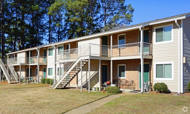
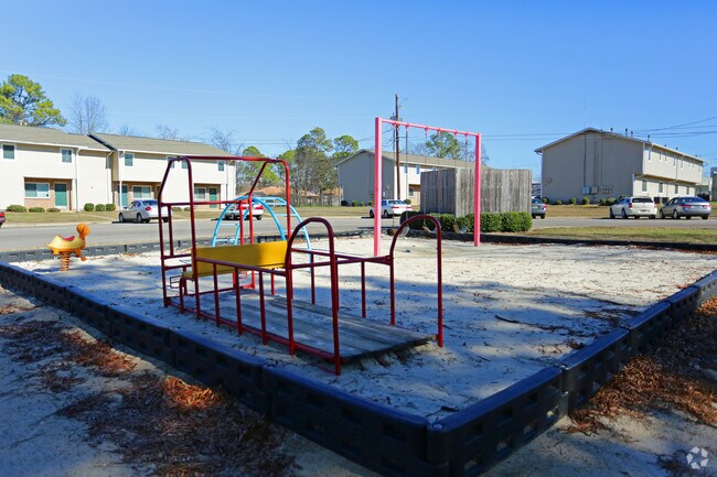
Property Record
3770 Norman Bridge Rd, Montgomery, AL 36105

NEARBY LISTINGS FOR SALE OR LEASE
Property Detail
3770 Norman Bridge Rd
Montgomery, AL
Normandale Apartments 1 Corr
10-09-30-3-008-046.000
1009303008046000
Realpropertynec
Montgomery
X
Alabama
01101C0208J
3
2025
9 AC
2025
Outer South/Airport
002201
Montgomery
2,605 SF
DEMOGRAPHICS near 3770 Norman Bridge Rd
1 Mile
3 Mile
5 Mile
2024 Total Population
9,159
53,864
112,769
2029 Population
9,097
53,609
111,371
Pop Growth 2024-2029
(0.68%)
(0.47%)
(1.24%)
Average Age
40
39
38
2024 Total Households
3,631
21,586
46,012
HH Growth 2024-2029
(0.69%)
(0.27%)
(1.16%)
Median Household Inc
$34,057
$37,164
$36,697
Avg Household Size
2.50
2.30
2.30
2024 Avg HH Vehicles
2.00
2.00
2.00
Median Home Value
$68,224
$102,244
$108,720
Median Year Built
1958
1963
1970
Nearby Places
Map Layers
Map Styles
 Street
 Aerial
- Restaurants
- Banks
- Shops
- Fitness
- Groceries
PUBLIC TRANSPORTATION
AIRPORT
Montgomery Regional (Dannelly Field)
DRIVE
WALK
Distance
Montgomery Regional (Dannelly Field)
11 min
7.2 mi
Nearby Properties
Address
Land Use
TOTAL SIZE
Lot Size
Zoning
Address
Land Use
TOTAL SIZE
Lot Size
Zoning
260,402 SF
17 AC
O-2
Address
Land Use
TOTAL SIZE
Lot Size
Zoning
36,543 SF
0.62 AC
SD-M
Address
Land Use
TOTAL SIZE
Lot Size
Zoning
40,829 SF
50.49 AC
SD
Address
Land Use
TOTAL SIZE
Lot Size
Zoning
32,902 SF
14 AC
R-75-M
Address
Land Use
TOTAL SIZE
Lot Size
Zoning
8,519 SF
15.60 AC
B-2
Address
Land Use
TOTAL SIZE
Lot Size
Zoning
91,378 SF
2.46 AC
SD-M
Address
Land Use
TOTAL SIZE
Lot Size
Zoning
341,170 SF
O-2
Address
Land Use
TOTAL SIZE
Lot Size
Zoning
38,226 SF
5.77 AC
T5
Address
Land Use
TOTAL SIZE
Lot Size
Zoning
14,733 SF
19 AC
O-2
Address
Land Use
TOTAL SIZE
Lot Size
Zoning
249,231 SF
20 AC
INST
Address
Land Use
TOTAL SIZE
Lot Size
Zoning
135,573 SF
35 AC
O-2
Address
Land Use
TOTAL SIZE
Lot Size
Zoning
1,721 SF
12.02 AC
R-60-M
Address
Land Use
TOTAL SIZE
Lot Size
Zoning
1,904 SF
13 AC
R-75-S
Address
Land Use
TOTAL SIZE
Lot Size
Zoning
65,060 SF
2.16 AC
T4-R
Address
Land Use
TOTAL SIZE
Lot Size
Zoning
145,385 SF
3.31 AC
T4-0
Address
Land Use
TOTAL SIZE
Lot Size
Zoning
61,137 SF
59 AC
INST
Address
Land Use
TOTAL SIZE
Lot Size
Zoning
57,565 SF
1.50 AC
T4-R
Address
Land Use
TOTAL SIZE
Lot Size
Zoning
95,886 SF
3.19 AC
B-4
Address
Land Use
TOTAL SIZE
Lot Size
Zoning
54,384 SF
0.65 AC
Address
Land Use
TOTAL SIZE
Lot Size
Zoning
8,652 SF
5.28 AC
R-75-D
Address
Land Use
TOTAL SIZE
Lot Size
Zoning
154,202 SF
14.90 AC
B-4
Address
Land Use
TOTAL SIZE
Lot Size
Zoning
91,241 SF
9.10 AC
R-65-S
Address
Land Use
TOTAL SIZE
Lot Size
Zoning
88,234 SF
O-1
Address
Land Use
TOTAL SIZE
Lot Size
Zoning
65,357 SF
4.29 AC
R-65-M
Address
Land Use
TOTAL SIZE
Lot Size
Zoning
4.69 AC
R-75-S
Address
Land Use
TOTAL SIZE
Lot Size
Zoning
8,000 SF
20 AC
INST
Address
Land Use
TOTAL SIZE
Lot Size
Zoning
62,492 SF
2.60 AC
T4-0
Address
Land Use
TOTAL SIZE
Lot Size
Zoning
22,578 SF
20.49 AC
B-3
Address
Land Use
TOTAL SIZE
Lot Size
Zoning
0.85 AC
T4
Address
Land Use
TOTAL SIZE
Lot Size
Zoning
3,078 SF
11 AC
R-60-S
The World's #1 Commercial Real Estate Marketplace
Connect with us
© 2026 CoStar Group
The information above has been obtained from sources believed reliable. While we do not doubt its accuracy we have not verified it and make no guarantee, warranty or representation about it. It is your responsibility to independently confirm its accuracy and completeness. Any projections, opinions, assumptions, or estimates used are for example only and do not represent the current or future performance of the property. The value of this transaction to you depends on tax and other factors which should be evaluated by your tax, financial, and legal advisors. You and your advisors should conduct a careful, independent investigation of the property to determine to your satisfaction the suitability of the property for your needs.