Property Record
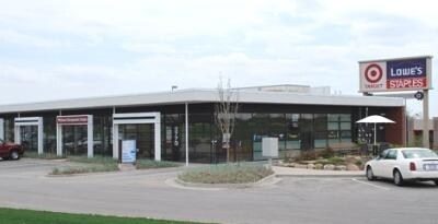
3770 8Th St Sw, Altoona, IA 50009


NEARBY LISTINGS FOR SALE OR LEASE
Property Detail
3770 8Th St Sw
Des Moines-West Des Moines, IA
Altoona Crossing Plat 3
171-00176008042
LOT 2 ALTOONA CROSSING PLAT 3
Regionalshoppingcenterormallwithanchorstore
Polk
X
Iowa
19153C0220F
2
2024
2.40 AC
2025
Northeast
010602
Des Moines
16,500 SF
DEMOGRAPHICS near 3770 8Th St Sw
1 Mile
3 Mile
5 Mile
2024 Total Population
5,445
41,010
83,519
2029 Population
5,835
42,891
87,250
Pop Growth 2024-2029
+ 7.16%
+ 4.59%
+ 4.47%
Average Age
39
39
39
2024 Total Households
2,144
16,033
31,782
HH Growth 2024-2029
+ 7.37%
+ 4.67%
+ 4.56%
Median Household Inc
$58,521
$72,171
$71,249
Avg Household Size
2.50
2.50
2.50
2024 Avg HH Vehicles
2.00
2.00
2.00
Median Home Value
$200,765
$212,568
$194,561
Median Year Built
2002
1992
1981
Nearby Places
Map Layers
Map Styles
 Street
 Aerial
- Restaurants
- Banks
- Shops
- Fitness
- Groceries
PUBLIC TRANSPORTATION
AIRPORT
Des Moines International
DRIVE
WALK
Distance
Des Moines International
28 min
13.6 mi
Freight Ports
Port Milwaukee
DRIVE
WALK
Distance
Port Milwaukee
406 min
365.1 mi
SALE & LEASE HISTORY
LISTING DATE
SALE/LEASE

Oct 11, 2019
For Lease
Jan 12, 2017
For Lease
Nearby Properties
Address
Land Use
TOTAL SIZE
Lot Size
Zoning
Address
Land Use
TOTAL SIZE
Lot Size
Zoning
1,232,488 SF
184.19 AC
Address
Land Use
TOTAL SIZE
Lot Size
Zoning
1,089,208 SF
145.90 AC
Address
Land Use
TOTAL SIZE
Lot Size
Zoning
1,018,608 SF
190.56 AC
Address
Land Use
TOTAL SIZE
Lot Size
Zoning
549,615 SF
149.20 AC
C6
Address
Land Use
TOTAL SIZE
Lot Size
Zoning
497,587 SF
31.46 AC
Address
Land Use
TOTAL SIZE
Lot Size
Zoning
459,000 SF
19.69 AC
Address
Land Use
TOTAL SIZE
Lot Size
Zoning
350,879 SF
16.14 AC
Address
Land Use
TOTAL SIZE
Lot Size
Zoning
397,563 SF
18.25 AC
Address
Land Use
TOTAL SIZE
Lot Size
Zoning
333,079 SF
34.07 AC
Address
Land Use
TOTAL SIZE
Lot Size
Zoning
146,138 SF
22.78 AC
C-3
Address
Land Use
TOTAL SIZE
Lot Size
Zoning
327,600 SF
16.57 AC
Address
Land Use
TOTAL SIZE
Lot Size
Zoning
212,388 SF
40.63 AC
Address
Land Use
TOTAL SIZE
Lot Size
Zoning
359,441 SF
173.80 AC
C6
Address
Land Use
TOTAL SIZE
Lot Size
Zoning
259,056 SF
16.31 AC
Address
Land Use
TOTAL SIZE
Lot Size
Zoning
302,604 SF
16.46 AC
Address
Land Use
TOTAL SIZE
Lot Size
Zoning
265,726 SF
14.76 AC
Address
Land Use
TOTAL SIZE
Lot Size
Zoning
312,500 SF
38.14 AC
Address
Land Use
TOTAL SIZE
Lot Size
Zoning
300,000 SF
18.95 AC
Address
Land Use
TOTAL SIZE
Lot Size
Zoning
300,000 SF
20.09 AC
Address
Land Use
TOTAL SIZE
Lot Size
Zoning
320,429 SF
22.34 AC
R3
Address
Land Use
TOTAL SIZE
Lot Size
Zoning
270,000 SF
18.35 AC
Address
Land Use
TOTAL SIZE
Lot Size
Zoning
270,000 SF
14.55 AC
Address
Land Use
TOTAL SIZE
Lot Size
Zoning
142,032 SF
10 AC
Address
Land Use
TOTAL SIZE
Lot Size
Zoning
195,500 SF
15.03 AC
Address
Land Use
TOTAL SIZE
Lot Size
Zoning
195,500 SF
8.09 AC
Address
Land Use
TOTAL SIZE
Lot Size
Zoning
167,308 SF
16.46 AC
Address
Land Use
TOTAL SIZE
Lot Size
Zoning
205,728 SF
21.74 AC
Address
Land Use
TOTAL SIZE
Lot Size
Zoning
135,824 SF
13.22 AC
Address
Land Use
TOTAL SIZE
Lot Size
Zoning
155,276 SF
6.66 AC
R-4
Address
Land Use
TOTAL SIZE
Lot Size
Zoning
183,595 SF
19.31 AC
C-2
The World's #1 Commercial Real Estate Marketplace
Connect with us
© 2025 CoStar Group
The information above has been obtained from sources believed reliable. While we do not doubt its accuracy we have not verified it and make no guarantee, warranty or representation about it. It is your responsibility to independently confirm its accuracy and completeness. Any projections, opinions, assumptions, or estimates used are for example only and do not represent the current or future performance of the property. The value of this transaction to you depends on tax and other factors which should be evaluated by your tax, financial, and legal advisors. You and your advisors should conduct a careful, independent investigation of the property to determine to your satisfaction the suitability of the property for your needs.