Property Record
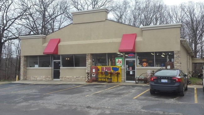
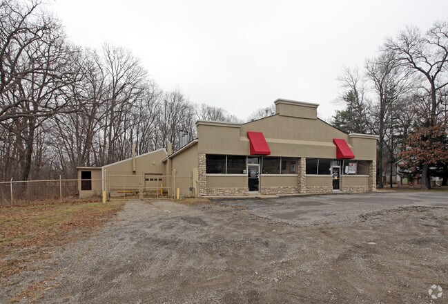
3779 S Ortonville Rd, Clarkston, MI 48348

NEARBY LISTINGS FOR SALE OR LEASE
Property Detail
3779 S Ortonville Rd
03-32-400-055
Supervisors Plat No 13
Warehouse
T5N, R9E, SEC 32 PART OF SE 1/4 BEG AT PT DIST N 00-01-45 E 991.37 FT FROM S 1/4 COR, TH N 00-01-45 E 328.96 FT, TH N
X
Oakland
26125C0195F
Michigan
2021
St Clair & Lapeer Counties
2022
Detroit
122700
Detroit-Warren-Dearborn, MI
9,144 SF
DEMOGRAPHICS near 3779 S Ortonville Rd
1 Mile
3 Mile
5 Mile
2024 Total Population
887
14,122
44,323
2029 Population
891
14,061
44,048
Pop Growth 2024-2029
+ 0.45%
(0.43%)
(0.62%)
Average Age
43
42
42
2024 Total Households
326
5,074
16,187
HH Growth 2024-2029
+ 0.31%
(0.39%)
(0.63%)
Median Household Inc
$114,903
$108,936
$107,240
Avg Household Size
2.70
2.70
2.70
2024 Avg HH Vehicles
2.00
2.00
2.00
Median Home Value
$343,636
$330,509
$341,403
Median Year Built
1981
1984
1985
Nearby Places
Map Layers
Map Styles
 Street
 Aerial
- Restaurants
- Banks
- Shops
- Fitness
- Groceries
PUBLIC TRANSPORTATION
AIRPORT
Bishop International
DRIVE
WALK
Distance
Bishop International
45 min
30.5 mi
Freight Ports
Port of Toledo
DRIVE
WALK
Distance
Port of Toledo
118 min
90.2 mi
SALE & LEASE HISTORY
LISTING DATE
SALE/LEASE

May 19, 2017
For Sale
Nearby Properties
Address
Land Use
TOTAL SIZE
Lot Size
Zoning
Address
Land Use
TOTAL SIZE
Lot Size
Zoning
129.86 AC
AI
Address
Land Use
TOTAL SIZE
Lot Size
Zoning
100.77 AC
AI
Address
Land Use
TOTAL SIZE
Lot Size
Zoning
14,460 SF
3.98 AC
PUD
Address
Land Use
TOTAL SIZE
Lot Size
Zoning
70,347 SF
12.89 AC
AI
Address
Land Use
TOTAL SIZE
Lot Size
Zoning
12.09 AC
OS-2
Address
Land Use
TOTAL SIZE
Lot Size
Zoning
46,800 SF
2.71 AC
AI
Address
Land Use
TOTAL SIZE
Lot Size
Zoning
13,484 SF
2.50 AC
AI
Address
Land Use
TOTAL SIZE
Lot Size
Zoning
10,034 SF
1.80 AC
OS-2
Address
Land Use
TOTAL SIZE
Lot Size
Zoning
12,060 SF
2.30 AC
AI
Address
Land Use
TOTAL SIZE
Lot Size
Zoning
2,400 SF
77.38 AC
AI
Address
Land Use
TOTAL SIZE
Lot Size
Zoning
3,291 SF
1.83 AC
AI
Address
Land Use
TOTAL SIZE
Lot Size
Zoning
7,260 SF
0.36 AC
R1A
Address
Land Use
TOTAL SIZE
Lot Size
Zoning
5,137 SF
4.74 AC
Address
Land Use
TOTAL SIZE
Lot Size
Zoning
5,117 SF
5 AC
C-3
Address
Land Use
TOTAL SIZE
Lot Size
Zoning
9,294 SF
1.93 AC
AI
Address
Land Use
TOTAL SIZE
Lot Size
Zoning
7,200 SF
0.23 AC
R1A
Address
Land Use
TOTAL SIZE
Lot Size
Zoning
3,680 SF
1.52 AC
AI
Address
Land Use
TOTAL SIZE
Lot Size
Zoning
3,300 SF
0.42 AC
AI
Address
Land Use
TOTAL SIZE
Lot Size
Zoning
13,672 SF
7 AC
AI
Address
Land Use
TOTAL SIZE
Lot Size
Zoning
253 SF
3.26 AC
M1
Address
Land Use
TOTAL SIZE
Lot Size
Zoning
4,744 SF
0.83 AC
AI
Address
Land Use
TOTAL SIZE
Lot Size
Zoning
4,758 SF
2.76 AC
AI
Address
Land Use
TOTAL SIZE
Lot Size
Zoning
2,025 SF
22 AC
AI
Address
Land Use
TOTAL SIZE
Lot Size
Zoning
11,800 SF
2.16 AC
AI
Address
Land Use
TOTAL SIZE
Lot Size
Zoning
10,320 SF
3.62 AC
AI
Address
Land Use
TOTAL SIZE
Lot Size
Zoning
3,480 SF
0.72 AC
AI
Address
Land Use
TOTAL SIZE
Lot Size
Zoning
1,690 SF
39.90 AC
AI
Address
Land Use
TOTAL SIZE
Lot Size
Zoning
4,625 SF
0.40 AC
AI
Address
Land Use
TOTAL SIZE
Lot Size
Zoning
14,904 SF
0.82 AC
AI
Address
Land Use
TOTAL SIZE
Lot Size
Zoning
10,192 SF
2.52 AC
AI
The World's #1 Commercial Real Estate Marketplace
Connect with us
© 2026 CoStar Group
The information above has been obtained from sources believed reliable. While we do not doubt its accuracy we have not verified it and make no guarantee, warranty or representation about it. It is your responsibility to independently confirm its accuracy and completeness. Any projections, opinions, assumptions, or estimates used are for example only and do not represent the current or future performance of the property. The value of this transaction to you depends on tax and other factors which should be evaluated by your tax, financial, and legal advisors. You and your advisors should conduct a careful, independent investigation of the property to determine to your satisfaction the suitability of the property for your needs.