Property Record
378 E Base St, Madison, FL 32340
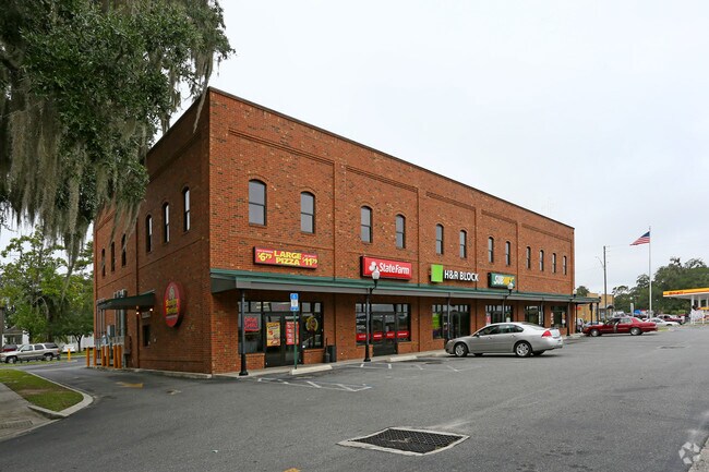


Property Detail
378 E Base St
00-00-00-3668-000-000
BLK 21 TOWN OF MADISON LOT # 137 OR 616/181 OR 789/20 OR 882/186 ALSO 3667,3669 LOTS 138, 139 & 140 OR 1165/247 OR 1570/187
Commercialnec
Madison
INC
Florida
B and X Area of moderate flood hazard, usually the area between the limits of the 100-year and 500-year floods.
no
2025
0.69 AC
2025
Florida Panhandle Area
110302
Other Market Areas
16,861 SF
NEARBY LISTINGS FOR SALE OR LEASE
DEMOGRAPHICS near 378 E Base St
1 mile
3 mile
5 mile
2025 Total Population
3,368
7,119
8,472
2030 Population
3,460
7,276
8,651
Pop Growth 2025-2030
+ 2.73%
+ 2.21%
+ 2.11%
Average Age
42
43
43
2025 Total Households
1,282
2,546
3,069
HH Growth 2025-2030
+ 3.12%
+ 2.95%
+ 2.74%
Median Household Inc
$36,474
$39,818
$44,176
Avg Household Size
2.30
2.30
2.30
2025 Avg HH Vehicles
2.00
2.00
2.00
Median Home Value
$99,731
$115,188
$122,090
Median Year Built
1973
1977
1979
Nearby Places
Map Layers
Map Styles
 Street
 Aerial
Transit
 Traffic
 Biking
Places
Listings with unknown addresses are not visible on the map
- Restaurants
- Banks
- Shops
- Fitness
- Groceries
PUBLIC TRANSPORTATION
AIRPORT
Valdosta Regional
Drive
Walk
Distance
Valdosta Regional
36 min
25.1 mi
SALE & LEASE HISTORY
LISTING DATE
SALE/LEASE

May 15, 2019
For Lease
Jun 22, 2017
For Lease
Aug 22, 2017
For Lease
Apr 26, 2021
For Lease
Nearby Properties
Address
Land Use
TOTAL SIZE
Lot Size
Zoning
Address
Land Use
TOTAL SIZE
Lot Size
Zoning
212,291 SF
59.16 AC
Address
Land Use
TOTAL SIZE
Lot Size
Zoning
228,223 SF
94.53 AC
INC
Address
Land Use
TOTAL SIZE
Lot Size
Zoning
78,953 SF
4.05 AC
INC
Address
Land Use
TOTAL SIZE
Lot Size
Zoning
136,374 SF
45.30 AC
PUB
Address
Land Use
TOTAL SIZE
Lot Size
Zoning
113,576 SF
8.92 AC
INC
Address
Land Use
TOTAL SIZE
Lot Size
Zoning
46,885 SF
4.84 AC
Address
Land Use
TOTAL SIZE
Lot Size
Zoning
40,872 SF
9.60 AC
Address
Land Use
TOTAL SIZE
Lot Size
Zoning
106,153 SF
10.22 AC
R2
Address
Land Use
TOTAL SIZE
Lot Size
Zoning
32,536 SF
2.03 AC
Address
Land Use
TOTAL SIZE
Lot Size
Zoning
27,283 SF
24.74 AC
Address
Land Use
TOTAL SIZE
Lot Size
Zoning
23,066 SF
5 AC
Address
Land Use
TOTAL SIZE
Lot Size
Zoning
57,806 SF
6.83 AC
INC
Address
Land Use
TOTAL SIZE
Lot Size
Zoning
13,486 SF
1.01 AC
INC
Address
Land Use
TOTAL SIZE
Lot Size
Zoning
11,432 SF
3.56 AC
Address
Land Use
TOTAL SIZE
Lot Size
Zoning
228.95 AC
Address
Land Use
TOTAL SIZE
Lot Size
Zoning
50,894 SF
5.74 AC
C5
Address
Land Use
TOTAL SIZE
Lot Size
Zoning
73,847 SF
4.60 AC
Address
Land Use
TOTAL SIZE
Lot Size
Zoning
64,621 SF
7.05 AC
Address
Land Use
TOTAL SIZE
Lot Size
Zoning
29,088 SF
0.68 AC
Address
Land Use
TOTAL SIZE
Lot Size
Zoning
10,918 SF
0.46 AC
Address
Land Use
TOTAL SIZE
Lot Size
Zoning
15,319 SF
6.50 AC
Address
Land Use
TOTAL SIZE
Lot Size
Zoning
22,384 SF
0.92 AC
Address
Land Use
TOTAL SIZE
Lot Size
Zoning
30,868 SF
7.77 AC
INC
Address
Land Use
TOTAL SIZE
Lot Size
Zoning
26,496 SF
31.66 AC
Address
Land Use
TOTAL SIZE
Lot Size
Zoning
27,467 SF
4.17 AC
C1
Address
Land Use
TOTAL SIZE
Lot Size
Zoning
20,750 SF
7.38 AC
Address
Land Use
TOTAL SIZE
Lot Size
Zoning
11,055 SF
1.90 AC
INC
Address
Land Use
TOTAL SIZE
Lot Size
Zoning
10,390 SF
1.87 AC
Address
Land Use
TOTAL SIZE
Lot Size
Zoning
24,061 SF
8.36 AC
Address
Land Use
TOTAL SIZE
Lot Size
Zoning
10,049 SF
8.36 AC
The World's #1 Commercial Real Estate Marketplace
Connect with us
© 2026 CoStar Group
The information above has been obtained from sources believed reliable. While we do not doubt its accuracy we have not verified it and make no guarantee, warranty or representation about it. It is your responsibility to independently confirm its accuracy and completeness. Any projections, opinions, assumptions, or estimates used are for example only and do not represent the current or future performance of the property. The value of this transaction to you depends on tax and other factors which should be evaluated by your tax, financial, and legal advisors. You and your advisors should conduct a careful, independent investigation of the property to determine to your satisfaction the suitability of the property for your needs.