Property Record
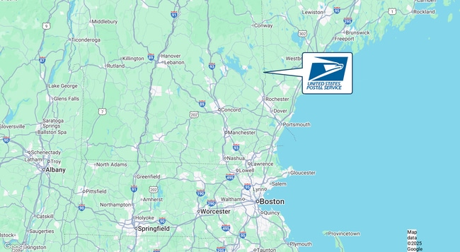
378 Meadow St, Sanbornville, NH 03872
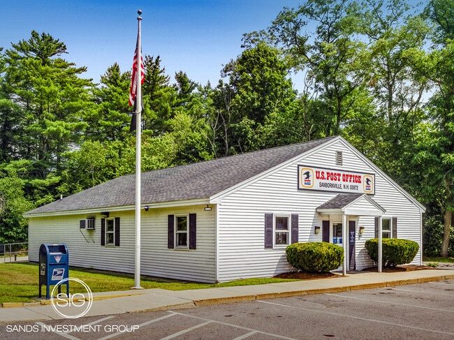

This Property Is For Sale
NEARBY LISTINGS FOR SALE OR LEASE
-
-
View all Sanbornville listings for sale on LoopNet.com
Property Detail
378 Meadow St
Commercialbuilding
Carroll
A
New Hampshire
33003C0770D
7.20 AC
2024
Concord/New Hampshire North Area
2024
Other Market Areas
956000
WKFD-000180-033000
2,574 SF
DEMOGRAPHICS near 378 Meadow St
1 Mile
3 Mile
5 Mile
2024 Total Population
1,092
2,813
6,092
2029 Population
1,194
3,103
6,729
Pop Growth 2024-2029
+ 9.34%
+ 10.31%
+ 10.46%
Average Age
45
46
46
2024 Total Households
458
1,184
2,580
HH Growth 2024-2029
+ 9.17%
+ 10.05%
+ 10.39%
Median Household Inc
$89,608
$95,336
$96,368
Avg Household Size
2.40
2.30
2.30
2024 Avg HH Vehicles
2.00
2.00
2.00
Median Home Value
$240,066
$272,999
$314,222
Median Year Built
1974
1977
1984
Nearby Places
Map Layers
Map Styles
 Street
 Aerial
- Restaurants
- Banks
- Shops
- Fitness
- Groceries
Nearby Properties
Address
Land Use
TOTAL SIZE
Lot Size
Zoning
Address
Land Use
TOTAL SIZE
Lot Size
Zoning
0.99 AC
V/RVIL
Address
Land Use
TOTAL SIZE
Lot Size
Zoning
54,318 SF
9.80 AC
R1R1 R
Address
Land Use
TOTAL SIZE
Lot Size
Zoning
11,339 SF
0.25 AC
V/RWS
Address
Land Use
TOTAL SIZE
Lot Size
Zoning
1,104 SF
1 AC
R2GEL
Address
Land Use
TOTAL SIZE
Lot Size
Zoning
19,255 SF
9.69 AC
V/RWS
Address
Land Use
TOTAL SIZE
Lot Size
Zoning
4,555 SF
0.78 AC
R2GEL
Address
Land Use
TOTAL SIZE
Lot Size
Zoning
1,944 SF
56.71 AC
AGRAGR
Address
Land Use
TOTAL SIZE
Lot Size
Zoning
22,272 SF
2.31 AC
V/RWS
Address
Land Use
TOTAL SIZE
Lot Size
Zoning
2,036 SF
4.97 AC
B&CBUS
Address
Land Use
TOTAL SIZE
Lot Size
Zoning
1,332 SF
0.29 AC
R2GEL
Address
Land Use
TOTAL SIZE
Lot Size
Zoning
6,578 SF
2.70 AC
RESIDE
Address
Land Use
TOTAL SIZE
Lot Size
Zoning
4.50 AC
RESIDE
Address
Land Use
TOTAL SIZE
Lot Size
Zoning
2,109 SF
1.20 AC
R2GEL
Address
Land Use
TOTAL SIZE
Lot Size
Zoning
2,476 SF
0.79 AC
R2GEL
Address
Land Use
TOTAL SIZE
Lot Size
Zoning
22,023 SF
2.46 AC
B&CBUS
Address
Land Use
TOTAL SIZE
Lot Size
Zoning
1,280 SF
1.20 AC
R2GEL
Address
Land Use
TOTAL SIZE
Lot Size
Zoning
3,562 SF
9.70 AC
R2LL W
Address
Land Use
TOTAL SIZE
Lot Size
Zoning
2,663 SF
0.64 AC
R2LL W
Address
Land Use
TOTAL SIZE
Lot Size
Zoning
1,114 SF
1.90 AC
R2GEL
Address
Land Use
TOTAL SIZE
Lot Size
Zoning
1,393 SF
0.96 AC
R2GEL
Address
Land Use
TOTAL SIZE
Lot Size
Zoning
6,781 SF
0.39 AC
R1.0T
Address
Land Use
TOTAL SIZE
Lot Size
Zoning
512 SF
1.80 AC
R2GEL
Address
Land Use
TOTAL SIZE
Lot Size
Zoning
1,151 SF
1.40 AC
R2GEL
Address
Land Use
TOTAL SIZE
Lot Size
Zoning
2.40 AC
R2LL W
Address
Land Use
TOTAL SIZE
Lot Size
Zoning
2,411 SF
0.99 AC
V/RWS
Address
Land Use
TOTAL SIZE
Lot Size
Zoning
3,000 SF
20.90 AC
R2LL L
Address
Land Use
TOTAL SIZE
Lot Size
Zoning
4.40 AC
RESIDE
Address
Land Use
TOTAL SIZE
Lot Size
Zoning
14,599 SF
78 AC
RES3 R
Address
Land Use
TOTAL SIZE
Lot Size
Zoning
6,020 SF
18 AC
RESIDE
Address
Land Use
TOTAL SIZE
Lot Size
Zoning
4,627 SF
15 AC
RESIDE
The World's #1 Commercial Real Estate Marketplace
Connect with us
© 2025 CoStar Group
The information above has been obtained from sources believed reliable. While we do not doubt its accuracy we have not verified it and make no guarantee, warranty or representation about it. It is your responsibility to independently confirm its accuracy and completeness. Any projections, opinions, assumptions, or estimates used are for example only and do not represent the current or future performance of the property. The value of this transaction to you depends on tax and other factors which should be evaluated by your tax, financial, and legal advisors. You and your advisors should conduct a careful, independent investigation of the property to determine to your satisfaction the suitability of the property for your needs.