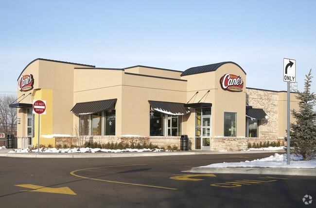
Property Record
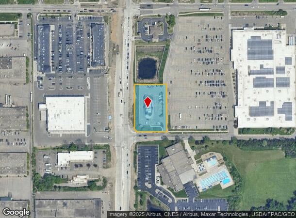
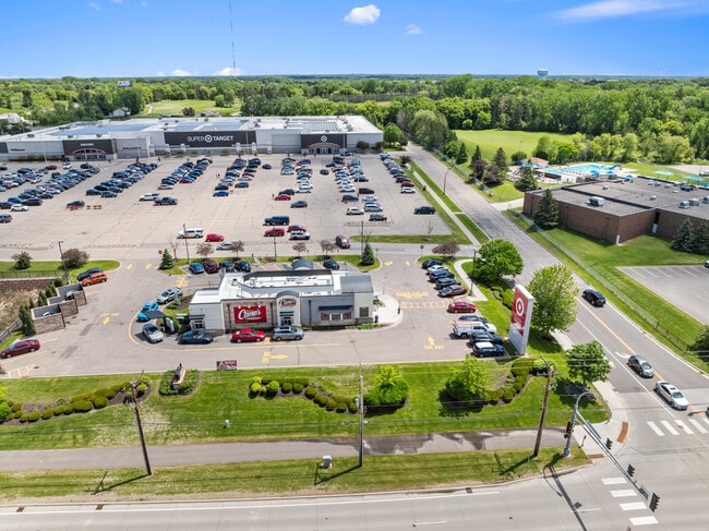
3780 Lexington Ave N, Saint Paul, MN 55126
This Property Is For Sale
NEARBY LISTINGS FOR SALE OR LEASE
Property Detail
3780 Lexington Ave N
Minneapolis-St. Paul-Bloomington, MN-WI
Shoreview Target 2Nd Add
26-30-23-32-0014
SHOREVIEW TARGET 2ND ADD LOT 2 BLK 1
Restaurantdrivein
Ramsey
X
Minnesota
27053C0250F
2
2024
1.14 AC
2025
Rosedale
040704
Minneapolis/St Paul
2,893 SF
DEMOGRAPHICS near 3780 Lexington Ave N
1 Mile
3 Mile
5 Mile
2024 Total Population
5,299
54,256
181,257
2029 Population
5,234
53,143
177,837
Pop Growth 2024-2029
(1.23%)
(2.05%)
(1.89%)
Average Age
42
42
42
2024 Total Households
2,452
22,382
74,742
HH Growth 2024-2029
(1.14%)
(2.20%)
(2.05%)
Median Household Inc
$85,725
$84,090
$84,501
Avg Household Size
2.10
2.30
2.30
2024 Avg HH Vehicles
2.00
2.00
2.00
Median Home Value
$324,015
$348,693
$321,610
Median Year Built
1978
1976
1974
Nearby Places
- Restaurants
- Banks
- Shops
- Fitness
- Groceries
PUBLIC TRANSPORTATION
COMMUTER RAIL
Fridley Station (Northstar Corridor - Northstar Commuter Rail)
DRIVE
WALK
Distance
Fridley Station (Northstar Corridor - Northstar Commuter Rail)
12 min
7.7 mi
AIRPORT
Minneapolis-St Paul International/Wold-Chamberlain
DRIVE
WALK
Distance
Minneapolis-St Paul International/Wold-Chamberlain
26 min
18.6 mi
Nearby Properties
Address
Land Use
TOTAL SIZE
Lot Size
Zoning
Address
Land Use
TOTAL SIZE
Lot Size
Zoning
70,115 SF
191.32 AC
Address
Land Use
TOTAL SIZE
Lot Size
Zoning
141,716 SF
567.20 AC
Address
Land Use
TOTAL SIZE
Lot Size
Zoning
Address
Land Use
TOTAL SIZE
Lot Size
Zoning
294,047 SF
7.99 AC
Address
Land Use
TOTAL SIZE
Lot Size
Zoning
Address
Land Use
TOTAL SIZE
Lot Size
Zoning
9,320 SF
77.38 AC
Address
Land Use
TOTAL SIZE
Lot Size
Zoning
476,695 SF
21.51 AC
Address
Land Use
TOTAL SIZE
Lot Size
Zoning
4.18 AC
Address
Land Use
TOTAL SIZE
Lot Size
Zoning
2.39 AC
Address
Land Use
TOTAL SIZE
Lot Size
Zoning
Address
Land Use
TOTAL SIZE
Lot Size
Zoning
220 SF
19.66 AC
Address
Land Use
TOTAL SIZE
Lot Size
Zoning
792 SF
42.69 AC
Address
Land Use
TOTAL SIZE
Lot Size
Zoning
419,070 SF
45.50 AC
Address
Land Use
TOTAL SIZE
Lot Size
Zoning
167,511 SF
14.49 AC
Address
Land Use
TOTAL SIZE
Lot Size
Zoning
3.83 AC
Address
Land Use
TOTAL SIZE
Lot Size
Zoning
335,252 SF
19.06 AC
Address
Land Use
TOTAL SIZE
Lot Size
Zoning
21.94 AC
Address
Land Use
TOTAL SIZE
Lot Size
Zoning
212,663 SF
3.50 AC
Address
Land Use
TOTAL SIZE
Lot Size
Zoning
294,500 SF
5.95 AC
Address
Land Use
TOTAL SIZE
Lot Size
Zoning
159.37 AC
Address
Land Use
TOTAL SIZE
Lot Size
Zoning
150,034 SF
48.48 AC
Address
Land Use
TOTAL SIZE
Lot Size
Zoning
115.62 AC
Address
Land Use
TOTAL SIZE
Lot Size
Zoning
170,875 SF
2.76 AC
Address
Land Use
TOTAL SIZE
Lot Size
Zoning
309,863 SF
56.34 AC
Address
Land Use
TOTAL SIZE
Lot Size
Zoning
91,679 SF
35.89 AC
Address
Land Use
TOTAL SIZE
Lot Size
Zoning
Address
Land Use
TOTAL SIZE
Lot Size
Zoning
1.77 AC
Address
Land Use
TOTAL SIZE
Lot Size
Zoning
213,177 SF
17.86 AC
Address
Land Use
TOTAL SIZE
Lot Size
Zoning
129,278 SF
4.53 AC
Address
Land Use
TOTAL SIZE
Lot Size
Zoning
129,222 SF
10.28 AC
The World's #1 Commercial Real Estate Marketplace
Connect with us
© 2025 CoStar Group
The information above has been obtained from sources believed reliable. While we do not doubt its accuracy we have not verified it and make no guarantee, warranty or representation about it. It is your responsibility to independently confirm its accuracy and completeness. Any projections, opinions, assumptions, or estimates used are for example only and do not represent the current or future performance of the property. The value of this transaction to you depends on tax and other factors which should be evaluated by your tax, financial, and legal advisors. You and your advisors should conduct a careful, independent investigation of the property to determine to your satisfaction the suitability of the property for your needs.