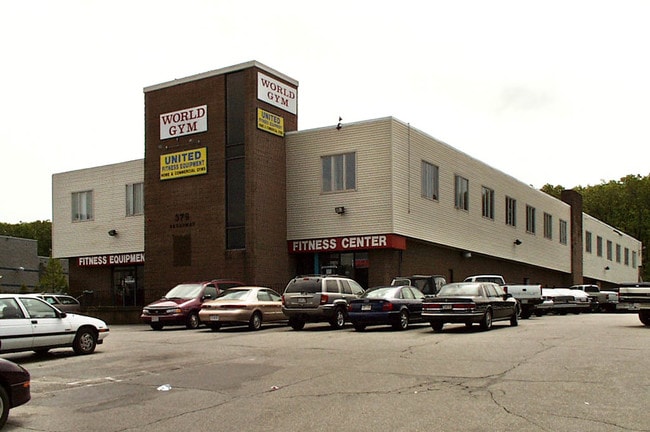
Property Record
379 Broadway, Lynnfield, MA 01940


Property Detail
379 Broadway
LYNF-000052-000000-002544
ESSEX
Commercialacreage
Massachusetts
GB
2544
B and X Area of moderate flood hazard, usually the area between the limits of the 100-year and 500-year floods.
1.58 AC
2025
Reading/Melrose
2025
Boston
209100
Boston-Cambridge-Newton, MA-NH
NEARBY LISTINGS FOR SALE OR LEASE
DEMOGRAPHICS near 379 Broadway
1 mile
3 mile
5 mile
2025 Total Population
5,276
57,991
284,754
2030 Population
5,492
59,693
290,925
Pop Growth 2025-2030
+ 4.09%
+ 2.93%
+ 2.17%
Average Age
43
44
41
2025 Total Households
2,002
21,577
108,066
HH Growth 2025-2030
+ 4.15%
+ 2.92%
+ 2.27%
Median Household Inc
$118,987
$118,535
$97,571
Avg Household Size
2.60
2.60
2.50
2025 Avg HH Vehicles
2.00
2.00
2.00
Median Home Value
$817,298
$718,574
$681,433
Median Year Built
1975
1965
1958
Nearby Places
Map Layers
Map Styles
 Street
 Aerial
Layers
 Traffic
 Biking
Places
Listings with unknown addresses are not visible on the map
- Restaurants
- Banks
- Shops
- Fitness
- Groceries
PUBLIC TRANSPORTATION
COMMUTER RAIL
Wakefield (Haverhill Line - Massachusetts Bay Transportation Authority Commuter Rail (Purple Line))
Drive
Walk
Distance
Wakefield (Haverhill Line - Massachusetts Bay Transportation Authority Commuter Rail (Purple Line))
10 min
5.1 mi
Greenwood (Haverhill Line - Massachusetts Bay Transportation Authority Commuter Rail (Purple Line))
Drive
Walk
Distance
Greenwood (Haverhill Line - Massachusetts Bay Transportation Authority Commuter Rail (Purple Line))
13 min
5.5 mi
AIRPORT
General Edward Lawrence Logan International
Drive
Walk
Distance
General Edward Lawrence Logan International
23 min
13.4 mi
Manchester Boston Regional
Drive
Walk
Distance
Manchester Boston Regional
66 min
45.6 mi
Freight Ports
Port of Boston
Drive
Walk
Distance
Port of Boston
26 min
16.1 mi
Nearby Properties
Address
Land Use
TOTAL SIZE
Lot Size
Zoning
Address
Land Use
TOTAL SIZE
Lot Size
Zoning
330,020 SF
7.32 AC
NA
Address
Land Use
TOTAL SIZE
Lot Size
Zoning
334,150 SF
28 AC
NA
Address
Land Use
TOTAL SIZE
Lot Size
Zoning
49.85 AC
R1B
Address
Land Use
TOTAL SIZE
Lot Size
Zoning
267,277 SF
60 AC
MD
Address
Land Use
TOTAL SIZE
Lot Size
Zoning
215,057 SF
12 AC
RB
Address
Land Use
TOTAL SIZE
Lot Size
Zoning
249,477 SF
13.98 AC
RA
Address
Land Use
TOTAL SIZE
Lot Size
Zoning
18.72 AC
R1
Address
Land Use
TOTAL SIZE
Lot Size
Zoning
217,937 SF
8.40 AC
I
Address
Land Use
TOTAL SIZE
Lot Size
Zoning
228,797 SF
10.61 AC
MD
Address
Land Use
TOTAL SIZE
Lot Size
Zoning
249,587 SF
5.79 AC
DDD
Address
Land Use
TOTAL SIZE
Lot Size
Zoning
59.99 AC
IP
Address
Land Use
TOTAL SIZE
Lot Size
Zoning
25.72 AC
IP
Address
Land Use
TOTAL SIZE
Lot Size
Zoning
98,516 SF
5.01 AC
R1
Address
Land Use
TOTAL SIZE
Lot Size
Zoning
28.30 AC
IP
Address
Land Use
TOTAL SIZE
Lot Size
Zoning
254,374 SF
34.70 AC
I
Address
Land Use
TOTAL SIZE
Lot Size
Zoning
232,783 SF
14.10 AC
IP
Address
Land Use
TOTAL SIZE
Lot Size
Zoning
111,783 SF
8.49 AC
NA
Address
Land Use
TOTAL SIZE
Lot Size
Zoning
182,380 SF
14.20 AC
IP
Address
Land Use
TOTAL SIZE
Lot Size
Zoning
210,452 SF
16.20 AC
NA
Address
Land Use
TOTAL SIZE
Lot Size
Zoning
110,812 SF
32.87 AC
RA
Address
Land Use
TOTAL SIZE
Lot Size
Zoning
135,440 SF
26.05 AC
B1
Address
Land Use
TOTAL SIZE
Lot Size
Zoning
624 SF
45.60 AC
DDD
Address
Land Use
TOTAL SIZE
Lot Size
Zoning
118,020 SF
3.18 AC
LI
Address
Land Use
TOTAL SIZE
Lot Size
Zoning
183,055 SF
12.75 AC
IP
Address
Land Use
TOTAL SIZE
Lot Size
Zoning
142,439 SF
7.49 AC
IP
Address
Land Use
TOTAL SIZE
Lot Size
Zoning
111,000 SF
0.90 AC
DDD
Address
Land Use
TOTAL SIZE
Lot Size
Zoning
160,000 SF
14.10 AC
I
Address
Land Use
TOTAL SIZE
Lot Size
Zoning
237,828 SF
12.53 AC
I
Address
Land Use
TOTAL SIZE
Lot Size
Zoning
162,138 SF
15.88 AC
NA
Address
Land Use
TOTAL SIZE
Lot Size
Zoning
47,242 SF
2.39 AC
R1
The World's #1 Commercial Real Estate Marketplace
Connect with us
© 2026 CoStar Group
The information above has been obtained from sources believed reliable. While we do not doubt its accuracy we have not verified it and make no guarantee, warranty or representation about it. It is your responsibility to independently confirm its accuracy and completeness. Any projections, opinions, assumptions, or estimates used are for example only and do not represent the current or future performance of the property. The value of this transaction to you depends on tax and other factors which should be evaluated by your tax, financial, and legal advisors. You and your advisors should conduct a careful, independent investigation of the property to determine to your satisfaction the suitability of the property for your needs.