Property Record
37930 2Nd St, Willoughby, OH 44094
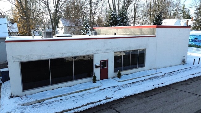
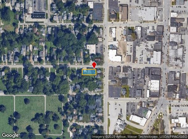
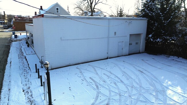
This Property Is For Sale
NEARBY LISTINGS FOR SALE OR LEASE
Property Detail
37930 2Nd St
27-A-029-A-00-048
GORE TRACT PART OF LOT 105
Storebuilding
Lake
X
Ohio
39035C0025E
105
0
0.17 AC
2024
Northeast
201400
Cleveland
3,700 SF
Cleveland-Elyria, OH
DEMOGRAPHICS near 37930 2Nd St
1 Mile
3 Mile
5 Mile
2024 Total Population
5,740
52,736
112,859
2029 Population
5,737
52,808
112,529
Pop Growth 2024-2029
(0.05%)
+ 0.14%
(0.29%)
Average Age
43
44
44
2024 Total Households
2,773
24,479
51,063
HH Growth 2024-2029
+ 0.04%
+ 0.22%
(0.25%)
Median Household Inc
$70,223
$69,024
$70,871
Avg Household Size
2.00
2.10
2.20
2024 Avg HH Vehicles
2.00
2.00
2.00
Median Home Value
$198,441
$169,338
$171,267
Median Year Built
1957
1967
1966
Nearby Places
- Restaurants
- Banks
- Shops
- Fitness
- Groceries
PUBLIC TRANSPORTATION
AIRPORT
Cleveland-Hopkins International
DRIVE
WALK
Distance
Cleveland-Hopkins International
46 min
32.1 mi
Freight Ports
Port of Toledo
DRIVE
WALK
Distance
Port of Toledo
160 min
132.5 mi
Nearby Properties
Address
Land Use
TOTAL SIZE
Lot Size
Zoning
Address
Land Use
TOTAL SIZE
Lot Size
Zoning
120.34 AC
Address
Land Use
TOTAL SIZE
Lot Size
Zoning
455,945 SF
78.40 AC
B-1
Address
Land Use
TOTAL SIZE
Lot Size
Zoning
747,384 SF
42.35 AC
Address
Land Use
TOTAL SIZE
Lot Size
Zoning
488,790 SF
11.54 AC
R-MFL
Address
Land Use
TOTAL SIZE
Lot Size
Zoning
307,867 SF
31.16 AC
S-CMF
Address
Land Use
TOTAL SIZE
Lot Size
Zoning
327,593 SF
103.27 AC
Address
Land Use
TOTAL SIZE
Lot Size
Zoning
308,298 SF
15.93 AC
Address
Land Use
TOTAL SIZE
Lot Size
Zoning
120,352 SF
15.05 AC
1FM60
Address
Land Use
TOTAL SIZE
Lot Size
Zoning
45,768 SF
13.53 AC
Address
Land Use
TOTAL SIZE
Lot Size
Zoning
148,642 SF
15.03 AC
Address
Land Use
TOTAL SIZE
Lot Size
Zoning
214,881 SF
47.99 AC
S-5
Address
Land Use
TOTAL SIZE
Lot Size
Zoning
42.35 AC
Address
Land Use
TOTAL SIZE
Lot Size
Zoning
53,637 SF
13.45 AC
G-BUS
Address
Land Use
TOTAL SIZE
Lot Size
Zoning
212,280 SF
17.96 AC
B-2
Address
Land Use
TOTAL SIZE
Lot Size
Zoning
127,458 SF
67.34 AC
R-4
Address
Land Use
TOTAL SIZE
Lot Size
Zoning
233,534 SF
26.21 AC
B-2
Address
Land Use
TOTAL SIZE
Lot Size
Zoning
136,722 SF
10.25 AC
GB
Address
Land Use
TOTAL SIZE
Lot Size
Zoning
187,332 SF
10 AC
R-100
Address
Land Use
TOTAL SIZE
Lot Size
Zoning
164,666 SF
8 AC
R-100
Address
Land Use
TOTAL SIZE
Lot Size
Zoning
159,188 SF
12.43 AC
R-BUS
Address
Land Use
TOTAL SIZE
Lot Size
Zoning
174,098 SF
20.51 AC
U-1
Address
Land Use
TOTAL SIZE
Lot Size
Zoning
141,900 SF
11.72 AC
B-2
Address
Land Use
TOTAL SIZE
Lot Size
Zoning
159,043 SF
11.61 AC
B2
Address
Land Use
TOTAL SIZE
Lot Size
Zoning
122,130 SF
9.51 AC
Address
Land Use
TOTAL SIZE
Lot Size
Zoning
133,526 SF
4 AC
Address
Land Use
TOTAL SIZE
Lot Size
Zoning
163,810 SF
15.39 AC
Address
Land Use
TOTAL SIZE
Lot Size
Zoning
109,803 SF
9.77 AC
Address
Land Use
TOTAL SIZE
Lot Size
Zoning
168,150 SF
14.21 AC
R-10
Address
Land Use
TOTAL SIZE
Lot Size
Zoning
120,676 SF
9.07 AC
R-MFL
Address
Land Use
TOTAL SIZE
Lot Size
Zoning
98,819 SF
2.94 AC
B2
The World's #1 Commercial Real Estate Marketplace
Connect with us
© 2025 CoStar Group
The information above has been obtained from sources believed reliable. While we do not doubt its accuracy we have not verified it and make no guarantee, warranty or representation about it. It is your responsibility to independently confirm its accuracy and completeness. Any projections, opinions, assumptions, or estimates used are for example only and do not represent the current or future performance of the property. The value of this transaction to you depends on tax and other factors which should be evaluated by your tax, financial, and legal advisors. You and your advisors should conduct a careful, independent investigation of the property to determine to your satisfaction the suitability of the property for your needs.