Property Record
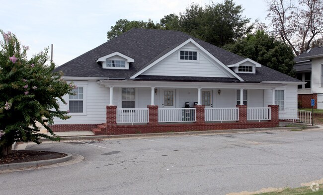
38 Hampton St, Mcdonough, GA 30253


Property Detail
38 Hampton St
0M09-06-001-000
LD: 7LL: 134
Commercialnec
Henry
C1
Georgia
B and X Area of moderate flood hazard, usually the area between the limits of the 100-year and 500-year floods.
0.76 AC
2025
South Clayton/Henry Cnty
2025
Atlanta
070325
Atlanta-Sandy Springs-Roswell, GA
6,008 SF
NEARBY LISTINGS FOR SALE OR LEASE
DEMOGRAPHICS near 38 Hampton St
1 mile
3 mile
5 mile
2025 Total Population
7,329
49,491
93,684
2030 Population
7,905
53,150
100,530
Pop Growth 2025-2030
+ 7.86%
+ 7.39%
+ 7.31%
Average Age
37
37
38
2025 Total Households
2,861
17,846
32,739
HH Growth 2025-2030
+ 7.90%
+ 7.56%
+ 7.48%
Median Household Inc
$54,386
$72,623
$83,206
Avg Household Size
2.50
2.70
2.80
2025 Avg HH Vehicles
2.00
2.00
2.00
Median Home Value
$285,679
$327,154
$351,629
Median Year Built
2002
2003
2003
Nearby Places
Map Layers
Map Styles
 Street
 Aerial
Layers
 Traffic
 Biking
Places
Listings with unknown addresses are not visible on the map
- Restaurants
- Banks
- Shops
- Fitness
- Groceries
PUBLIC TRANSPORTATION
AIRPORT
Hartsfield - Jackson Atlanta International
Drive
Walk
Distance
Hartsfield - Jackson Atlanta International
34 min
23.9 mi
SALE & LEASE HISTORY
LISTING DATE
SALE/LEASE

Jul 05, 2021
For Lease
Nearby Properties
Address
Land Use
TOTAL SIZE
Lot Size
Zoning
Address
Land Use
TOTAL SIZE
Lot Size
Zoning
33,565 SF
44.68 AC
Address
Land Use
TOTAL SIZE
Lot Size
Zoning
3,973,920 SF
88.41 AC
I
Address
Land Use
TOTAL SIZE
Lot Size
Zoning
67,298 SF
30.88 AC
RM
Address
Land Use
TOTAL SIZE
Lot Size
Zoning
1,226,687 SF
100.81 AC
M2
Address
Land Use
TOTAL SIZE
Lot Size
Zoning
10,092 SF
46.06 AC
RM
Address
Land Use
TOTAL SIZE
Lot Size
Zoning
29,768 SF
50.81 AC
RM
Address
Land Use
TOTAL SIZE
Lot Size
Zoning
35,929 SF
38.16 AC
C3
Address
Land Use
TOTAL SIZE
Lot Size
Zoning
27,336 SF
27.95 AC
Address
Land Use
TOTAL SIZE
Lot Size
Zoning
2,337,242 SF
71.11 AC
M2
Address
Land Use
TOTAL SIZE
Lot Size
Zoning
21,880 SF
22.04 AC
RMH
Address
Land Use
TOTAL SIZE
Lot Size
Zoning
59,445 SF
20.17 AC
PD
Address
Land Use
TOTAL SIZE
Lot Size
Zoning
6,422 SF
24.67 AC
RM
Address
Land Use
TOTAL SIZE
Lot Size
Zoning
1,588,692 SF
44.95 AC
M1
Address
Land Use
TOTAL SIZE
Lot Size
Zoning
11,256 SF
34.51 AC
RM
Address
Land Use
TOTAL SIZE
Lot Size
Zoning
40,500 SF
27.66 AC
RA
Address
Land Use
TOTAL SIZE
Lot Size
Zoning
5,485 SF
27.03 AC
RM
Address
Land Use
TOTAL SIZE
Lot Size
Zoning
6,344 SF
21.40 AC
C1
Address
Land Use
TOTAL SIZE
Lot Size
Zoning
18,084 SF
59.72 AC
M1
Address
Land Use
TOTAL SIZE
Lot Size
Zoning
25,622 SF
17.43 AC
RMH
Address
Land Use
TOTAL SIZE
Lot Size
Zoning
1,456,864 SF
82.62 AC
Address
Land Use
TOTAL SIZE
Lot Size
Zoning
3,877,368 SF
44.93 AC
M2
Address
Land Use
TOTAL SIZE
Lot Size
Zoning
2,877,520 SF
53.73 AC
C2
Address
Land Use
TOTAL SIZE
Lot Size
Zoning
23,400 SF
29 AC
RM
Address
Land Use
TOTAL SIZE
Lot Size
Zoning
40,246 SF
13.73 AC
Address
Land Use
TOTAL SIZE
Lot Size
Zoning
498,160 SF
44.14 AC
M1
Address
Land Use
TOTAL SIZE
Lot Size
Zoning
532,585 SF
67.79 AC
M2
Address
Land Use
TOTAL SIZE
Lot Size
Zoning
3,114 SF
15.44 AC
RM
Address
Land Use
TOTAL SIZE
Lot Size
Zoning
63,279 SF
52.18 AC
C1
Address
Land Use
TOTAL SIZE
Lot Size
Zoning
997,015 SF
153.75 AC
M1
Address
Land Use
TOTAL SIZE
Lot Size
Zoning
429,447 SF
40.07 AC
M2
The World's #1 Commercial Real Estate Marketplace
Connect with us
© 2026 CoStar Group
The information above has been obtained from sources believed reliable. While we do not doubt its accuracy we have not verified it and make no guarantee, warranty or representation about it. It is your responsibility to independently confirm its accuracy and completeness. Any projections, opinions, assumptions, or estimates used are for example only and do not represent the current or future performance of the property. The value of this transaction to you depends on tax and other factors which should be evaluated by your tax, financial, and legal advisors. You and your advisors should conduct a careful, independent investigation of the property to determine to your satisfaction the suitability of the property for your needs.