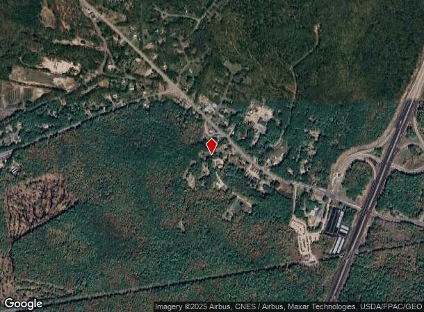
Property Record
38 Hubbard Ln, Wells, ME 04090
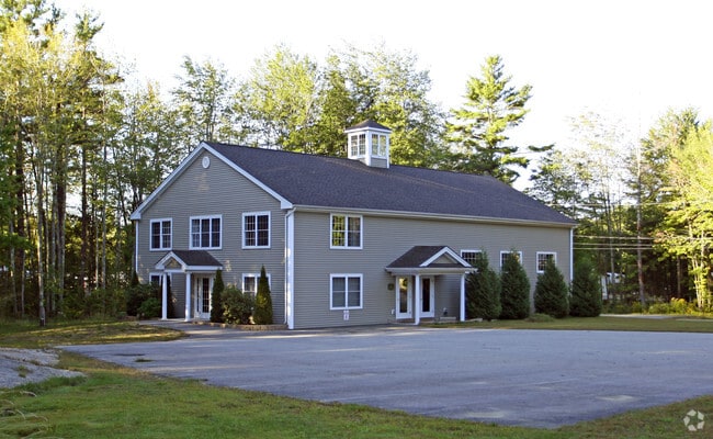
This Property Is For Sale
NEARBY LISTINGS FOR SALE OR LEASE
-
-
View all Wells listings for sale on LoopNet.com
Property Detail
38 Hubbard Ln
WLLS-000049-000034-000000-A000000
York
Departmentstore
Maine
X
34-a
23031C0578G
1.10 AC
2024
York County
2024
Portland/South Portland
034002
Portland-South Portland, ME
2,000 SF
DEMOGRAPHICS near 38 Hubbard Ln
1 Mile
3 Mile
5 Mile
2024 Total Population
657
7,211
15,059
2029 Population
704
7,820
16,192
Pop Growth 2024-2029
+ 7.15%
+ 8.45%
+ 7.52%
Average Age
45
49
49
2024 Total Households
270
3,259
6,759
HH Growth 2024-2029
+ 7.41%
+ 8.56%
+ 7.60%
Median Household Inc
$69,107
$70,302
$74,261
Avg Household Size
2.40
2.20
2.20
2024 Avg HH Vehicles
2.00
2.00
2.00
Median Home Value
$366,417
$392,175
$395,721
Median Year Built
1997
1994
1989
Nearby Places
- Restaurants
- Banks
- Shops
- Fitness
- Groceries
PUBLIC TRANSPORTATION
COMMUTER RAIL
Wells (Downeaster - Amtrak)
DRIVE
WALK
Distance
Wells (Downeaster - Amtrak)
2 min
10 min
0.6 mi
AIRPORT
Portsmouth International at Pease
DRIVE
WALK
Distance
Portsmouth International at Pease
31 min
23.2 mi
Portland International Jetport
DRIVE
WALK
Distance
Portland International Jetport
36 min
28.8 mi
Freight Ports
Portland, ME
DRIVE
WALK
Distance
Portland, ME
37 min
31.4 mi
Nearby Properties
Address
Land Use
TOTAL SIZE
Lot Size
Zoning
Address
Land Use
TOTAL SIZE
Lot Size
Zoning
86,468 SF
48.52 AC
GB
Address
Land Use
TOTAL SIZE
Lot Size
Zoning
Address
Land Use
TOTAL SIZE
Lot Size
Zoning
76,411 SF
84.80 AC
RA
Address
Land Use
TOTAL SIZE
Lot Size
Zoning
381,495 SF
61.07 AC
LI
Address
Land Use
TOTAL SIZE
Lot Size
Zoning
71,230 SF
11.81 AC
RC
Address
Land Use
TOTAL SIZE
Lot Size
Zoning
145,412 SF
39.02 AC
LI
Address
Land Use
TOTAL SIZE
Lot Size
Zoning
47,779 SF
7.07 AC
RC
Address
Land Use
TOTAL SIZE
Lot Size
Zoning
2,733 SF
45.48 AC
R
Address
Land Use
TOTAL SIZE
Lot Size
Zoning
19,686 SF
9.16 AC
RC
Address
Land Use
TOTAL SIZE
Lot Size
Zoning
2,730 SF
51 AC
R
Address
Land Use
TOTAL SIZE
Lot Size
Zoning
2,415 SF
44.88 AC
R
Address
Land Use
TOTAL SIZE
Lot Size
Zoning
28,027 SF
2.14 AC
EX
Address
Land Use
TOTAL SIZE
Lot Size
Zoning
56,299 SF
5.03 AC
GB
Address
Land Use
TOTAL SIZE
Lot Size
Zoning
38,083 SF
3.01 AC
GB
Address
Land Use
TOTAL SIZE
Lot Size
Zoning
0.78 AC
R
Address
Land Use
TOTAL SIZE
Lot Size
Zoning
44,369 SF
19.28 AC
GB
Address
Land Use
TOTAL SIZE
Lot Size
Zoning
8,504 SF
3.18 AC
RA
Address
Land Use
TOTAL SIZE
Lot Size
Zoning
2,400 SF
15.03 AC
GB
Address
Land Use
TOTAL SIZE
Lot Size
Zoning
5,000 SF
24.15 AC
GB
Address
Land Use
TOTAL SIZE
Lot Size
Zoning
1 AC
EX
Address
Land Use
TOTAL SIZE
Lot Size
Zoning
12,120 SF
0.38 AC
BB
Address
Land Use
TOTAL SIZE
Lot Size
Zoning
14,102 SF
4.32 AC
GB
Address
Land Use
TOTAL SIZE
Lot Size
Zoning
20,220 SF
2.94 AC
GB
Address
Land Use
TOTAL SIZE
Lot Size
Zoning
2,542 SF
0.70 AC
RD
Address
Land Use
TOTAL SIZE
Lot Size
Zoning
1,302 SF
4.28 AC
GB
Address
Land Use
TOTAL SIZE
Lot Size
Zoning
2,366 SF
4.65 AC
GB
Address
Land Use
TOTAL SIZE
Lot Size
Zoning
12,556 SF
1.50 AC
GB
Address
Land Use
TOTAL SIZE
Lot Size
Zoning
1,834 SF
28.49 AC
GB
Address
Land Use
TOTAL SIZE
Lot Size
Zoning
5,592 SF
7.71 AC
RA
Address
Land Use
TOTAL SIZE
Lot Size
Zoning
3,787 SF
0.12 AC
RB
The World's #1 Commercial Real Estate Marketplace
Connect with us
© 2025 CoStar Group
The information above has been obtained from sources believed reliable. While we do not doubt its accuracy we have not verified it and make no guarantee, warranty or representation about it. It is your responsibility to independently confirm its accuracy and completeness. Any projections, opinions, assumptions, or estimates used are for example only and do not represent the current or future performance of the property. The value of this transaction to you depends on tax and other factors which should be evaluated by your tax, financial, and legal advisors. You and your advisors should conduct a careful, independent investigation of the property to determine to your satisfaction the suitability of the property for your needs.