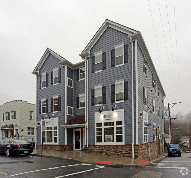
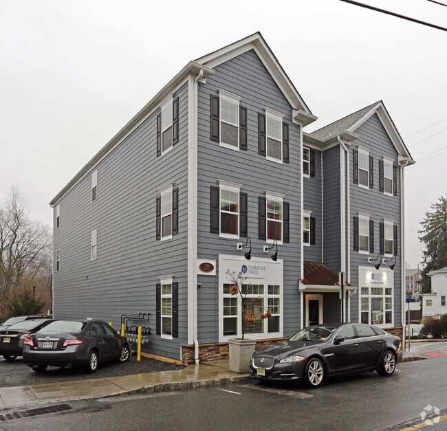
Property Record
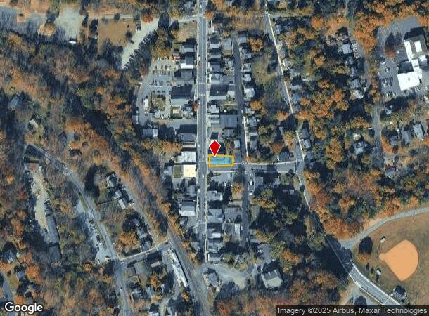
38 Main St, High Bridge, NJ 08829

NEARBY LISTINGS FOR SALE OR LEASE
Property Detail
38 Main St
14-00008-0000-00007
Hunterdon
Retailwithmorethanonenonretailuse
New Jersey
X
7
34019C0117F
0.12 AC
2024
Route 78 West
2025
Northern New Jersey
010900
Newark, NJ-PA
5,534 SF
DEMOGRAPHICS near 38 Main St
1 Mile
3 Mile
5 Mile
2024 Total Population
4,150
15,971
34,888
2029 Population
4,225
16,202
35,271
Pop Growth 2024-2029
+ 1.81%
+ 1.45%
+ 1.10%
Average Age
41
42
43
2024 Total Households
1,616
5,904
12,991
HH Growth 2024-2029
+ 1.86%
+ 1.78%
+ 1.35%
Median Household Inc
$104,849
$119,604
$120,145
Avg Household Size
2.40
2.40
2.50
2024 Avg HH Vehicles
2.00
2.00
2.00
Median Home Value
$300,641
$395,843
$412,531
Median Year Built
1969
1977
1977
Nearby Places
- Restaurants
- Banks
- Shops
- Fitness
- Groceries
PUBLIC TRANSPORTATION
COMMUTER RAIL
High Bridge (Raritan Valley Line - NJ Transit Commuter Rail (NJ Transit))
DRIVE
WALK
Distance
High Bridge (Raritan Valley Line - NJ Transit Commuter Rail (NJ Transit))
0 min
2 min
0.1 mi
Annandale (Raritan Valley Line - NJ Transit Commuter Rail (NJ Transit))
DRIVE
WALK
Distance
Annandale (Raritan Valley Line - NJ Transit Commuter Rail (NJ Transit))
7 min
2.2 mi
AIRPORT
Trenton Mercer
DRIVE
WALK
Distance
Trenton Mercer
50 min
33.1 mi
Lehigh Valley International
DRIVE
WALK
Distance
Lehigh Valley International
53 min
35.0 mi
Freight Ports
New York Container Terminal
DRIVE
WALK
Distance
New York Container Terminal
64 min
48.6 mi
Nearby Properties
Address
Land Use
TOTAL SIZE
Lot Size
Zoning
Address
Land Use
TOTAL SIZE
Lot Size
Zoning
84.62 AC
ROM1
Address
Land Use
TOTAL SIZE
Lot Size
Zoning
1,740.74 AC
INS
Address
Land Use
TOTAL SIZE
Lot Size
Zoning
49.26 AC
RR4S
Address
Land Use
TOTAL SIZE
Lot Size
Zoning
3,432 SF
24.17 AC
OB3
Address
Land Use
TOTAL SIZE
Lot Size
Zoning
56.97 AC
R3
Address
Land Use
TOTAL SIZE
Lot Size
Zoning
255.40 AC
WM
Address
Land Use
TOTAL SIZE
Lot Size
Zoning
215.75 AC
RC
Address
Land Use
TOTAL SIZE
Lot Size
Zoning
2,526 SF
339.93 AC
RC
Address
Land Use
TOTAL SIZE
Lot Size
Zoning
40.13 AC
AH2
Address
Land Use
TOTAL SIZE
Lot Size
Zoning
Address
Land Use
TOTAL SIZE
Lot Size
Zoning
261.91 AC
RC
Address
Land Use
TOTAL SIZE
Lot Size
Zoning
Address
Land Use
TOTAL SIZE
Lot Size
Zoning
9,408 SF
37 AC
ROM1
Address
Land Use
TOTAL SIZE
Lot Size
Zoning
5.36 AC
PUD
Address
Land Use
TOTAL SIZE
Lot Size
Zoning
Address
Land Use
TOTAL SIZE
Lot Size
Zoning
1.88 AC
OB-2
Address
Land Use
TOTAL SIZE
Lot Size
Zoning
52,594 SF
4.58 AC
GA
Address
Land Use
TOTAL SIZE
Lot Size
Zoning
10.18 AC
OB-4
Address
Land Use
TOTAL SIZE
Lot Size
Zoning
5.24 AC
C-N
Address
Land Use
TOTAL SIZE
Lot Size
Zoning
34.80 AC
ROM
Address
Land Use
TOTAL SIZE
Lot Size
Zoning
2,544 SF
562.37 AC
RC
Address
Land Use
TOTAL SIZE
Lot Size
Zoning
Address
Land Use
TOTAL SIZE
Lot Size
Zoning
1,620 SF
15.85 AC
C2
Address
Land Use
TOTAL SIZE
Lot Size
Zoning
47,400 SF
15.68 AC
I
Address
Land Use
TOTAL SIZE
Lot Size
Zoning
11,467 SF
8.98 AC
OB-2
Address
Land Use
TOTAL SIZE
Lot Size
Zoning
Address
Land Use
TOTAL SIZE
Lot Size
Zoning
14,526 SF
5.03 AC
R-2A
Address
Land Use
TOTAL SIZE
Lot Size
Zoning
11,584 SF
4.17 AC
C1
Address
Land Use
TOTAL SIZE
Lot Size
Zoning
7.14 AC
R-2A
Address
Land Use
TOTAL SIZE
Lot Size
Zoning
5.64 AC
C-4
The World's #1 Commercial Real Estate Marketplace
Connect with us
© 2025 CoStar Group
The information above has been obtained from sources believed reliable. While we do not doubt its accuracy we have not verified it and make no guarantee, warranty or representation about it. It is your responsibility to independently confirm its accuracy and completeness. Any projections, opinions, assumptions, or estimates used are for example only and do not represent the current or future performance of the property. The value of this transaction to you depends on tax and other factors which should be evaluated by your tax, financial, and legal advisors. You and your advisors should conduct a careful, independent investigation of the property to determine to your satisfaction the suitability of the property for your needs.