Property Record
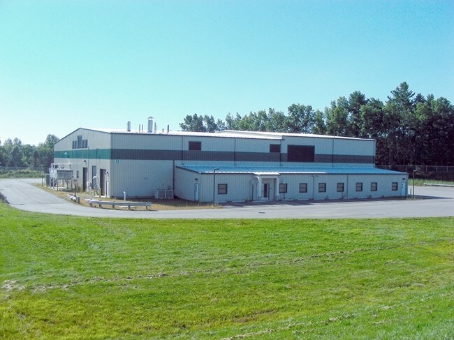
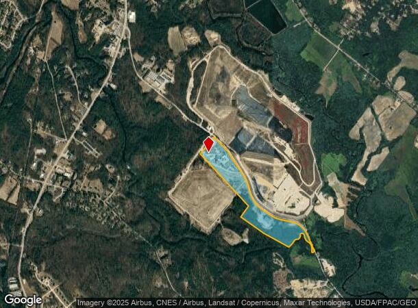
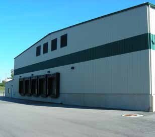
38 Turnkey Way, Rochester, NH 03839
NEARBY LISTINGS FOR SALE OR LEASE
-
-
View all Rochester listings for sale on LoopNet.com
Property Detail
38 Turnkey Way
Commercialnec
Strafford
X
New Hampshire
33017C0213D
65 AC
2024
Strafford County
2024
Boston
084500
Boston-Cambridge-Newton, MA-NH
37,781 SF
RCHE-000267-000003
DEMOGRAPHICS near 38 Turnkey Way
1 mile
3 mile
5 mile
2024 Total Population
209
12,933
45,702
2029 Population
222
13,609
47,859
Pop Growth 2024-2029
+ 6.22%
+ 5.23%
+ 4.72%
Average Age
40
42
42
2024 Total Households
80
5,070
18,453
HH Growth 2024-2029
+ 6.25%
+ 5.40%
+ 4.84%
Median Household Inc
$102,500
$102,433
$96,312
Avg Household Size
2.50
2.40
2.40
2024 Avg HH Vehicles
2.00
2.00
2.00
Median Home Value
$346,666
$306,187
$295,724
Median Year Built
1984
1987
1977
Nearby Places
Map Layers
Map Styles
 Street
 Aerial
Transit
 Traffic
 Biking
Places
Listings with unknown addresses are not visible on the map
- Restaurants
- Banks
- Shops
- Fitness
- Groceries
PUBLIC TRANSPORTATION
COMMUTER RAIL
Dover (Downeaster - Amtrak)
Drive
Walk
Distance
Dover (Downeaster - Amtrak)
17 min
6.9 mi
Durham (Downeaster - Amtrak)
Drive
Walk
Distance
Durham (Downeaster - Amtrak)
22 min
9.3 mi
AIRPORT
Portsmouth International at Pease
Drive
Walk
Distance
Portsmouth International at Pease
32 min
20.8 mi
Freight Ports
Portland, ME
Drive
Walk
Distance
Portland, ME
80 min
56.6 mi
Nearby Properties
Address
Land Use
TOTAL SIZE
Lot Size
Zoning
Address
Land Use
TOTAL SIZE
Lot Size
Zoning
26 AC
R-40
Address
Land Use
TOTAL SIZE
Lot Size
Zoning
Address
Land Use
TOTAL SIZE
Lot Size
Zoning
177,717 SF
116.87 AC
COMMER
Address
Land Use
TOTAL SIZE
Lot Size
Zoning
79,192 SF
12.90 AC
R1
Address
Land Use
TOTAL SIZE
Lot Size
Zoning
127 AC
RCY
Address
Land Use
TOTAL SIZE
Lot Size
Zoning
35 AC
R-40
Address
Land Use
TOTAL SIZE
Lot Size
Zoning
77,916 SF
6.58 AC
A
Address
Land Use
TOTAL SIZE
Lot Size
Zoning
68,532 SF
28.30 AC
COMMER
Address
Land Use
TOTAL SIZE
Lot Size
Zoning
9.53 AC
R1
Address
Land Use
TOTAL SIZE
Lot Size
Zoning
106,003 SF
27.94 AC
COMMER
Address
Land Use
TOTAL SIZE
Lot Size
Zoning
97,792 SF
23.89 AC
R1
Address
Land Use
TOTAL SIZE
Lot Size
Zoning
18.02 AC
COMM 3
Address
Land Use
TOTAL SIZE
Lot Size
Zoning
4,916 SF
93 AC
A
Address
Land Use
TOTAL SIZE
Lot Size
Zoning
82,752 SF
9.88 AC
R2
Address
Land Use
TOTAL SIZE
Lot Size
Zoning
44,530 SF
2.03 AC
A
Address
Land Use
TOTAL SIZE
Lot Size
Zoning
11,904 SF
I4
Address
Land Use
TOTAL SIZE
Lot Size
Zoning
44,530 SF
5.67 AC
A
Address
Land Use
TOTAL SIZE
Lot Size
Zoning
37,900 SF
16.65 AC
RCY
Address
Land Use
TOTAL SIZE
Lot Size
Zoning
289 AC
IND
Address
Land Use
TOTAL SIZE
Lot Size
Zoning
40,091 SF
5.12 AC
A
Address
Land Use
TOTAL SIZE
Lot Size
Zoning
40,091 SF
1.85 AC
A
Address
Land Use
TOTAL SIZE
Lot Size
Zoning
40,567 SF
20.50 AC
R2
Address
Land Use
TOTAL SIZE
Lot Size
Zoning
9,073 SF
174 AC
A
Address
Land Use
TOTAL SIZE
Lot Size
Zoning
3,120 SF
65.30 AC
A
Address
Land Use
TOTAL SIZE
Lot Size
Zoning
3,200 SF
63.70 AC
A
Address
Land Use
TOTAL SIZE
Lot Size
Zoning
138,281 SF
5.27 AC
OFC
Address
Land Use
TOTAL SIZE
Lot Size
Zoning
3.76 AC
COMMER
Address
Land Use
TOTAL SIZE
Lot Size
Zoning
20,760 SF
59.64 AC
A
Address
Land Use
TOTAL SIZE
Lot Size
Zoning
104,606 SF
3.24 AC
HC
The World's #1 Commercial Real Estate Marketplace
Connect with us
© 2026 CoStar Group
The information above has been obtained from sources believed reliable. While we do not doubt its accuracy we have not verified it and make no guarantee, warranty or representation about it. It is your responsibility to independently confirm its accuracy and completeness. Any projections, opinions, assumptions, or estimates used are for example only and do not represent the current or future performance of the property. The value of this transaction to you depends on tax and other factors which should be evaluated by your tax, financial, and legal advisors. You and your advisors should conduct a careful, independent investigation of the property to determine to your satisfaction the suitability of the property for your needs.