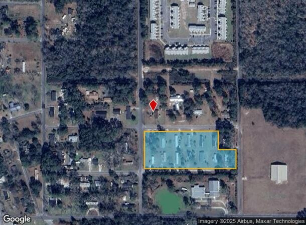
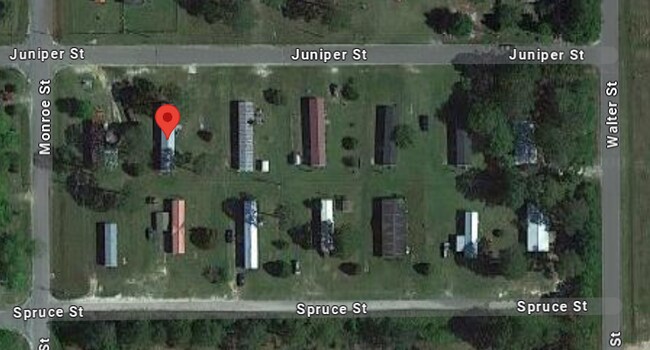
Property Record
400 Juniper St, Waycross, GA 31501

NEARBY LISTINGS FOR SALE OR LEASE
Property Detail
400 Juniper St
051A-03-044-B 01
JUNIPER ST 400 B58 L1-2 & 6-26 & PT3 LL121/8
Commercialnec
Ware
X
Georgia
13229C0280D
11
2024
Georgia South Area
2024
Other Market Areas
950500
Waycross, GA
DEMOGRAPHICS near 400 Juniper St
1 Mile
3 Mile
5 Mile
2024 Total Population
3,849
21,622
31,168
2029 Population
3,826
21,583
31,193
Pop Growth 2024-2029
(0.60%)
(0.18%)
+ 0.08%
Average Age
42
40
40
2024 Total Households
1,584
8,527
11,985
HH Growth 2024-2029
(0.76%)
(0.36%)
(0.02%)
Median Household Inc
$35,550
$36,730
$38,572
Avg Household Size
2.30
2.40
2.50
2024 Avg HH Vehicles
1.00
2.00
2.00
Median Home Value
$93,095
$86,369
$95,300
Median Year Built
1974
1972
1976
Nearby Places
Map Layers
Map Styles
 Street
 Aerial
- Restaurants
- Banks
- Shops
- Fitness
- Groceries
SALE & LEASE HISTORY
LISTING DATE
SALE/LEASE

Jun 06, 2024
For Sale
Nearby Properties
Address
Land Use
TOTAL SIZE
Lot Size
Zoning
Address
Land Use
TOTAL SIZE
Lot Size
Zoning
56.91 AC
005
Address
Land Use
TOTAL SIZE
Lot Size
Zoning
64,745 SF
13.49 AC
001
Address
Land Use
TOTAL SIZE
Lot Size
Zoning
5,474 SF
5.18 AC
005
Address
Land Use
TOTAL SIZE
Lot Size
Zoning
77,096 SF
32.52 AC
002
Address
Land Use
TOTAL SIZE
Lot Size
Zoning
91,611 SF
76.30 AC
006
Address
Land Use
TOTAL SIZE
Lot Size
Zoning
120,700 SF
22.70 AC
001
Address
Land Use
TOTAL SIZE
Lot Size
Zoning
260,001 SF
14.28 AC
009
Address
Land Use
TOTAL SIZE
Lot Size
Zoning
3,264 SF
864.77 AC
006
Address
Land Use
TOTAL SIZE
Lot Size
Zoning
52,943 SF
155.98 AC
006
Address
Land Use
TOTAL SIZE
Lot Size
Zoning
74,500 SF
24.83 AC
006
Address
Land Use
TOTAL SIZE
Lot Size
Zoning
3,250 SF
7.25 AC
005
Address
Land Use
TOTAL SIZE
Lot Size
Zoning
74,232 SF
13.77 AC
005
Address
Land Use
TOTAL SIZE
Lot Size
Zoning
46,296 SF
16 AC
006
Address
Land Use
TOTAL SIZE
Lot Size
Zoning
36,654 SF
7.50 AC
005
Address
Land Use
TOTAL SIZE
Lot Size
Zoning
87,845 SF
10.46 AC
002
Address
Land Use
TOTAL SIZE
Lot Size
Zoning
34,125 SF
2.67 AC
005
Address
Land Use
TOTAL SIZE
Lot Size
Zoning
37,800 SF
3.93 AC
005
Address
Land Use
TOTAL SIZE
Lot Size
Zoning
55,024 SF
1.55 AC
002
Address
Land Use
TOTAL SIZE
Lot Size
Zoning
36,460 SF
10.56 AC
SF
Address
Land Use
TOTAL SIZE
Lot Size
Zoning
34,492 SF
0.69 AC
005
Address
Land Use
TOTAL SIZE
Lot Size
Zoning
23,854 SF
14.62 AC
005
Address
Land Use
TOTAL SIZE
Lot Size
Zoning
12,417 SF
10.69 AC
001
Address
Land Use
TOTAL SIZE
Lot Size
Zoning
40,016 SF
15.54 AC
006
Address
Land Use
TOTAL SIZE
Lot Size
Zoning
59,671 SF
7.75 AC
002
Address
Land Use
TOTAL SIZE
Lot Size
Zoning
37,532 SF
1.39 AC
002
Address
Land Use
TOTAL SIZE
Lot Size
Zoning
16,972 SF
1.78 AC
005
Address
Land Use
TOTAL SIZE
Lot Size
Zoning
9,578 SF
12.17 AC
001
Address
Land Use
TOTAL SIZE
Lot Size
Zoning
8,464 SF
7.98 AC
005
Address
Land Use
TOTAL SIZE
Lot Size
Zoning
75,942 SF
6.25 AC
002
Address
Land Use
TOTAL SIZE
Lot Size
Zoning
12,747 SF
5.65 AC
006
The World's #1 Commercial Real Estate Marketplace
Connect with us
© 2025 CoStar Group
The information above has been obtained from sources believed reliable. While we do not doubt its accuracy we have not verified it and make no guarantee, warranty or representation about it. It is your responsibility to independently confirm its accuracy and completeness. Any projections, opinions, assumptions, or estimates used are for example only and do not represent the current or future performance of the property. The value of this transaction to you depends on tax and other factors which should be evaluated by your tax, financial, and legal advisors. You and your advisors should conduct a careful, independent investigation of the property to determine to your satisfaction the suitability of the property for your needs.