Property Record
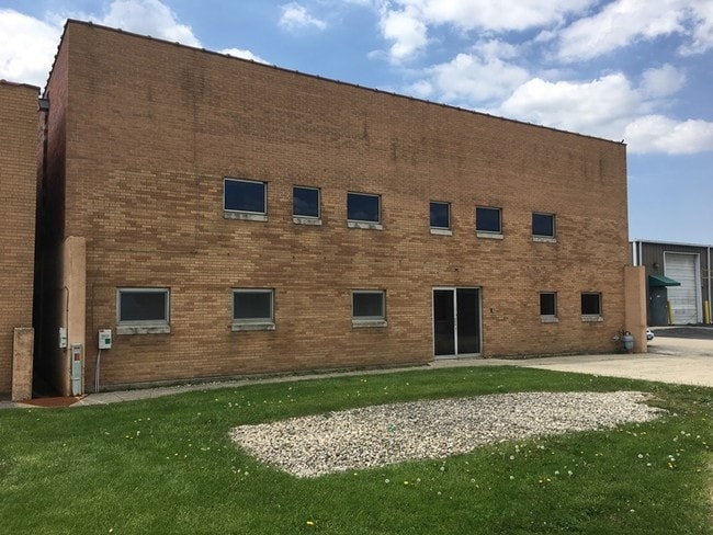
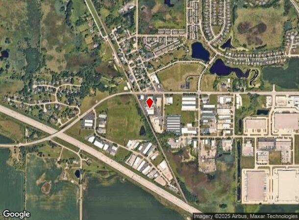
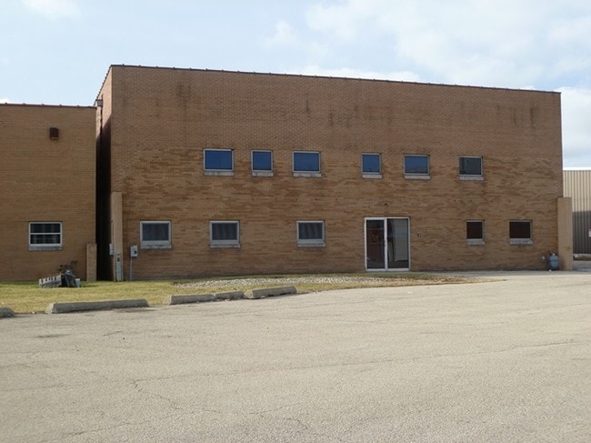
38 W End Dr, Gilberts, IL 60136

NEARBY LISTINGS FOR SALE OR LEASE
Property Detail
38 W End Dr
02-24-301-005
Gilberts Industrial District Condo
Industrialgeneral
GILBERTS INDUSTRIAL DISTRICT CONDO - UNIT A
X
Kane
17089C0155H
Illinois
2024
2
2024
North Kane/I-90
850707
Chicago
11,970 SF
Chicago-Naperville-Elgin, IL-IN-WI
DEMOGRAPHICS near 38 W End Dr
1 Mile
3 Mile
5 Mile
2024 Total Population
2,232
19,706
91,624
2029 Population
2,213
19,701
91,411
Pop Growth 2024-2029
(0.85%)
(0.03%)
(0.23%)
Average Age
38
39
40
2024 Total Households
735
6,632
32,589
HH Growth 2024-2029
(0.82%)
(0.17%)
(0.29%)
Median Household Inc
$113,281
$117,917
$109,425
Avg Household Size
3.10
3.00
2.80
2024 Avg HH Vehicles
2.00
2.00
2.00
Median Home Value
$303,650
$308,847
$302,271
Median Year Built
1990
2001
1996
Nearby Places
Map Layers
Map Styles
 Street
 Aerial
- Restaurants
- Banks
- Shops
- Fitness
- Groceries
PUBLIC TRANSPORTATION
COMMUTER RAIL
Big Timber Road Station (Milwaukee District West Line - Northeast Illinois Regional Commuter Railroad (Metra))
DRIVE
WALK
Distance
Big Timber Road Station (Milwaukee District West Line - Northeast Illinois Regional Commuter Railroad (Metra))
10 min
4.7 mi
Elgin Station (Milwaukee District West Line - Northeast Illinois Regional Commuter Railroad (Metra))
DRIVE
WALK
Distance
Elgin Station (Milwaukee District West Line - Northeast Illinois Regional Commuter Railroad (Metra))
16 min
8.3 mi
AIRPORT
Chicago O'Hare International
DRIVE
WALK
Distance
Chicago O'Hare International
40 min
31.8 mi
SALE & LEASE HISTORY
LISTING DATE
SALE/LEASE

Jun 08, 2017
For Lease
Jun 08, 2017
For Sale
Nearby Properties
Address
Land Use
TOTAL SIZE
Lot Size
Zoning
Address
Land Use
TOTAL SIZE
Lot Size
Zoning
Address
Land Use
TOTAL SIZE
Lot Size
Zoning
61.92 AC
Address
Land Use
TOTAL SIZE
Lot Size
Zoning
37.65 AC
Address
Land Use
TOTAL SIZE
Lot Size
Zoning
10.88 AC
Address
Land Use
TOTAL SIZE
Lot Size
Zoning
547,668 SF
30.17 AC
Address
Land Use
TOTAL SIZE
Lot Size
Zoning
57.30 AC
Address
Land Use
TOTAL SIZE
Lot Size
Zoning
18.73 AC
Address
Land Use
TOTAL SIZE
Lot Size
Zoning
411,943 SF
17 AC
Address
Land Use
TOTAL SIZE
Lot Size
Zoning
20.02 AC
Address
Land Use
TOTAL SIZE
Lot Size
Zoning
20.33 AC
Address
Land Use
TOTAL SIZE
Lot Size
Zoning
22.04 AC
Address
Land Use
TOTAL SIZE
Lot Size
Zoning
14.36 AC
Address
Land Use
TOTAL SIZE
Lot Size
Zoning
20.93 AC
Address
Land Use
TOTAL SIZE
Lot Size
Zoning
Address
Land Use
TOTAL SIZE
Lot Size
Zoning
307,150 SF
29.72 AC
Address
Land Use
TOTAL SIZE
Lot Size
Zoning
18.55 AC
Address
Land Use
TOTAL SIZE
Lot Size
Zoning
522,133 SF
16 AC
Address
Land Use
TOTAL SIZE
Lot Size
Zoning
7.92 AC
Address
Land Use
TOTAL SIZE
Lot Size
Zoning
14.01 AC
Address
Land Use
TOTAL SIZE
Lot Size
Zoning
342,700 SF
19 AC
Address
Land Use
TOTAL SIZE
Lot Size
Zoning
10.87 AC
Address
Land Use
TOTAL SIZE
Lot Size
Zoning
9.17 AC
Address
Land Use
TOTAL SIZE
Lot Size
Zoning
250,000 SF
13.22 AC
Address
Land Use
TOTAL SIZE
Lot Size
Zoning
250,530 SF
12 AC
Address
Land Use
TOTAL SIZE
Lot Size
Zoning
251,200 SF
13.99 AC
Address
Land Use
TOTAL SIZE
Lot Size
Zoning
11.16 AC
Address
Land Use
TOTAL SIZE
Lot Size
Zoning
13.53 AC
Address
Land Use
TOTAL SIZE
Lot Size
Zoning
19.06 AC
Address
Land Use
TOTAL SIZE
Lot Size
Zoning
Address
Land Use
TOTAL SIZE
Lot Size
Zoning
7,254 SF
1.98 AC
The World's #1 Commercial Real Estate Marketplace
Connect with us
© 2025 CoStar Group
The information above has been obtained from sources believed reliable. While we do not doubt its accuracy we have not verified it and make no guarantee, warranty or representation about it. It is your responsibility to independently confirm its accuracy and completeness. Any projections, opinions, assumptions, or estimates used are for example only and do not represent the current or future performance of the property. The value of this transaction to you depends on tax and other factors which should be evaluated by your tax, financial, and legal advisors. You and your advisors should conduct a careful, independent investigation of the property to determine to your satisfaction the suitability of the property for your needs.