Property Record
38 Winthrop St, Rehoboth, MA 02769


NEARBY LISTINGS FOR SALE OR LEASE
Property Detail
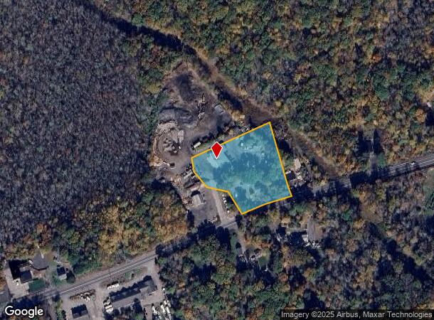
38 Winthrop St
REHO-000053-000000-000031
Bristol
Commercialofficeresidentialmixeduse
Massachusetts
X
1.88 AC
25005C0227F
Attleboro/New Bedford
2025
Boston
2025
Providence-Warwick, RI-MA
633100
DEMOGRAPHICS near 38 Winthrop St
1 Mile
3 Mile
5 Mile
2024 Total Population
649
7,837
31,831
2029 Population
652
7,843
31,735
Pop Growth 2024-2029
+ 0.46%
+ 0.08%
(0.30%)
Average Age
42
42
42
2024 Total Households
228
2,753
11,428
HH Growth 2024-2029
+ 0.44%
+ 0.07%
(0.36%)
Median Household Inc
$117,499
$119,016
$111,714
Avg Household Size
2.80
2.80
2.80
2024 Avg HH Vehicles
3.00
3.00
2.00
Median Home Value
$479,411
$466,370
$439,906
Median Year Built
1977
1983
1982
Nearby Places
Map Layers
Map Styles
 Street
 Aerial
- Restaurants
- Banks
- Shops
- Fitness
- Groceries
PUBLIC TRANSPORTATION
AIRPORT
Rhode Island Tf Green International
DRIVE
WALK
Distance
Rhode Island Tf Green International
34 min
19.3 mi
General Edward Lawrence Logan International
DRIVE
WALK
Distance
General Edward Lawrence Logan International
66 min
47.2 mi
Freight Ports
Port of New Bedford Harbor
DRIVE
WALK
Distance
Port of New Bedford Harbor
43 min
29.5 mi
Nearby Properties
Address
Land Use
TOTAL SIZE
Lot Size
Zoning
Address
Land Use
TOTAL SIZE
Lot Size
Zoning
47.75 AC
Address
Land Use
TOTAL SIZE
Lot Size
Zoning
8,590 SF
60.60 AC
C
Address
Land Use
TOTAL SIZE
Lot Size
Zoning
5,670 SF
7.12 AC
HIWABZ
Address
Land Use
TOTAL SIZE
Lot Size
Zoning
9,269 SF
47.80 AC
C
Address
Land Use
TOTAL SIZE
Lot Size
Zoning
43,680 SF
44.70 AC
HIWABZ
Address
Land Use
TOTAL SIZE
Lot Size
Zoning
12.80 AC
HIWABZ
Address
Land Use
TOTAL SIZE
Lot Size
Zoning
6,708 SF
22.15 AC
R1
Address
Land Use
TOTAL SIZE
Lot Size
Zoning
Address
Land Use
TOTAL SIZE
Lot Size
Zoning
42.03 AC
Address
Land Use
TOTAL SIZE
Lot Size
Zoning
9,001 SF
2.19 AC
Address
Land Use
TOTAL SIZE
Lot Size
Zoning
18,891 SF
13.38 AC
Address
Land Use
TOTAL SIZE
Lot Size
Zoning
125 AC
Address
Land Use
TOTAL SIZE
Lot Size
Zoning
14,940 SF
3.35 AC
HIWABZ
Address
Land Use
TOTAL SIZE
Lot Size
Zoning
Address
Land Use
TOTAL SIZE
Lot Size
Zoning
12,254 SF
5.41 AC
Address
Land Use
TOTAL SIZE
Lot Size
Zoning
164.23 AC
Address
Land Use
TOTAL SIZE
Lot Size
Zoning
3,200 SF
6.60 AC
C
Address
Land Use
TOTAL SIZE
Lot Size
Zoning
30 AC
RURRES
Address
Land Use
TOTAL SIZE
Lot Size
Zoning
4,279 SF
1.43 AC
Address
Land Use
TOTAL SIZE
Lot Size
Zoning
26,941 SF
3.19 AC
HIWABZ
Address
Land Use
TOTAL SIZE
Lot Size
Zoning
7,856 SF
12.06 AC
Address
Land Use
TOTAL SIZE
Lot Size
Zoning
14.16 AC
Address
Land Use
TOTAL SIZE
Lot Size
Zoning
4,800 SF
13.50 AC
HIWABZ
Address
Land Use
TOTAL SIZE
Lot Size
Zoning
10,253 SF
0.70 AC
Address
Land Use
TOTAL SIZE
Lot Size
Zoning
8,226 SF
2.15 AC
Address
Land Use
TOTAL SIZE
Lot Size
Zoning
16,050 SF
3.47 AC
HIWABZ
Address
Land Use
TOTAL SIZE
Lot Size
Zoning
3,760 SF
2.66 AC
HIWABZ
Address
Land Use
TOTAL SIZE
Lot Size
Zoning
9,740 SF
3 AC
C
Address
Land Use
TOTAL SIZE
Lot Size
Zoning
3,104 SF
28.30 AC
Address
Land Use
TOTAL SIZE
Lot Size
Zoning
3,160 SF
3.23 AC
The World's #1 Commercial Real Estate Marketplace
Connect with us
© 2026 CoStar Group
The information above has been obtained from sources believed reliable. While we do not doubt its accuracy we have not verified it and make no guarantee, warranty or representation about it. It is your responsibility to independently confirm its accuracy and completeness. Any projections, opinions, assumptions, or estimates used are for example only and do not represent the current or future performance of the property. The value of this transaction to you depends on tax and other factors which should be evaluated by your tax, financial, and legal advisors. You and your advisors should conduct a careful, independent investigation of the property to determine to your satisfaction the suitability of the property for your needs.