Property Record
380 Cooley St, Springfield, MA 01128
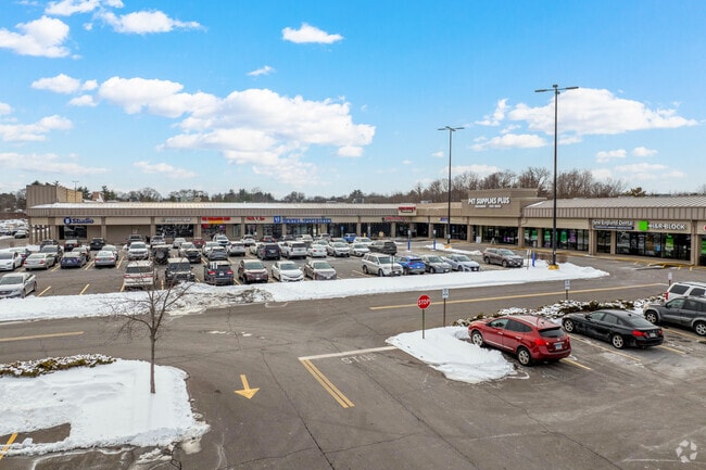

Property Detail
380 Cooley St
Springfield, MA
HAMPDEN
SPRI-003170-000000-000053
Massachusetts
Regionalshoppingcenterormallwithanchorstore
19.74 AC
SR1C1
Hampden County
B and X Area of moderate flood hazard, usually the area between the limits of the 100-year and 500-year floods.
Hartford
196,530 SF
NEARBY LISTINGS FOR SALE OR LEASE
DEMOGRAPHICS near 380 Cooley St
1 mile
3 mile
5 mile
2025 Total Population
7,514
74,824
184,114
2030 Population
7,505
74,818
184,131
Pop Growth 2025-2030
(0.12%)
(0.01%)
+ 0.01%
Average Age
41
40
40
2025 Total Households
2,895
27,486
69,381
HH Growth 2025-2030
(0.14%)
(0.08%)
(0.02%)
Median Household Inc
$81,489
$76,191
$62,972
Avg Household Size
2.50
2.50
2.50
2025 Avg HH Vehicles
2.00
2.00
2.00
Median Home Value
$289,025
$275,970
$286,659
Median Year Built
1958
1956
1954
Nearby Places
Map Layers
Map Styles
 Street
 Aerial
Layers
 Traffic
 Biking
Places
Listings with unknown addresses are not visible on the map
- Restaurants
- Banks
- Shops
- Fitness
- Groceries
PUBLIC TRANSPORTATION
COMMUTER RAIL
Springfield (Hartford Line - CONN DOT)
Drive
Walk
Distance
Springfield (Hartford Line - CONN DOT)
10 min
6.1 mi
AIRPORT
Bradley International
Drive
Walk
Distance
Bradley International
38 min
19.9 mi
Freight Ports
Port of New Haven
Drive
Walk
Distance
Port of New Haven
89 min
68.1 mi
SALE & LEASE HISTORY
LISTING DATE
SALE/LEASE

Sep 16, 2020
For Lease
Oct 04, 2023
For Lease
Apr 21, 2017
For Lease
Nearby Properties
Address
Land Use
TOTAL SIZE
Lot Size
Zoning
Address
Land Use
TOTAL SIZE
Lot Size
Zoning
89,312 SF
38.72 AC
R1
Address
Land Use
TOTAL SIZE
Lot Size
Zoning
178,132 SF
15.60 AC
B1
Address
Land Use
TOTAL SIZE
Lot Size
Zoning
207,383 SF
37.44 AC
R6
Address
Land Use
TOTAL SIZE
Lot Size
Zoning
431,476 SF
88.64 AC
SC2B1
Address
Land Use
TOTAL SIZE
Lot Size
Zoning
56,576 SF
62.84 AC
SR1R4
Address
Land Use
TOTAL SIZE
Lot Size
Zoning
1.89 AC
SR2I2
Address
Land Use
TOTAL SIZE
Lot Size
Zoning
36,446 SF
25 AC
R1
Address
Land Use
TOTAL SIZE
Lot Size
Zoning
153,742 SF
22.34 AC
R1
Address
Land Use
TOTAL SIZE
Lot Size
Zoning
232,510 SF
61.40 AC
RB
Address
Land Use
TOTAL SIZE
Lot Size
Zoning
127,645 SF
20 AC
RC
Address
Land Use
TOTAL SIZE
Lot Size
Zoning
5,802 SF
49.19 AC
R2
Address
Land Use
TOTAL SIZE
Lot Size
Zoning
102,932 SF
60.01 AC
R6
Address
Land Use
TOTAL SIZE
Lot Size
Zoning
27,200 SF
13.22 AC
MULT
Address
Land Use
TOTAL SIZE
Lot Size
Zoning
105,000 SF
17.59 AC
SR1R3
Address
Land Use
TOTAL SIZE
Lot Size
Zoning
84,605 SF
13.15 AC
RB
Address
Land Use
TOTAL SIZE
Lot Size
Zoning
40,212 SF
5.12 AC
R6
Address
Land Use
TOTAL SIZE
Lot Size
Zoning
62,548 SF
10.50 AC
R1
Address
Land Use
TOTAL SIZE
Lot Size
Zoning
38,850 SF
10.06 AC
R1
Address
Land Use
TOTAL SIZE
Lot Size
Zoning
19,380 SF
3.30 AC
R2
Address
Land Use
TOTAL SIZE
Lot Size
Zoning
10,344 SF
9.54 AC
R4
Address
Land Use
TOTAL SIZE
Lot Size
Zoning
11,115 SF
57.72 AC
R1
Address
Land Use
TOTAL SIZE
Lot Size
Zoning
62,115 SF
1.69 AC
R1
Address
Land Use
TOTAL SIZE
Lot Size
Zoning
55,881 SF
2 AC
R2
Address
Land Use
TOTAL SIZE
Lot Size
Zoning
513,160 SF
38 AC
INDG
Address
Land Use
TOTAL SIZE
Lot Size
Zoning
34,732 SF
24.73 AC
R1
Address
Land Use
TOTAL SIZE
Lot Size
Zoning
47,458 SF
3.87 AC
R1
Address
Land Use
TOTAL SIZE
Lot Size
Zoning
62,262 SF
18.69 AC
SR1R4
Address
Land Use
TOTAL SIZE
Lot Size
Zoning
39,860 SF
3.94 AC
R1
Address
Land Use
TOTAL SIZE
Lot Size
Zoning
37,404 SF
10.26 AC
R1
The World's #1 Commercial Real Estate Marketplace
Connect with us
© 2026 CoStar Group
The information above has been obtained from sources believed reliable. While we do not doubt its accuracy we have not verified it and make no guarantee, warranty or representation about it. It is your responsibility to independently confirm its accuracy and completeness. Any projections, opinions, assumptions, or estimates used are for example only and do not represent the current or future performance of the property. The value of this transaction to you depends on tax and other factors which should be evaluated by your tax, financial, and legal advisors. You and your advisors should conduct a careful, independent investigation of the property to determine to your satisfaction the suitability of the property for your needs.