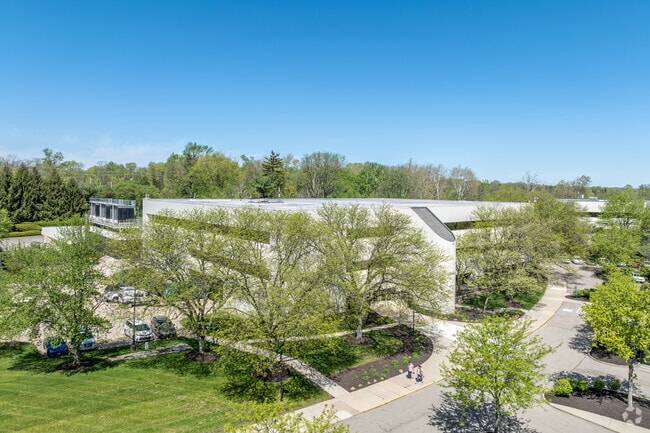
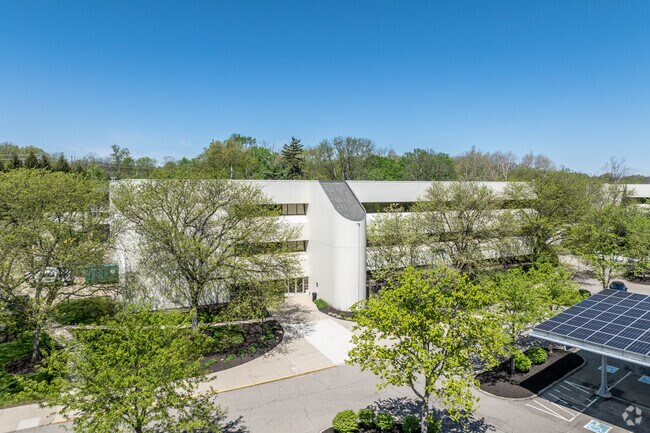
Property Record
380 Cooper Rd, Westerville, OH 43081
This Property Is For Sale
NEARBY LISTINGS FOR SALE OR LEASE
Property Detail
380 Cooper Rd
Columbus, OH
United States Military Lands
080-008068
340-50 CLEVELAND AVE R17 T2 1/4T2 7.756 ACRES
Officebuilding
Franklin
AE
Ohio
39049C0177K
5
2024
37.08 AC
2024
Westerville
007101
Columbus
362,014 SF
DEMOGRAPHICS near 380 Cooper Rd
1 Mile
3 Mile
5 Mile
2024 Total Population
6,429
102,535
251,063
2029 Population
6,490
103,021
256,244
Pop Growth 2024-2029
+ 0.95%
+ 0.47%
+ 2.06%
Average Age
37
38
38
2024 Total Households
2,258
41,139
99,207
HH Growth 2024-2029
+ 1.33%
+ 0.74%
+ 2.02%
Median Household Inc
$86,869
$73,765
$77,417
Avg Household Size
2.50
2.40
2.50
2024 Avg HH Vehicles
2.00
2.00
2.00
Median Home Value
$257,248
$249,595
$278,638
Median Year Built
1974
1979
1982
Nearby Places
Map Layers
Map Styles
 Street
 Aerial
- Restaurants
- Banks
- Shops
- Fitness
- Groceries
PUBLIC TRANSPORTATION
AIRPORT
John Glenn Columbus International
DRIVE
WALK
Distance
John Glenn Columbus International
21 min
12.5 mi
Rickenbacker International
DRIVE
WALK
Distance
Rickenbacker International
38 min
26.9 mi
Freight Ports
Port of Toledo
DRIVE
WALK
Distance
Port of Toledo
175 min
136.6 mi
Nearby Properties
Address
Land Use
TOTAL SIZE
Lot Size
Zoning
Address
Land Use
TOTAL SIZE
Lot Size
Zoning
440,828 SF
13.72 AC
Address
Land Use
TOTAL SIZE
Lot Size
Zoning
534,330 SF
10.13 AC
Address
Land Use
TOTAL SIZE
Lot Size
Zoning
635,036 SF
45.24 AC
Address
Land Use
TOTAL SIZE
Lot Size
Zoning
443,308 SF
9 AC
Address
Land Use
TOTAL SIZE
Lot Size
Zoning
426,490 SF
19.43 AC
Address
Land Use
TOTAL SIZE
Lot Size
Zoning
446,516 SF
95.88 AC
Address
Land Use
TOTAL SIZE
Lot Size
Zoning
697,077 SF
40.91 AC
Address
Land Use
TOTAL SIZE
Lot Size
Zoning
159,315 SF
13.25 AC
Address
Land Use
TOTAL SIZE
Lot Size
Zoning
218,891 SF
19.56 AC
Address
Land Use
TOTAL SIZE
Lot Size
Zoning
171,631 SF
17.55 AC
Address
Land Use
TOTAL SIZE
Lot Size
Zoning
271,562 SF
5.79 AC
Address
Land Use
TOTAL SIZE
Lot Size
Zoning
354,123 SF
19.81 AC
Address
Land Use
TOTAL SIZE
Lot Size
Zoning
217,722 SF
67.75 AC
Address
Land Use
TOTAL SIZE
Lot Size
Zoning
169,697 SF
5.59 AC
Address
Land Use
TOTAL SIZE
Lot Size
Zoning
3,263 SF
989.66 AC
Address
Land Use
TOTAL SIZE
Lot Size
Zoning
109,480 SF
17.86 AC
Address
Land Use
TOTAL SIZE
Lot Size
Zoning
134,311 SF
17.26 AC
Address
Land Use
TOTAL SIZE
Lot Size
Zoning
62,852 SF
15.56 AC
Address
Land Use
TOTAL SIZE
Lot Size
Zoning
201,072 SF
22.28 AC
Address
Land Use
TOTAL SIZE
Lot Size
Zoning
262,768 SF
4.35 AC
Address
Land Use
TOTAL SIZE
Lot Size
Zoning
292,377 SF
36.29 AC
Address
Land Use
TOTAL SIZE
Lot Size
Zoning
151,248 SF
13.30 AC
Address
Land Use
TOTAL SIZE
Lot Size
Zoning
170,259 SF
16.30 AC
Address
Land Use
TOTAL SIZE
Lot Size
Zoning
137,489 SF
14.73 AC
Address
Land Use
TOTAL SIZE
Lot Size
Zoning
258,205 SF
5.13 AC
Address
Land Use
TOTAL SIZE
Lot Size
Zoning
249,112 SF
5.94 AC
Address
Land Use
TOTAL SIZE
Lot Size
Zoning
119,213 SF
25.43 AC
Address
Land Use
TOTAL SIZE
Lot Size
Zoning
140,337 SF
10.14 AC
Address
Land Use
TOTAL SIZE
Lot Size
Zoning
236,681 SF
7.83 AC
Address
Land Use
TOTAL SIZE
Lot Size
Zoning
217,703 SF
8.55 AC
The World's #1 Commercial Real Estate Marketplace
Connect with us
© 2025 CoStar Group
The information above has been obtained from sources believed reliable. While we do not doubt its accuracy we have not verified it and make no guarantee, warranty or representation about it. It is your responsibility to independently confirm its accuracy and completeness. Any projections, opinions, assumptions, or estimates used are for example only and do not represent the current or future performance of the property. The value of this transaction to you depends on tax and other factors which should be evaluated by your tax, financial, and legal advisors. You and your advisors should conduct a careful, independent investigation of the property to determine to your satisfaction the suitability of the property for your needs.