Property Record
380 E Bayfront Pky, Erie, PA 16507


NEARBY LISTINGS FOR SALE OR LEASE
-
-
View all Erie listings for lease on LoopNet.com
Property Detail
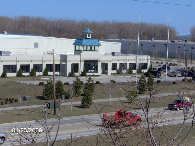
380 E Bayfront Pky
Erie, PA
The Erie Western Pennsylvania
14-010-047.0-113.00
380 E BAYFRONT LOTS A-1 & C-1 6.00 AC NET REF MB 2001-251 & 2001-350
Manufacturinglight
Erie
X
Pennsylvania
42049C0065E
a-1&c-1
2025
6 AC
2025
Greater Erie
000400
Erie
70,256 SF
DEMOGRAPHICS near 380 E Bayfront Pky
1 Mile
3 Mile
5 Mile
2024 Total Population
11,428
74,913
137,338
2029 Population
11,491
74,162
135,903
Pop Growth 2024-2029
+ 0.55%
(1.00%)
(1.04%)
Average Age
38
37
40
2024 Total Households
4,788
30,236
56,703
HH Growth 2024-2029
+ 0.46%
(1.08%)
(1.14%)
Median Household Inc
$21,257
$37,160
$47,780
Avg Household Size
2.00
2.30
2.20
2024 Avg HH Vehicles
1.00
1.00
1.00
Median Home Value
$59,392
$73,164
$120,662
Median Year Built
1947
1948
1955
Nearby Places
Map Layers
Map Styles
 Street
 Aerial
- Restaurants
- Banks
- Shops
- Fitness
- Groceries
PUBLIC TRANSPORTATION
COMMUTER RAIL
Erie Amtrak Station (Lake Shore Limited - Amtrak)
DRIVE
WALK
Distance
Erie Amtrak Station (Lake Shore Limited - Amtrak)
5 min
1.9 mi
AIRPORT
Erie International/Tom Ridge Field
DRIVE
WALK
Distance
Erie International/Tom Ridge Field
13 min
6.9 mi
Freight Ports
Port of Toledo
DRIVE
WALK
Distance
Port of Toledo
254 min
216.3 mi
SALE & LEASE HISTORY
LISTING DATE
SALE/LEASE

Sep 25, 2016
For Lease
Sep 24, 2016
For Sale
Nearby Properties
Address
Land Use
TOTAL SIZE
Lot Size
Zoning
Address
Land Use
TOTAL SIZE
Lot Size
Zoning
31,764 SF
46.83 AC
R3
Address
Land Use
TOTAL SIZE
Lot Size
Zoning
583,648 SF
5.55 AC
WC2
Address
Land Use
TOTAL SIZE
Lot Size
Zoning
227,630 SF
343.90 AC
I1
Address
Land Use
TOTAL SIZE
Lot Size
Zoning
2.73 AC
C3
Address
Land Use
TOTAL SIZE
Lot Size
Zoning
172,806 SF
1.88 AC
WC2
Address
Land Use
TOTAL SIZE
Lot Size
Zoning
630,344 SF
7.57 AC
RLB
Address
Land Use
TOTAL SIZE
Lot Size
Zoning
12.27 AC
WM
Address
Land Use
TOTAL SIZE
Lot Size
Zoning
5 AC
RLB
Address
Land Use
TOTAL SIZE
Lot Size
Zoning
3.38 AC
RLB
Address
Land Use
TOTAL SIZE
Lot Size
Zoning
3.10 AC
WC
Address
Land Use
TOTAL SIZE
Lot Size
Zoning
189,344 SF
2.14 AC
C3
Address
Land Use
TOTAL SIZE
Lot Size
Zoning
138,119 SF
11.39 AC
Address
Land Use
TOTAL SIZE
Lot Size
Zoning
103,358 SF
2.77 AC
WC
Address
Land Use
TOTAL SIZE
Lot Size
Zoning
800 SF
10.05 AC
R2
Address
Land Use
TOTAL SIZE
Lot Size
Zoning
375,929 SF
5.02 AC
C3
Address
Land Use
TOTAL SIZE
Lot Size
Zoning
3,401 SF
3,161.16 AC
Address
Land Use
TOTAL SIZE
Lot Size
Zoning
148,615 SF
19.77 AC
Address
Land Use
TOTAL SIZE
Lot Size
Zoning
1.56 AC
C3
Address
Land Use
TOTAL SIZE
Lot Size
Zoning
170,870 SF
4.51 AC
RLB
Address
Land Use
TOTAL SIZE
Lot Size
Zoning
117,879 SF
13.47 AC
M1
Address
Land Use
TOTAL SIZE
Lot Size
Zoning
2.45 AC
RLB
Address
Land Use
TOTAL SIZE
Lot Size
Zoning
8.60 AC
R2
Address
Land Use
TOTAL SIZE
Lot Size
Zoning
163,596 SF
14.31 AC
C2
Address
Land Use
TOTAL SIZE
Lot Size
Zoning
0.66 AC
C3
Address
Land Use
TOTAL SIZE
Lot Size
Zoning
178,236 SF
26.15 AC
RLB
Address
Land Use
TOTAL SIZE
Lot Size
Zoning
73,971 SF
1.49 AC
WC
Address
Land Use
TOTAL SIZE
Lot Size
Zoning
10.62 AC
R2
Address
Land Use
TOTAL SIZE
Lot Size
Zoning
88,232 SF
1 AC
RLB
Address
Land Use
TOTAL SIZE
Lot Size
Zoning
47,635 SF
2.97 AC
R1
Address
Land Use
TOTAL SIZE
Lot Size
Zoning
108,788 SF
0.74 AC
C3
The World's #1 Commercial Real Estate Marketplace
Connect with us
© 2026 CoStar Group
The information above has been obtained from sources believed reliable. While we do not doubt its accuracy we have not verified it and make no guarantee, warranty or representation about it. It is your responsibility to independently confirm its accuracy and completeness. Any projections, opinions, assumptions, or estimates used are for example only and do not represent the current or future performance of the property. The value of this transaction to you depends on tax and other factors which should be evaluated by your tax, financial, and legal advisors. You and your advisors should conduct a careful, independent investigation of the property to determine to your satisfaction the suitability of the property for your needs.