Property Record
380 Smithfield Ave, Pawtucket, RI 02860
Property Detail
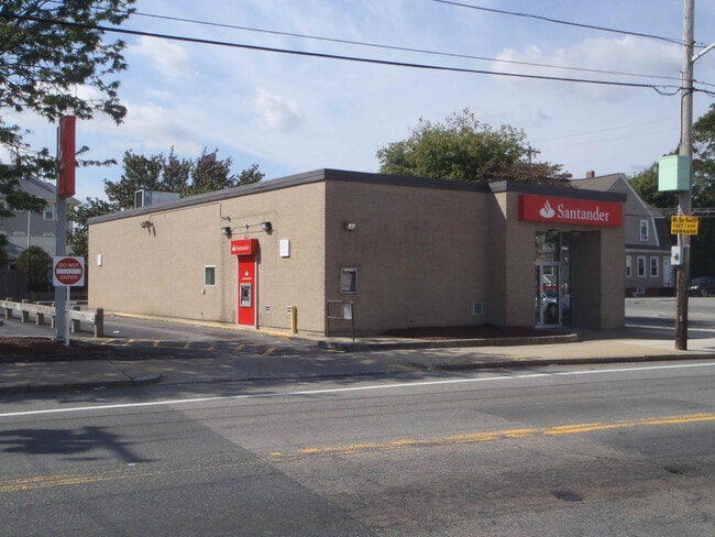
380 Smithfield Ave
PAWT-000050-000000-001793
Providence
Financialbuilding
Rhode Island
CL
1793
B and X Area of moderate flood hazard, usually the area between the limits of the 100-year and 500-year floods.
0.34 AC
2025
Pawtucket
2025
Providence
016300
Providence-Warwick, RI-MA
2,371 SF
NEARBY LISTINGS FOR SALE OR LEASE
DEMOGRAPHICS near 380 Smithfield Ave
1 mile
3 mile
5 mile
2025 Total Population
25,012
181,768
393,874
2030 Population
25,875
186,852
404,810
Pop Growth 2025-2030
+ 3.45%
+ 2.80%
+ 2.78%
Average Age
39
39
39
2025 Total Households
9,707
73,399
156,604
HH Growth 2025-2030
+ 3.35%
+ 2.91%
+ 2.95%
Median Household Inc
$66,903
$70,524
$73,530
Avg Household Size
2.50
2.30
2.40
2025 Avg HH Vehicles
2.00
1.00
2.00
Median Home Value
$327,490
$367,546
$368,989
Median Year Built
1952
1949
1951
Nearby Places
Map Layers
Map Styles
 Street
 Aerial
Layers
 Traffic
 Biking
Places
Listings with unknown addresses are not visible on the map
- Restaurants
- Banks
- Shops
- Fitness
- Groceries
PUBLIC TRANSPORTATION
COMMUTER RAIL
Drive
Walk
Distance
3 min
1.5 mi
Providence (Providence/Stoughton Line - Massachusetts Bay Transportation Authority Commuter Rail (Purple Line))
Drive
Walk
Distance
Providence (Providence/Stoughton Line - Massachusetts Bay Transportation Authority Commuter Rail (Purple Line))
7 min
3.7 mi
AIRPORT
Rhode Island Tf Green International
Drive
Walk
Distance
Rhode Island Tf Green International
23 min
12.9 mi
Worcester Regional
Drive
Walk
Distance
Worcester Regional
54 min
41.3 mi
General Edward Lawrence Logan International
Drive
Walk
Distance
General Edward Lawrence Logan International
65 min
48.6 mi
SALE & LEASE HISTORY
LISTING DATE
SALE/LEASE

Oct 05, 2020
For Lease
Oct 05, 2020
For Sale
Nearby Properties
Address
Land Use
TOTAL SIZE
Lot Size
Zoning
Address
Land Use
TOTAL SIZE
Lot Size
Zoning
162,816 SF
16.52 AC
D-1-10
Address
Land Use
TOTAL SIZE
Lot Size
Zoning
45,407 SF
38.03 AC
I-2
Address
Land Use
TOTAL SIZE
Lot Size
Zoning
19.69 AC
R-1
Address
Land Use
TOTAL SIZE
Lot Size
Zoning
268,679 SF
8.64 AC
I-1-75
Address
Land Use
TOTAL SIZE
Lot Size
Zoning
12.90 AC
I-2
Address
Land Use
TOTAL SIZE
Lot Size
Zoning
79.57 AC
O1
Address
Land Use
TOTAL SIZE
Lot Size
Zoning
20.05 AC
I-2
Address
Land Use
TOTAL SIZE
Lot Size
Zoning
170,531 SF
3 AC
M-2
Address
Land Use
TOTAL SIZE
Lot Size
Zoning
254,488 SF
17.50 AC
IS
Address
Land Use
TOTAL SIZE
Lot Size
Zoning
6.39 AC
I-2
Address
Land Use
TOTAL SIZE
Lot Size
Zoning
18.51 AC
PS
Address
Land Use
TOTAL SIZE
Lot Size
Zoning
28.92 AC
PS
Address
Land Use
TOTAL SIZE
Lot Size
Zoning
140,769 SF
5.37 AC
PS
Address
Land Use
TOTAL SIZE
Lot Size
Zoning
293,736 SF
1.24 AC
D-1-75
Address
Land Use
TOTAL SIZE
Lot Size
Zoning
277,453 SF
1.83 AC
M-MU-9
Address
Land Use
TOTAL SIZE
Lot Size
Zoning
255,438 SF
174 SF
I-1-75
Address
Land Use
TOTAL SIZE
Lot Size
Zoning
200.05 AC
RA40
Address
Land Use
TOTAL SIZE
Lot Size
Zoning
270,505 SF
2.85 AC
D-1-75
Address
Land Use
TOTAL SIZE
Lot Size
Zoning
1,274 SF
99.20 AC
OS
Address
Land Use
TOTAL SIZE
Lot Size
Zoning
159,028 SF
12.09 AC
RG
Address
Land Use
TOTAL SIZE
Lot Size
Zoning
161,714 SF
1.48 AC
M-MU-9
Address
Land Use
TOTAL SIZE
Lot Size
Zoning
168,150 SF
2.77 AC
PO
Address
Land Use
TOTAL SIZE
Lot Size
Zoning
116,311 SF
0.22 AC
D-1-10
Address
Land Use
TOTAL SIZE
Lot Size
Zoning
116,080 SF
0.77 AC
C-2
Address
Land Use
TOTAL SIZE
Lot Size
Zoning
3.88 AC
M-MU-7
Address
Land Use
TOTAL SIZE
Lot Size
Zoning
288,736 SF
11.99 AC
RG
Address
Land Use
TOTAL SIZE
Lot Size
Zoning
21 AC
RM
Address
Land Use
TOTAL SIZE
Lot Size
Zoning
252,597 SF
0.23 AC
D-1-10
Address
Land Use
TOTAL SIZE
Lot Size
Zoning
237,440 SF
19.31 AC
IS
Address
Land Use
TOTAL SIZE
Lot Size
Zoning
134,113 SF
0.74 AC
RM
The World's #1 Commercial Real Estate Marketplace
Connect with us
© 2026 CoStar Group
The information above has been obtained from sources believed reliable. While we do not doubt its accuracy we have not verified it and make no guarantee, warranty or representation about it. It is your responsibility to independently confirm its accuracy and completeness. Any projections, opinions, assumptions, or estimates used are for example only and do not represent the current or future performance of the property. The value of this transaction to you depends on tax and other factors which should be evaluated by your tax, financial, and legal advisors. You and your advisors should conduct a careful, independent investigation of the property to determine to your satisfaction the suitability of the property for your needs.