Property Record
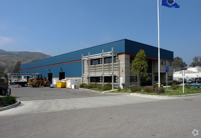
380 W Stanley Ave, Ventura, CA 93001


NEARBY LISTINGS FOR SALE OR LEASE
Property Detail
380 W Stanley Ave
068-0-142-230
Valley Of San Buenaventura
Lightindustrial
REF: 16 RS 53
X
Ventura
06111C0741F
California
2024
2.34 AC
2025
Ventura
002302
Los Angeles
17,561 SF
Oxnard-Thousand Oaks-Ventura, CA
DEMOGRAPHICS near 380 W Stanley Ave
1 Mile
3 Mile
5 Mile
2024 Total Population
11,971
30,777
59,141
2029 Population
11,860
30,604
59,170
Pop Growth 2024-2029
(0.93%)
(0.56%)
+ 0.05%
Average Age
36
40
42
2024 Total Households
3,804
11,878
23,446
HH Growth 2024-2029
(1.05%)
(0.48%)
+ 0.11%
Median Household Inc
$62,966
$73,944
$84,943
Avg Household Size
3.00
2.50
2.40
2024 Avg HH Vehicles
2.00
2.00
2.00
Median Home Value
$516,346
$742,647
$757,237
Median Year Built
1970
1962
1964
Nearby Places
Map Layers
Map Styles
 Street
 Aerial
- Restaurants
- Banks
- Shops
- Fitness
- Groceries
PUBLIC TRANSPORTATION
COMMUTER RAIL
DRIVE
WALK
Distance
6 min
2.3 mi
DRIVE
WALK
Distance
13 min
8.8 mi
AIRPORT
Santa Barbara Municipal
DRIVE
WALK
Distance
Santa Barbara Municipal
47 min
38.2 mi
Freight Ports
The Port of Hueneme
DRIVE
WALK
Distance
The Port of Hueneme
25 min
15.1 mi
Nearby Properties
Address
Land Use
TOTAL SIZE
Lot Size
Zoning
Address
Land Use
TOTAL SIZE
Lot Size
Zoning
4.19 AC
H
Address
Land Use
TOTAL SIZE
Lot Size
Zoning
Address
Land Use
TOTAL SIZE
Lot Size
Zoning
7,280 SF
5.38 AC
C-T-O
Address
Land Use
TOTAL SIZE
Lot Size
Zoning
6.81 AC
C-T-O
Address
Land Use
TOTAL SIZE
Lot Size
Zoning
2.89 AC
C-T-O
Address
Land Use
TOTAL SIZE
Lot Size
Zoning
639.79 AC
Address
Land Use
TOTAL SIZE
Lot Size
Zoning
Address
Land Use
TOTAL SIZE
Lot Size
Zoning
11,444 SF
6.57 AC
Address
Land Use
TOTAL SIZE
Lot Size
Zoning
732 SF
0.51 AC
DR
Address
Land Use
TOTAL SIZE
Lot Size
Zoning
0.84 AC
Address
Land Use
TOTAL SIZE
Lot Size
Zoning
57,554 SF
0.58 AC
Address
Land Use
TOTAL SIZE
Lot Size
Zoning
9,572 SF
1.91 AC
MULT
Address
Land Use
TOTAL SIZE
Lot Size
Zoning
43,498 SF
1.67 AC
R33
Address
Land Use
TOTAL SIZE
Lot Size
Zoning
19,709 SF
0.14 AC
DC
Address
Land Use
TOTAL SIZE
Lot Size
Zoning
168 SF
7.87 AC
M3
Address
Land Use
TOTAL SIZE
Lot Size
Zoning
19,431 SF
0.59 AC
DR
Address
Land Use
TOTAL SIZE
Lot Size
Zoning
38,456 SF
1.49 AC
R33
Address
Land Use
TOTAL SIZE
Lot Size
Zoning
1.33 AC
DC
Address
Land Use
TOTAL SIZE
Lot Size
Zoning
29,058 SF
1.18 AC
C2
Address
Land Use
TOTAL SIZE
Lot Size
Zoning
3,596 SF
1.19 AC
Address
Land Use
TOTAL SIZE
Lot Size
Zoning
29,798 SF
0.57 AC
C1
Address
Land Use
TOTAL SIZE
Lot Size
Zoning
3.60 AC
8
Address
Land Use
TOTAL SIZE
Lot Size
Zoning
1.40 AC
7
Address
Land Use
TOTAL SIZE
Lot Size
Zoning
5.10 AC
Address
Land Use
TOTAL SIZE
Lot Size
Zoning
1.54 AC
Address
Land Use
TOTAL SIZE
Lot Size
Zoning
0.77 AC
7
Address
Land Use
TOTAL SIZE
Lot Size
Zoning
56,026 SF
3.41 AC
PO
Address
Land Use
TOTAL SIZE
Lot Size
Zoning
11,970 SF
5.18 AC
M1
Address
Land Use
TOTAL SIZE
Lot Size
Zoning
0.88 AC
The World's #1 Commercial Real Estate Marketplace
Connect with us
© 2026 CoStar Group
The information above has been obtained from sources believed reliable. While we do not doubt its accuracy we have not verified it and make no guarantee, warranty or representation about it. It is your responsibility to independently confirm its accuracy and completeness. Any projections, opinions, assumptions, or estimates used are for example only and do not represent the current or future performance of the property. The value of this transaction to you depends on tax and other factors which should be evaluated by your tax, financial, and legal advisors. You and your advisors should conduct a careful, independent investigation of the property to determine to your satisfaction the suitability of the property for your needs.