Property Record
3800 N Gillett St, Appleton, WI 54913
NEARBY LISTINGS FOR SALE OR LEASE
Property Detail
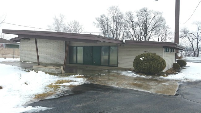
3800 N Gillett St
Appleton, WI
Transportation Project Plat 1130-63-21-4
10-1-0628-00
N104.35FT OF S313.06FT OF W208.71FT NE NW LESS W40FT & PRT USESED FOR HY 41 SEC15 T21N R17E .33AC M/L & PARCEL 97 TPP NO: 1130-63-21-4.09 (1097 SQ FT
Commercialnec
Outagamie
AE
Wisconsin
55087C0316D
0.32 AC
2024
Outagamie County
2024
Green Bay
012505
DEMOGRAPHICS near 3800 N Gillett St
1 Mile
3 Mile
5 Mile
2024 Total Population
7,909
59,903
121,122
2029 Population
8,240
62,251
125,318
Pop Growth 2024-2029
+ 4.19%
+ 3.92%
+ 3.46%
Average Age
40
40
40
2024 Total Households
3,329
24,928
50,303
HH Growth 2024-2029
+ 4.09%
+ 3.89%
+ 3.46%
Median Household Inc
$95,915
$71,121
$70,094
Avg Household Size
2.30
2.30
2.30
2024 Avg HH Vehicles
2.00
2.00
2.00
Median Home Value
$275,737
$198,063
$207,395
Median Year Built
1995
1974
1977
Nearby Places
Map Layers
Map Styles
 Street
 Aerial
- Restaurants
- Banks
- Shops
- Fitness
- Groceries
PUBLIC TRANSPORTATION
AIRPORT
Appleton International
DRIVE
WALK
Distance
Appleton International
13 min
8.6 mi
Green Bay/Austin Straubel International
DRIVE
WALK
Distance
Green Bay/Austin Straubel International
39 min
30.9 mi
Freight Ports
Port Milwaukee
DRIVE
WALK
Distance
Port Milwaukee
126 min
110.4 mi
SALE & LEASE HISTORY
LISTING DATE
SALE/LEASE

Jan 24, 2017
For Sale
Nearby Properties
Address
Land Use
TOTAL SIZE
Lot Size
Zoning
Address
Land Use
TOTAL SIZE
Lot Size
Zoning
645,392 SF
25.87 AC
Address
Land Use
TOTAL SIZE
Lot Size
Zoning
500,700 SF
47.17 AC
Address
Land Use
TOTAL SIZE
Lot Size
Zoning
189,107 SF
13.37 AC
Address
Land Use
TOTAL SIZE
Lot Size
Zoning
70,136 SF
6.34 AC
C2
Address
Land Use
TOTAL SIZE
Lot Size
Zoning
2,032 SF
18.48 AC
R3
Address
Land Use
TOTAL SIZE
Lot Size
Zoning
65,818 SF
8.01 AC
C2
Address
Land Use
TOTAL SIZE
Lot Size
Zoning
278,801 SF
20.94 AC
Address
Land Use
TOTAL SIZE
Lot Size
Zoning
194,573 SF
19.99 AC
Address
Land Use
TOTAL SIZE
Lot Size
Zoning
53,321 SF
2.51 AC
CBD
Address
Land Use
TOTAL SIZE
Lot Size
Zoning
44,164 SF
0.62 AC
CBD
Address
Land Use
TOTAL SIZE
Lot Size
Zoning
17.43 AC
M2
Address
Land Use
TOTAL SIZE
Lot Size
Zoning
40,560 SF
6.67 AC
R3
Address
Land Use
TOTAL SIZE
Lot Size
Zoning
107,202 SF
39.98 AC
C2
Address
Land Use
TOTAL SIZE
Lot Size
Zoning
66,504 SF
5.25 AC
C2
Address
Land Use
TOTAL SIZE
Lot Size
Zoning
15,560 SF
15.24 AC
Address
Land Use
TOTAL SIZE
Lot Size
Zoning
6.66 AC
Address
Land Use
TOTAL SIZE
Lot Size
Zoning
249,444 SF
18.81 AC
Address
Land Use
TOTAL SIZE
Lot Size
Zoning
5,394 SF
0.30 AC
CBD
Address
Land Use
TOTAL SIZE
Lot Size
Zoning
21,540 SF
0.79 AC
CBD
Address
Land Use
TOTAL SIZE
Lot Size
Zoning
25,705 SF
2.03 AC
PDR3
Address
Land Use
TOTAL SIZE
Lot Size
Zoning
83,926 SF
7.35 AC
C2
Address
Land Use
TOTAL SIZE
Lot Size
Zoning
45,646 SF
44 SF
PDC2
Address
Land Use
TOTAL SIZE
Lot Size
Zoning
22.26 AC
Address
Land Use
TOTAL SIZE
Lot Size
Zoning
25.59 AC
Address
Land Use
TOTAL SIZE
Lot Size
Zoning
248,212 SF
7.87 AC
M2
Address
Land Use
TOTAL SIZE
Lot Size
Zoning
6,000 SF
1.70 AC
CBD
Address
Land Use
TOTAL SIZE
Lot Size
Zoning
39,510 SF
7.73 AC
Address
Land Use
TOTAL SIZE
Lot Size
Zoning
7,979 SF
6.64 AC
C2
Address
Land Use
TOTAL SIZE
Lot Size
Zoning
12.02 AC
M2
Address
Land Use
TOTAL SIZE
Lot Size
Zoning
97,355 SF
7.99 AC
The World's #1 Commercial Real Estate Marketplace
Connect with us
© 2026 CoStar Group
The information above has been obtained from sources believed reliable. While we do not doubt its accuracy we have not verified it and make no guarantee, warranty or representation about it. It is your responsibility to independently confirm its accuracy and completeness. Any projections, opinions, assumptions, or estimates used are for example only and do not represent the current or future performance of the property. The value of this transaction to you depends on tax and other factors which should be evaluated by your tax, financial, and legal advisors. You and your advisors should conduct a careful, independent investigation of the property to determine to your satisfaction the suitability of the property for your needs.