Property Record
3801 Darbytown Rd, Henrico, VA 23231

NEARBY LISTINGS FOR SALE OR LEASE
-
-
View all Henrico listings for sale on LoopNet.com
Property Detail
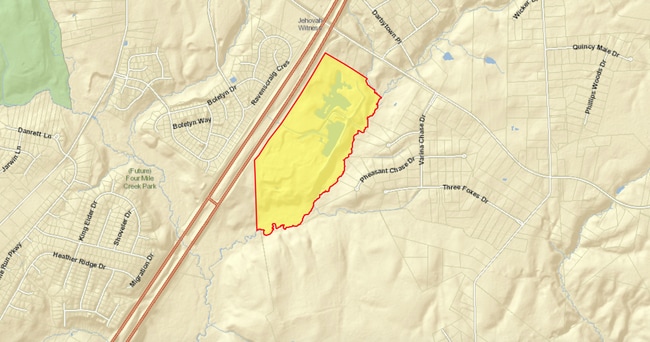
3801 Darbytown Rd
826-690-8089
02280A0000 0007B; SL DARBYTOWN EL#295 AC 114.273 41 B1 9
Vacantlandnec
Henrico
A
Virginia
51087C0229D
114.27 AC
2025
East End
2025
Richmond VA
201502
Richmond, VA
DEMOGRAPHICS near 3801 Darbytown Rd
1 Mile
3 Mile
5 Mile
2024 Total Population
2,653
8,330
25,505
2029 Population
2,690
8,392
25,484
Pop Growth 2024-2029
+ 1.39%
+ 0.74%
(0.08%)
Average Age
40
44
42
2024 Total Households
905
3,128
10,028
HH Growth 2024-2029
+ 1.33%
+ 0.64%
(0.12%)
Median Household Inc
$121,411
$108,575
$83,998
Avg Household Size
2.80
2.60
2.50
2024 Avg HH Vehicles
3.00
3.00
2.00
Median Home Value
$272,405
$281,190
$253,635
Median Year Built
2003
1993
1990
Nearby Places
Map Layers
Map Styles
 Street
 Aerial
- Restaurants
- Banks
- Shops
- Fitness
- Groceries
PUBLIC TRANSPORTATION
AIRPORT
Richmond International
DRIVE
WALK
Distance
Richmond International
14 min
8.3 mi
Freight Ports
Virginia Port Authority - Richmond
DRIVE
WALK
Distance
Virginia Port Authority - Richmond
19 min
12.5 mi
SALE & LEASE HISTORY
LISTING DATE
SALE/LEASE

Aug 08, 2019
For Sale
Nearby Properties
Address
Land Use
TOTAL SIZE
Lot Size
Zoning
Address
Land Use
TOTAL SIZE
Lot Size
Zoning
446,500 SF
49.33 AC
M1-C
Address
Land Use
TOTAL SIZE
Lot Size
Zoning
5,134 SF
179.47 AC
A-1
Address
Land Use
TOTAL SIZE
Lot Size
Zoning
278,967 SF
26.07 AC
M1-C
Address
Land Use
TOTAL SIZE
Lot Size
Zoning
1,782 SF
400 AC
A-1
Address
Land Use
TOTAL SIZE
Lot Size
Zoning
202,560 SF
13.27 AC
M-1C
Address
Land Use
TOTAL SIZE
Lot Size
Zoning
216,000 SF
17.08 AC
M-1C
Address
Land Use
TOTAL SIZE
Lot Size
Zoning
83,644 SF
29.83 AC
A-1
Address
Land Use
TOTAL SIZE
Lot Size
Zoning
159,200 SF
12.34 AC
M-1C
Address
Land Use
TOTAL SIZE
Lot Size
Zoning
153,219 SF
9.91 AC
M-1C
Address
Land Use
TOTAL SIZE
Lot Size
Zoning
69,405 SF
14.13 AC
A-1
Address
Land Use
TOTAL SIZE
Lot Size
Zoning
69,910 SF
9.62 AC
A-1
Address
Land Use
TOTAL SIZE
Lot Size
Zoning
119,152 SF
8.49 AC
M-1C
Address
Land Use
TOTAL SIZE
Lot Size
Zoning
45,664 SF
7.34 AC
MIXE
Address
Land Use
TOTAL SIZE
Lot Size
Zoning
21,591 SF
68.72 AC
M-2C
Address
Land Use
TOTAL SIZE
Lot Size
Zoning
1,106 SF
120 AC
A-1
Address
Land Use
TOTAL SIZE
Lot Size
Zoning
9,449 SF
6.17 AC
A-1
Address
Land Use
TOTAL SIZE
Lot Size
Zoning
10,124 SF
5.14 AC
A-1
Address
Land Use
TOTAL SIZE
Lot Size
Zoning
49,624 SF
21.33 AC
M-2
Address
Land Use
TOTAL SIZE
Lot Size
Zoning
2,190 SF
219.12 AC
A-1
Address
Land Use
TOTAL SIZE
Lot Size
Zoning
848 SF
289.01 AC
A-1
Address
Land Use
TOTAL SIZE
Lot Size
Zoning
17,175 SF
5.76 AC
A-1
Address
Land Use
TOTAL SIZE
Lot Size
Zoning
40.50 AC
M1-C
Address
Land Use
TOTAL SIZE
Lot Size
Zoning
33.97 AC
M1-C
Address
Land Use
TOTAL SIZE
Lot Size
Zoning
17,544 SF
9.93 AC
A-1
Address
Land Use
TOTAL SIZE
Lot Size
Zoning
32.01 AC
M-1C
Address
Land Use
TOTAL SIZE
Lot Size
Zoning
3,150 SF
2.33 AC
A-1
Address
Land Use
TOTAL SIZE
Lot Size
Zoning
9,230 SF
1.77 AC
B-1C
Address
Land Use
TOTAL SIZE
Lot Size
Zoning
6,260 SF
2.36 AC
B-3C
Address
Land Use
TOTAL SIZE
Lot Size
Zoning
8,980 SF
1.95 AC
B-3
Address
Land Use
TOTAL SIZE
Lot Size
Zoning
26.28 AC
M-2C
The World's #1 Commercial Real Estate Marketplace
Connect with us
© 2025 CoStar Group
The information above has been obtained from sources believed reliable. While we do not doubt its accuracy we have not verified it and make no guarantee, warranty or representation about it. It is your responsibility to independently confirm its accuracy and completeness. Any projections, opinions, assumptions, or estimates used are for example only and do not represent the current or future performance of the property. The value of this transaction to you depends on tax and other factors which should be evaluated by your tax, financial, and legal advisors. You and your advisors should conduct a careful, independent investigation of the property to determine to your satisfaction the suitability of the property for your needs.