Property Record
3801 E 9Th St, Texarkana, AR 71854
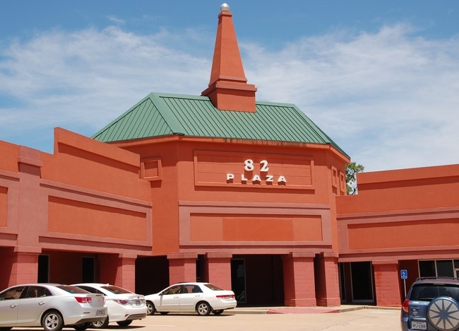
Property Detail
3801 E 9Th St
00290805
PT BLKS 2 & 3 MCLAIN PLAT
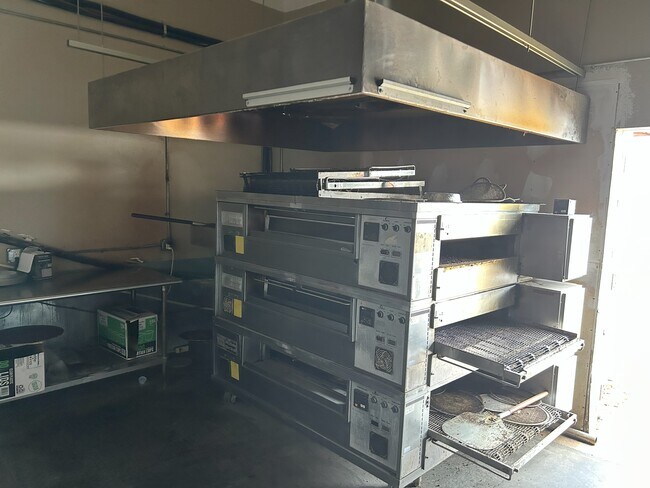
Restaurantbuilding
MILLER
B and X Area of moderate flood hazard, usually the area between the limits of the 100-year and 500-year floods.
Arkansas
2025
1 AC
2025
Arkansas South Area
020802
Other Market Areas
5,900 SF
Texarkana, TX-AR
NEARBY LISTINGS FOR SALE OR LEASE
DEMOGRAPHICS near 3801 E 9Th St
1 mile
3 mile
5 mile
2024 Total Population
1,793
24,938
51,608
2029 Population
1,757
24,714
51,238
Pop Growth 2024-2029
(2.01%)
(0.90%)
(0.72%)
Average Age
37
39
40
2024 Total Households
764
9,718
20,687
HH Growth 2024-2029
(1.96%)
(0.95%)
(0.74%)
Median Household Inc
$31,363
$40,351
$43,404
Avg Household Size
2.30
2.30
2.30
2024 Avg HH Vehicles
1.00
2.00
2.00
Median Home Value
$203,097
$132,257
$138,750
Median Year Built
1998
1973
1976
Nearby Places
Map Layers
Map Styles
 Street
 Aerial
Transit
 Traffic
 Biking
Places
Listings with unknown addresses are not visible on the map
- Restaurants
- Banks
- Shops
- Fitness
- Groceries
PUBLIC TRANSPORTATION
COMMUTER RAIL
Texarkana Amtrak Station (Texas Eagle - Amtrak)
Drive
Walk
Distance
Texarkana Amtrak Station (Texas Eagle - Amtrak)
5 min
3.2 mi
AIRPORT
Texarkana Regional-Webb Field
Drive
Walk
Distance
Texarkana Regional-Webb Field
7 min
2.5 mi
Freight Ports
Port of Shreveport
Drive
Walk
Distance
Port of Shreveport
104 min
92.6 mi
SALE & LEASE HISTORY
LISTING DATE
SALE/LEASE

Nov 20, 2024
For Lease
Mar 16, 2017
For Lease
Feb 08, 2022
For Lease
Nearby Properties
Address
Land Use
TOTAL SIZE
Lot Size
Zoning
Address
Land Use
TOTAL SIZE
Lot Size
Zoning
1,896,910 SF
46.19 AC
Address
Land Use
TOTAL SIZE
Lot Size
Zoning
Address
Land Use
TOTAL SIZE
Lot Size
Zoning
1,896,910 SF
Address
Land Use
TOTAL SIZE
Lot Size
Zoning
102,614 SF
0.89 AC
Address
Land Use
TOTAL SIZE
Lot Size
Zoning
100,000 SF
5.92 AC
Address
Land Use
TOTAL SIZE
Lot Size
Zoning
74,246 SF
1.34 AC
Address
Land Use
TOTAL SIZE
Lot Size
Zoning
55,033 SF
Address
Land Use
TOTAL SIZE
Lot Size
Zoning
4.43 AC
Address
Land Use
TOTAL SIZE
Lot Size
Zoning
270,796 SF
33.10 AC
Address
Land Use
TOTAL SIZE
Lot Size
Zoning
185,060 SF
Address
Land Use
TOTAL SIZE
Lot Size
Zoning
2.55 AC
Address
Land Use
TOTAL SIZE
Lot Size
Zoning
28,480 SF
0.96 AC
Address
Land Use
TOTAL SIZE
Lot Size
Zoning
179,723 SF
36.84 AC
Address
Land Use
TOTAL SIZE
Lot Size
Zoning
26,696 SF
1.29 AC
Address
Land Use
TOTAL SIZE
Lot Size
Zoning
21,296 SF
1.82 AC
Address
Land Use
TOTAL SIZE
Lot Size
Zoning
2.07 AC
Address
Land Use
TOTAL SIZE
Lot Size
Zoning
47,776 SF
8 AC
Address
Land Use
TOTAL SIZE
Lot Size
Zoning
26,721 SF
0.32 AC
Address
Land Use
TOTAL SIZE
Lot Size
Zoning
24,108 SF
2.07 AC
Address
Land Use
TOTAL SIZE
Lot Size
Zoning
90,160 SF
1.96 AC
Address
Land Use
TOTAL SIZE
Lot Size
Zoning
101,920 SF
17.18 AC
Address
Land Use
TOTAL SIZE
Lot Size
Zoning
211,666 SF
15.11 AC
Address
Land Use
TOTAL SIZE
Lot Size
Zoning
0.48 AC
Address
Land Use
TOTAL SIZE
Lot Size
Zoning
14,086 SF
0.45 AC
Address
Land Use
TOTAL SIZE
Lot Size
Zoning
19,456 SF
0.96 AC
Address
Land Use
TOTAL SIZE
Lot Size
Zoning
49,836 SF
6.61 AC
Address
Land Use
TOTAL SIZE
Lot Size
Zoning
15,940 SF
13.43 AC
Address
Land Use
TOTAL SIZE
Lot Size
Zoning
19,883 SF
5.89 AC
Address
Land Use
TOTAL SIZE
Lot Size
Zoning
13,050 SF
0.77 AC
Address
Land Use
TOTAL SIZE
Lot Size
Zoning
2,103 SF
6.55 AC
The World's #1 Commercial Real Estate Marketplace
Connect with us
© 2026 CoStar Group
The information above has been obtained from sources believed reliable. While we do not doubt its accuracy we have not verified it and make no guarantee, warranty or representation about it. It is your responsibility to independently confirm its accuracy and completeness. Any projections, opinions, assumptions, or estimates used are for example only and do not represent the current or future performance of the property. The value of this transaction to you depends on tax and other factors which should be evaluated by your tax, financial, and legal advisors. You and your advisors should conduct a careful, independent investigation of the property to determine to your satisfaction the suitability of the property for your needs.