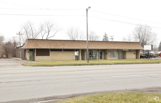
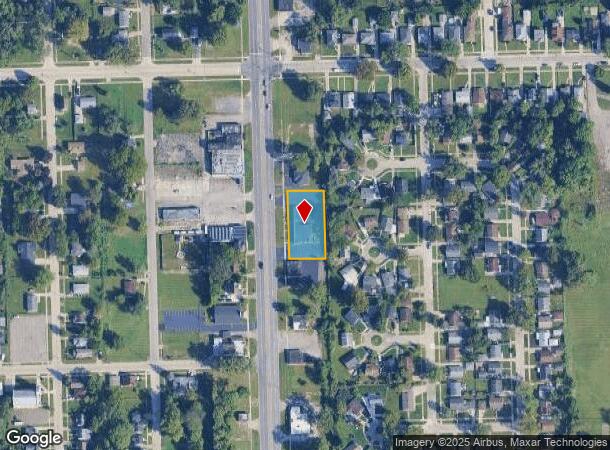
Property Record
3801 Inkster Rd, Inkster, MI 48141

NEARBY LISTINGS FOR SALE OR LEASE
Property Detail
3801 Inkster Rd
Detroit-Warren-Dearborn, MI
Wayne County Cond
44-025-99-0001-000
31E1A1 B1A B2C THAT PART OF THE NW 1/4 OF SEC 31 T2S R10E DES AS BEG AT A POINT ON THE E LINE OF INKSTER RD DISTANT S 89D 56M
Commercialnec
Wayne
X
Michigan
26163C0241E
0001
2024
0.46 AC
2025
Dearborn
570900
Detroit
3,088 SF
DEMOGRAPHICS near 3801 Inkster Rd
1 Mile
3 Mile
5 Mile
2024 Total Population
10,859
97,610
249,623
2029 Population
10,720
94,304
240,192
Pop Growth 2024-2029
(1.28%)
(3.39%)
(3.78%)
Average Age
38
39
40
2024 Total Households
4,251
37,698
99,050
HH Growth 2024-2029
(1.39%)
(3.44%)
(3.82%)
Median Household Inc
$36,955
$56,767
$60,889
Avg Household Size
2.50
2.50
2.50
2024 Avg HH Vehicles
1.00
2.00
2.00
Median Home Value
$79,613
$142,178
$155,039
Median Year Built
1957
1956
1957
Nearby Places
Map Layers
Map Styles
 Street
 Aerial
- Restaurants
- Banks
- Shops
- Fitness
- Groceries
PUBLIC TRANSPORTATION
COMMUTER RAIL
Dearborn (Wolverine - Amtrak)
DRIVE
WALK
Distance
Dearborn (Wolverine - Amtrak)
10 min
4.9 mi
AIRPORT
Detroit Metro Wayne County
DRIVE
WALK
Distance
Detroit Metro Wayne County
16 min
8.2 mi
Windsor International
DRIVE
WALK
Distance
Windsor International
47 min
29.0 mi
Freight Ports
Port of Toledo
DRIVE
WALK
Distance
Port of Toledo
72 min
56.0 mi
Nearby Properties
Address
Land Use
TOTAL SIZE
Lot Size
Zoning
Address
Land Use
TOTAL SIZE
Lot Size
Zoning
126,712 SF
4.52 AC
BC
Address
Land Use
TOTAL SIZE
Lot Size
Zoning
280,510 SF
32.49 AC
M-T
Address
Land Use
TOTAL SIZE
Lot Size
Zoning
463,642 SF
22.82 AC
Address
Land Use
TOTAL SIZE
Lot Size
Zoning
328,480 SF
11.54 AC
IA
Address
Land Use
TOTAL SIZE
Lot Size
Zoning
219,144 SF
24.53 AC
B-2
Address
Land Use
TOTAL SIZE
Lot Size
Zoning
196,930 SF
9.93 AC
Address
Land Use
TOTAL SIZE
Lot Size
Zoning
107,680 SF
7.46 AC
BC
Address
Land Use
TOTAL SIZE
Lot Size
Zoning
354,444 SF
20.10 AC
I-1
Address
Land Use
TOTAL SIZE
Lot Size
Zoning
467,594 SF
34.54 AC
IND-B IND
Address
Land Use
TOTAL SIZE
Lot Size
Zoning
99.86 AC
Address
Land Use
TOTAL SIZE
Lot Size
Zoning
109,250 SF
26.52 AC
M-T
Address
Land Use
TOTAL SIZE
Lot Size
Zoning
Address
Land Use
TOTAL SIZE
Lot Size
Zoning
58,958 SF
2.15 AC
BC
Address
Land Use
TOTAL SIZE
Lot Size
Zoning
127,017 SF
6.91 AC
Address
Land Use
TOTAL SIZE
Lot Size
Zoning
51,220 SF
13.83 AC
B-3
Address
Land Use
TOTAL SIZE
Lot Size
Zoning
176,883 SF
10.83 AC
Address
Land Use
TOTAL SIZE
Lot Size
Zoning
110,117 SF
5.85 AC
RE
Address
Land Use
TOTAL SIZE
Lot Size
Zoning
93,425 SF
7.75 AC
Address
Land Use
TOTAL SIZE
Lot Size
Zoning
88,769 SF
0.91 AC
IB
Address
Land Use
TOTAL SIZE
Lot Size
Zoning
150,420 SF
11.83 AC
Address
Land Use
TOTAL SIZE
Lot Size
Zoning
93,202 SF
25.98 AC
M1-LIG
Address
Land Use
TOTAL SIZE
Lot Size
Zoning
314,418 SF
28.06 AC
Address
Land Use
TOTAL SIZE
Lot Size
Zoning
103,706 SF
10.33 AC
Address
Land Use
TOTAL SIZE
Lot Size
Zoning
53,263 SF
2.80 AC
Address
Land Use
TOTAL SIZE
Lot Size
Zoning
49,232 SF
23.35 AC
M-T
Address
Land Use
TOTAL SIZE
Lot Size
Zoning
61,031 SF
5.14 AC
BC
Address
Land Use
TOTAL SIZE
Lot Size
Zoning
186,112 SF
13.42 AC
M1-LIG
Address
Land Use
TOTAL SIZE
Lot Size
Zoning
110,371 SF
8.68 AC
Address
Land Use
TOTAL SIZE
Lot Size
Zoning
29,172 SF
15 AC
M-T
Address
Land Use
TOTAL SIZE
Lot Size
Zoning
45,294 SF
8.32 AC
B-3
The World's #1 Commercial Real Estate Marketplace
Connect with us
© 2025 CoStar Group
The information above has been obtained from sources believed reliable. While we do not doubt its accuracy we have not verified it and make no guarantee, warranty or representation about it. It is your responsibility to independently confirm its accuracy and completeness. Any projections, opinions, assumptions, or estimates used are for example only and do not represent the current or future performance of the property. The value of this transaction to you depends on tax and other factors which should be evaluated by your tax, financial, and legal advisors. You and your advisors should conduct a careful, independent investigation of the property to determine to your satisfaction the suitability of the property for your needs.