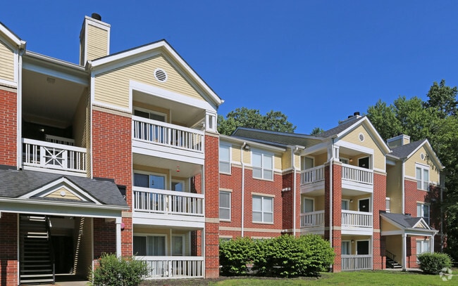
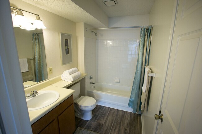
Property Record
3801 Knollton Rd, Indianapolis, IN 46228
NEARBY LISTINGS FOR SALE OR LEASE
Property Detail
3801 Knollton Rd
Indianapolis-Carmel-Greenwood, IN
PT W1/2 SW1/4 S15 T16 R3 BEG 889.36FT N OF SW CORN 72.72FT NE 217.1FT E 365FT SW 169.38FT W509.12FT TO BEG 1.8AC
49-06-15-114-001.000-800
Marion
Apartment
Indiana
2023
6 AC
2024
Wynnedale Spring Hill
321002
Indianapolis
2,288 SF
DEMOGRAPHICS near 3801 Knollton Rd
1 Mile
3 Mile
5 Mile
2024 Total Population
4,301
92,752
291,410
2029 Population
4,275
93,050
290,756
Pop Growth 2024-2029
(0.60%)
+ 0.32%
(0.22%)
Average Age
39
36
36
2024 Total Households
1,704
36,471
123,678
HH Growth 2024-2029
(0.70%)
+ 0.42%
(0.20%)
Median Household Inc
$65,702
$55,448
$56,576
Avg Household Size
2.20
2.40
2.20
2024 Avg HH Vehicles
2.00
2.00
2.00
Median Home Value
$258,039
$201,779
$194,510
Median Year Built
1967
1956
1966
Nearby Places
Map Layers
Map Styles
 Street
 Aerial
- Restaurants
- Banks
- Shops
- Fitness
- Groceries
PUBLIC TRANSPORTATION
COMMUTER RAIL
Indianapolis (Cardinal - Amtrak)
DRIVE
WALK
Distance
Indianapolis (Cardinal - Amtrak)
12 min
6.4 mi
AIRPORT
Indianapolis International
DRIVE
WALK
Distance
Indianapolis International
30 min
15.9 mi
Freight Ports
Port of Toledo
DRIVE
WALK
Distance
Port of Toledo
268 min
223.9 mi
Nearby Properties
Address
Land Use
TOTAL SIZE
Lot Size
Zoning
Address
Land Use
TOTAL SIZE
Lot Size
Zoning
176,017 SF
3.92 AC
ZO01
Address
Land Use
TOTAL SIZE
Lot Size
Zoning
967,690 SF
59.63 AC
ZO01
Address
Land Use
TOTAL SIZE
Lot Size
Zoning
296,086 SF
6.19 AC
ZO01
Address
Land Use
TOTAL SIZE
Lot Size
Zoning
207,800 SF
2.23 AC
ZO01
Address
Land Use
TOTAL SIZE
Lot Size
Zoning
4,808 SF
5.76 AC
ZO01
Address
Land Use
TOTAL SIZE
Lot Size
Zoning
2,505 SF
13.80 AC
ZO01
Address
Land Use
TOTAL SIZE
Lot Size
Zoning
108,872 SF
30 AC
Address
Land Use
TOTAL SIZE
Lot Size
Zoning
3,546 SF
25.09 AC
ZO01
Address
Land Use
TOTAL SIZE
Lot Size
Zoning
18,154 SF
9.40 AC
ZO01
Address
Land Use
TOTAL SIZE
Lot Size
Zoning
70,717 SF
7.40 AC
ZO01
Address
Land Use
TOTAL SIZE
Lot Size
Zoning
23,195 SF
31.18 AC
Address
Land Use
TOTAL SIZE
Lot Size
Zoning
42,611 SF
151.50 AC
ZO01
Address
Land Use
TOTAL SIZE
Lot Size
Zoning
61,534 SF
5.35 AC
Address
Land Use
TOTAL SIZE
Lot Size
Zoning
20,746 SF
28.38 AC
ZO01
Address
Land Use
TOTAL SIZE
Lot Size
Zoning
380,355 SF
26.75 AC
ZO01
Address
Land Use
TOTAL SIZE
Lot Size
Zoning
9,094 SF
6.22 AC
ZO01
Address
Land Use
TOTAL SIZE
Lot Size
Zoning
8,496 SF
20 AC
ZO01
Address
Land Use
TOTAL SIZE
Lot Size
Zoning
4,944 SF
26.99 AC
ZO01
Address
Land Use
TOTAL SIZE
Lot Size
Zoning
8,998 SF
3.56 AC
ZO01
Address
Land Use
TOTAL SIZE
Lot Size
Zoning
76,022 SF
57.30 AC
ZO01
Address
Land Use
TOTAL SIZE
Lot Size
Zoning
16.60 AC
ZO01
Address
Land Use
TOTAL SIZE
Lot Size
Zoning
188,212 SF
28.51 AC
Address
Land Use
TOTAL SIZE
Lot Size
Zoning
19,740 SF
22.04 AC
ZO01
Address
Land Use
TOTAL SIZE
Lot Size
Zoning
5,628 SF
27.80 AC
ZO01
Address
Land Use
TOTAL SIZE
Lot Size
Zoning
10,006 SF
8.89 AC
ZO01
Address
Land Use
TOTAL SIZE
Lot Size
Zoning
20,985 SF
80 AC
ZO01
Address
Land Use
TOTAL SIZE
Lot Size
Zoning
197,582 SF
20.48 AC
ZO01
Address
Land Use
TOTAL SIZE
Lot Size
Zoning
48,300 SF
36.34 AC
Address
Land Use
TOTAL SIZE
Lot Size
Zoning
47,500 SF
17.40 AC
The World's #1 Commercial Real Estate Marketplace
Connect with us
© 2026 CoStar Group
The information above has been obtained from sources believed reliable. While we do not doubt its accuracy we have not verified it and make no guarantee, warranty or representation about it. It is your responsibility to independently confirm its accuracy and completeness. Any projections, opinions, assumptions, or estimates used are for example only and do not represent the current or future performance of the property. The value of this transaction to you depends on tax and other factors which should be evaluated by your tax, financial, and legal advisors. You and your advisors should conduct a careful, independent investigation of the property to determine to your satisfaction the suitability of the property for your needs.