Property Record
3801 Us Highway 41 N, Byron, GA 31008


NEARBY LISTINGS FOR SALE OR LEASE
Property Detail
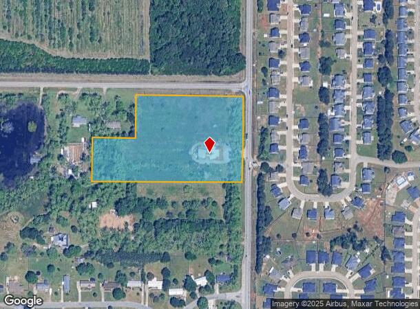
3801 Us Highway 41 N
Warner Robins, GA
Hwy 41 N Of Watson
000460106000
TRACT B 5.93 ACRES LL 73 5TH LD
Utilities
Houston
X
Georgia
13021C0240G
73
2024
5.93 AC
2024
Perry/Warner Robins
020113
Other Market Areas
2,745 SF
DEMOGRAPHICS near 3801 Us Highway 41 N
1 Mile
3 Mile
5 Mile
2024 Total Population
3,895
25,700
64,114
2029 Population
4,284
27,860
69,248
Pop Growth 2024-2029
+ 9.99%
+ 8.40%
+ 8.01%
Average Age
37
39
39
2024 Total Households
1,394
10,154
25,906
HH Growth 2024-2029
+ 9.90%
+ 8.20%
+ 7.83%
Median Household Inc
$81,812
$64,660
$59,646
Avg Household Size
2.80
2.50
2.40
2024 Avg HH Vehicles
2.00
2.00
2.00
Median Home Value
$136,489
$150,117
$149,747
Median Year Built
1995
1994
1989
Nearby Places
Map Layers
Map Styles
 Street
 Aerial
- Restaurants
- Banks
- Shops
- Fitness
- Groceries
SALE & LEASE HISTORY
LISTING DATE
SALE/LEASE

Sep 24, 2016
For Sale
Mar 26, 2018
For Sale
Nearby Properties
Address
Land Use
TOTAL SIZE
Lot Size
Zoning
Address
Land Use
TOTAL SIZE
Lot Size
Zoning
27,504 SF
26.31 AC
PUD
Address
Land Use
TOTAL SIZE
Lot Size
Zoning
9,600 SF
24.25 AC
C-H
Address
Land Use
TOTAL SIZE
Lot Size
Zoning
7,172 SF
24.73 AC
R4
Address
Land Use
TOTAL SIZE
Lot Size
Zoning
226,032 SF
49.90 AC
C2
Address
Land Use
TOTAL SIZE
Lot Size
Zoning
11,056 SF
17.41 AC
R4
Address
Land Use
TOTAL SIZE
Lot Size
Zoning
10,000 SF
1,163 AC
R-AG
Address
Land Use
TOTAL SIZE
Lot Size
Zoning
18,954 SF
20 AC
C2
Address
Land Use
TOTAL SIZE
Lot Size
Zoning
158,300 SF
29.99 AC
R1
Address
Land Use
TOTAL SIZE
Lot Size
Zoning
223,608 SF
22.40 AC
C2
Address
Land Use
TOTAL SIZE
Lot Size
Zoning
56,260 SF
17.70 AC
C2
Address
Land Use
TOTAL SIZE
Lot Size
Zoning
5,320 SF
15.47 AC
R-4
Address
Land Use
TOTAL SIZE
Lot Size
Zoning
10,000 SF
43.93 AC
I-1
Address
Land Use
TOTAL SIZE
Lot Size
Zoning
125,797 SF
5.74 AC
M2
Address
Land Use
TOTAL SIZE
Lot Size
Zoning
125,412 SF
9.82 AC
C2
Address
Land Use
TOTAL SIZE
Lot Size
Zoning
84,909 SF
8.64 AC
C2
Address
Land Use
TOTAL SIZE
Lot Size
Zoning
80,825 SF
7.20 AC
I-1
Address
Land Use
TOTAL SIZE
Lot Size
Zoning
70,500 SF
18.47 AC
R1
Address
Land Use
TOTAL SIZE
Lot Size
Zoning
14,140 SF
16.59 AC
R1
Address
Land Use
TOTAL SIZE
Lot Size
Zoning
8,640 SF
12.49 AC
R-AG
Address
Land Use
TOTAL SIZE
Lot Size
Zoning
47,568 SF
1.51 AC
C-3
Address
Land Use
TOTAL SIZE
Lot Size
Zoning
108,075 SF
10.55 AC
R2
Address
Land Use
TOTAL SIZE
Lot Size
Zoning
42,056 SF
2.14 AC
C-3
Address
Land Use
TOTAL SIZE
Lot Size
Zoning
62,600 SF
4.35 AC
C2
Address
Land Use
TOTAL SIZE
Lot Size
Zoning
44,400 SF
8.28 AC
C2
Address
Land Use
TOTAL SIZE
Lot Size
Zoning
34,501 SF
6.82 AC
M2
Address
Land Use
TOTAL SIZE
Lot Size
Zoning
19,613 SF
5.85 AC
C2
Address
Land Use
TOTAL SIZE
Lot Size
Zoning
50,571 SF
2.02 AC
C2
Address
Land Use
TOTAL SIZE
Lot Size
Zoning
35,940 SF
18.96 AC
C2
Address
Land Use
TOTAL SIZE
Lot Size
Zoning
35,004 SF
1.45 AC
C-3
Address
Land Use
TOTAL SIZE
Lot Size
Zoning
54,773 SF
4.48 AC
C2
The World's #1 Commercial Real Estate Marketplace
Connect with us
© 2025 CoStar Group
The information above has been obtained from sources believed reliable. While we do not doubt its accuracy we have not verified it and make no guarantee, warranty or representation about it. It is your responsibility to independently confirm its accuracy and completeness. Any projections, opinions, assumptions, or estimates used are for example only and do not represent the current or future performance of the property. The value of this transaction to you depends on tax and other factors which should be evaluated by your tax, financial, and legal advisors. You and your advisors should conduct a careful, independent investigation of the property to determine to your satisfaction the suitability of the property for your needs.